Calderdale
Located in England, United Kingdom Coordinates: 53°42′00″ N 2°00′00″ W
- Population
- 211,439
- 211.4K
- Elevation
- 243 m
- above sea level
- Local time
- UTC+00:00
- Europe/London · UTC+00:00
- Places inside
- 94
- listed under Calderdale
About Calderdale
Calderdale is a district. Location: England, United Kingdom. Population: 211,439.
In comparison
- 25 sights and natural places within 10 km Crow Hill, Manshead End
- Listed here: Neighbourhood: 37, Village: 36, Mountain: 8, Municipality: 7
Places in Calderdale
94 places-
Halifax City82.6K
-
Brighouse Town32.9K
-
Rastrick Town11.4K
-
Holywell Green Village3.2K
-
Luddenden Foot Village2.2K
-
Akroydon Neighbourhood
-
Bailiff Bridge Neighbourhood
-
Bank Top Neighbourhood
-
Bank Top Mountain
-
Beacon Hill Mountain
-
Beechwood Neighbourhood
-
Blackley Village
-
Blackshaw Municipality
-
Bleak Hill Mountain
-
Booth Village
-
Boothtown Neighbourhood
-
Bradshaw Neighbourhood
-
Brookfoot Neighbourhood
-
Brookhouse Village
-
Claremount Neighbourhood
-
Coley Village
-
Cotton Stones Village
-
Cross Hill Neighbourhood
-
Crow Edge Mountain
-
Crow Hill Mountain
-
Elland Lower Edge Village
-
Elland Upper Edge Village
-
Erringden Municipality
-
Friendly Neighbourhood
-
Greenfield Village
-
Heathfield Neighbourhood
-
Hebden Royd Municipality
-
Heptonstall Municipality
-
Highroad Well Neighbourhood
-
Hipperholme Village
-
Holdsworth Neighbourhood
-
Holmfield Neighbourhood
-
Hove Edge Neighbourhood
-
Hubberton Green Village
-
Hullen Edge Village
-
Jagger Green Village
-
King Cross Neighbourhood
-
Kirklees Priory Historic site
-
Lee Mount Neighbourhood
-
Lightcliffe Neighbourhood
-
Lindwell Neighbourhood
-
Little Bradley Neighbourhood
-
Low Bentley Village
-
Low Fields Neighbourhood
-
Luddenden Village
-
Lumbrook Village
-
Mill Bank Village
-
Mixenden Neighbourhood
-
Mount Tabor Village
-
Norland Town Village
-
Northgate Village
-
Northowram Village
-
Norton Tower Neighbourhood
-
Norwood Green Village
-
Ogden Village
Nature and heritage in Calderdale
-
Boulsworth Hill Mountain, Wadsworth
-
Freeholds Top Mountain, Todmorden
-
Black Hameldon Mountain, Heptonstall
-
Moss Moor Mountain, Ripponden
-
Hameldon Mountain, Heptonstall
-
Manshead End Mountain, Ripponden
Nearby attractions & nature
Everything nearby-
Hebden Water River, England3.9 km N
-
Blackstone Edge Mountain, England6.9 km SW
-
Snoddle Hill Mountain, Rochdale6.5 km SW
-
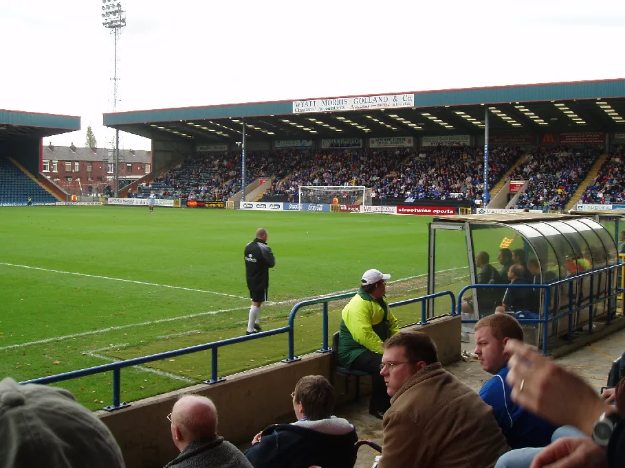 Spotland Stadium Landmark, Rochdale15 km SW
-
Ratcliffe Hill Mountain, Rochdale8.9 km SW
-
Cleggswood Hill Mountain, Rochdale9.1 km SW
Sources & licences
Data last updated: