Lower Tremar
Located in St. Cleer, Cornwall Coordinates: 50°29′17″ N 4°27′24″ W
- Elevation
- 166 m
- above sea level
- Local time
- UTC+00:00
- Europe/London · UTC+00:00
About Lower Tremar
Lower Tremar is a neighbourhood. Location: St. Cleer, Cornwall.
In comparison
- Nearest larger town: Pensilva, 3 km NE
- 22 sights and natural places within 10 km Caradon Hill, Caradon Hill Transmitting Station
Nearby attractions & nature
Everything nearby-
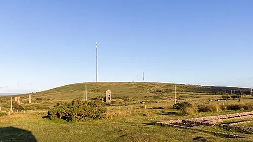 Caradon Hill Mountain, St. Cleer2.9 km NE
-
Caradon Hill Transmitting Station Landmark, Linkinhorne3 km NE
-
Gormain Hill Mountain, St. Cleer3.3 km W
-
Draynes Common Mountain, St. Neot4.8 km W
-
Langstone Downs Mountain, Linkinhorne5.6 km N
-
Stowe's Hill Mountain, Linkinhorne4.2 km N
Sources & licences
Data last updated: