Bootle
Located in Cumberland, Cumbria Coordinates: 54°17′53″ N 3°22′58″ W
- Elevation
- 29 m
- above sea level
- Local time
- UTC+00:00
- Europe/London · UTC+00:00
- Places inside
- 11
- listed under Bootle
About Bootle
Bootle is a village. Location: Cumberland, Cumbria. Elevation: 29 m.
In comparison
- Nearest larger town: Broughton in Furness, 11 km E
- 57 sights and natural places within 10 km Ford House, Tarn Bay
- Listed here: Village: 5, Mountain: 2, Natural site: 2, Landmark: 1
Places in Bootle
11 places-
Annaside Village
-
Bootle Village
-
Ford House Landmark
-
Hycemoor Village
-
Monk Moors Village
-
Selker Bay Natural site
-
Stoneside Hill Mountain
-
Tarn Bay Natural site
-
The Hawes Mountain
-
The Nook Village
-
Town Head Neighbourhood
Nearby attractions & nature
Everything nearby-
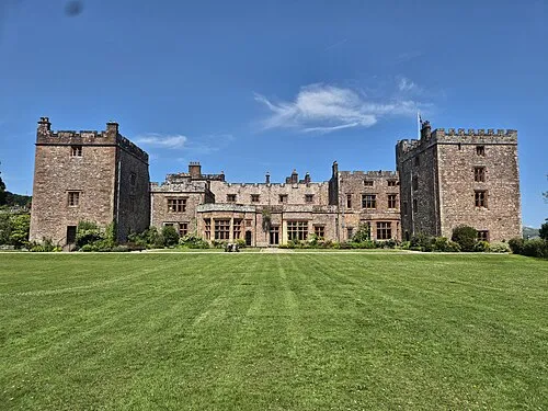 Muncaster Castle Historic site, Muncaster6.3 km N
-
Buck Barrow Mountain, Waberthwaite5.2 km E
-
Great Paddy Crag Mountain, Millom Without5 km E
-
River Esk River, England4.5 km NW
-
Burn Moor Mountain, Ulpha5.6 km NE
-
Black Combe Mountain, Whicham5.7 km SE
Sources & licences
Data last updated: