Durham
Located in England, United Kingdom Coordinates: 54°46′36″ N 1°34′33″ W
- Population
- 894,025
- 894K
- Elevation
- 52 m
- above sea level
- Local time
- UTC+00:00
- Europe/London · UTC+00:00
- Places inside
- 225
- listed under Durham
About Durham
Durham is a district. Location: England, United Kingdom. Population: 894,025.
In comparison
- 21 sights and natural places within 10 km Durham Castle, Durham Castle
- Listed here: Municipality: 135, Village: 49, Neighbourhood: 25, Historic site: 4
Places in Durham
225 places-
Shotley Bridge Village
-
Shotton Municipality
-
South Bedburn Municipality
-
South Church Neighbourhood
-
South Hetton Municipality
-
South Pelaw Neighbourhood
-
Spennymoor Municipality
-
Staindrop Municipality
-
Stanhope Municipality
-
Stanley Municipality
-
Startforth Municipality
-
St Helen Auckland Neighbourhood
-
Streatlam and Stainton Municipality
-
Sunniside Village
-
Templetown Neighbourhood
-
The Dene Village
-
The High Force Natural site
-
The Sands Neighbourhood
-
Thornley Municipality
-
Tow Law Municipality
-
Trimdon Municipality
-
Trimdon Foundry Municipality
-
Urpeth Municipality
-
Wackerfield Municipality
-
Waldridge Municipality
-
West Auckland Municipality
-
Western Hill Neighbourhood
-
Westerton Hill Mountain
-
West Rainton Municipality
-
Westwick Municipality
-
Wheatley Hill Municipality
-
Whitehill Village
-
Whitesmocks Neighbourhood
-
Whorlton Municipality
-
Windlestone Municipality
-
Wingate Municipality
-
Winston Municipality
-
Witton Gilbert Municipality
-
Witton-le-Wear Municipality
-
Witton Park Village
-
Wolsingham Municipality
-
Woodhouses Village
-
Woodland Municipality
-
Woodside Village
-
Wycliffe with Thorpe Municipality
Nature and heritage in Durham
-
Pawlaw Pike Mountain, Stanhope
-
Fendrith Hill Mountain, Forest and Frith
-
Three Pikes Mountain, Forest and Frith
-
Mickle Fell Mountain, Lunedale
-
Collier Law Mountain, LCPs of Stanhope, Wolsingham and Tow Law
-
Beacon Hill Mountain, Easington Colliery
Nearby attractions & nature
Everything nearby-
River Deerness River, England1.9 km SW
-
Cobbler's Hill Mountain, Hetton7 km NE
-
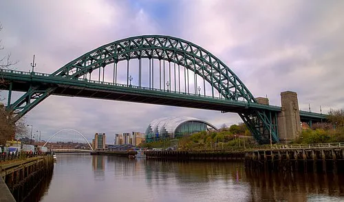 Tyne Bridge Landmark, Gateshead21 km N
-
 St James' Park Landmark, Newcastle upon Tyne22 km N
-
Houghton-le-Spring Rectory park Natural site, Sunderland9.9 km NE
-
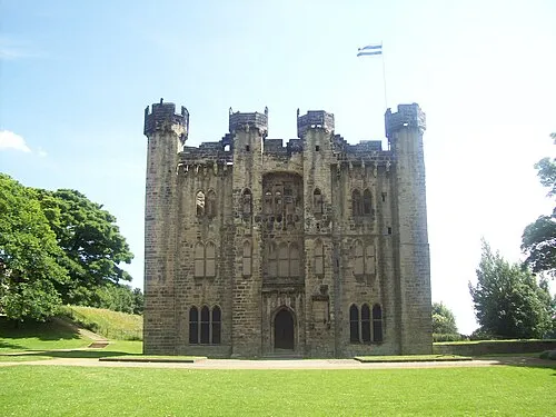 Hylton Castle Historic site, Sunderland18 km NE
Sources & licences
Data last updated: