South Tyneside
Located in England, United Kingdom Coordinates: 54°57′00″ N 1°25′00″ W
- Population
- 151,393
- 151.4K
- Elevation
- 24 m
- above sea level
- Local time
- UTC+00:00
- Europe/London · UTC+00:00
- Places inside
- 43
- listed under South Tyneside
About South Tyneside
South Tyneside is a district. Location: England, United Kingdom. Population: 151,393.
In comparison
- 27 sights and natural places within 10 km Whitburn, Beacon Hill
- Listed here: Neighbourhood: 22, Village: 6, Town: 5, Landmark: 3
Places in South Tyneside
43 places-
South Shields City83.7K
-
Jarrow Town29.5K
-
Hebburn Town21.3K
-
The Boldons Town13.6K
-
Whitburn Town5.4K
-
East Boldon Town5K
-
Arbeia museum Museum
-
Arbeia Roman fort Historic site
-
Beacon Hill Mountain
-
Biddick Hall Neighbourhood
-
Boldon Colliery Village
-
Boldon Hills Mountain
-
Brockley Whins Neighbourhood
-
Campbell Park Neighbourhood
-
Cauldwell Neighbourhood
-
Cleadon Village
-
Cleadon Park Neighbourhood
-
East Jarrow Neighbourhood
-
Fellgate Neighbourhood
-
Harton Village
-
Harton Nook Neighbourhood
-
Hebburn Hall Landmark
-
Hebburn Hall Ponds Neighbourhood
-
Hebburn New Town Neighbourhood
-
Hebburn Row Neighbourhood
-
Hedworth Neighbourhood
-
High Shields Neighbourhood
-
Horsley Hill Neighbourhood
-
Jarrow Historic site
-
Low Walker Village
-
Marsden Village
-
Mill Dam Neighbourhood
-
Monkton Neighbourhood
-
Primrose Neighbourhood
-
Simonside Neighbourhood
-
Souter Lighthouse Landmark
-
St. Paul's Church Jarrow Attraction
-
The Lawe Neighbourhood
-
Tyne Dock Neighbourhood
-
West Boldon Village
-
West Harton Neighbourhood
-
Westoe Neighbourhood
-
Whitburn Landmark
Nearby attractions & nature
Everything nearby-
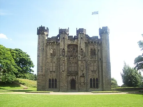 Hylton Castle Historic site, Sunderland3.5 km SW
-
Marsden Bay Natural site, England4.3 km NE
-
Whitburn Bay Natural site, England4.2 km E
-
Stadium Of Light Landmark, Burdon4.4 km SE
-
River Don River, England5 km NW
-
River Wear River, England5.1 km SE
Sources & licences
Data last updated: