
- Population
- 83,655
- 83.7K
- Elevation
- 12 m
- above sea level
- Local time
- UTC+00:00
- Europe/London · UTC+00:00
- Airports
- NCL Newcastle International Airport17 km
- MME Teesside International Airport54 km
About South Shields
South Shields is a city. Location: South Tyneside, England. Population: 83,655. Elevation: 12 m.
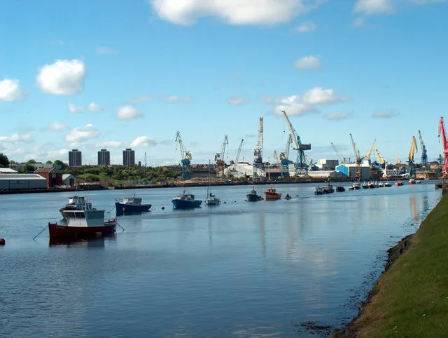
South Shields ( SHEELZ) is a coastal port town in South Tyneside, Tyne and Wear, England; it lies on the south bank of the mouth of the River Tyne. The town was known in Roman times as Arbeia and as Caer Urfa by the Early Middle Ages. It is the fourth largest settlement in Tyne and Wear, after Newcastle upon Tyne, Sunderland and Gateshead; in 2021, it had a population of 75,337. South Shields was historically a part of County Durham, but in 1974 it became a part of the newly formed ceremonial county Tyne and Wear.
Source: Wikipedia · CC BY-SA 4.0
Photos of South Shields
-

Dave Barber · CC BY-SA 3.0 -

Central Hall, South Shields · Public domain -

Robert Graham · CC BY-SA 2.0 -

MOs810 · CC BY 4.0 -

Chris Morgan · CC BY-SA 2.0


Climate of South Shields
Best months for sightseeingBest months for sightseeing: June–September.
This month · November
A cold month
Day 10° · Night 4° · Rain 65 mm
- Hottest month
- July (day 20°)
- Coldest month
- January (night 2°)
- Wettest month
- August (65 mm)
- Driest month
- February (42 mm)
Bars: average monthly low and high temperature. Below: precipitation. Monthly averages for 1970–2000 at about 18 km resolution, adjusted for elevation. Highlighted months are mild and relatively dry. Source: WorldClim 2.1 (CC BY 4.0).
Show values as a table
| Month | Jan | Feb | Mar | Apr | May | Jun | Jul | Aug | Sep | Oct | Nov | Dec |
|---|---|---|---|---|---|---|---|---|---|---|---|---|
| Average high (°C) | 7° | 8° | 10° | 11° | 14° | 17° | 20° | 20° | 17° | 14° | 10° | 8° |
| Average low (°C) | 2° | 2° | 3° | 3° | 6° | 8° | 11° | 11° | 9° | 7° | 4° | 3° |
| Precipitation (mm) | 61 | 42 | 55 | 46 | 49 | 52 | 52 | 65 | 62 | 61 | 65 | 63 |
Other places to visit in this season: June July August September
How to get to South Shields
The nearest airport is Newcastle International Airport (NCL), 17 km to the west as the crow flies. The nearest large city is Sunderland, 11 km to the south.
Airports
- Newcastle International Airport (NCL) Newcastle upon Tyne, Tyne and Wear 17 kmwest
- Teesside International Airport (MME) Darlington, Durham 54 kmsouth
- Leeds Bradford Airport (LBA) Leeds, West Yorkshire 127 kmsouth
Nearby large cities
- Sunderland Population: 170.1K 11 kmsouth
- Newcastle upon Tyne Population: 300.1K 12 kmwest
- Middlesbrough Population: 142.7K 49 kmsouth
- York Population: 156.1K 118 kmsouth
- Leeds Population: 536.3K 134 kmsouth
Straight-line distances; road distances are longer. Airport data: OurAirports.
Day trips from South Shields
Within 100 km: 652 historic and cultural sites, 854 natural sites, 205 lakes, rivers and coasts.
0–25 km115 places
- Saint Mary’s Island Island 8 kmN
- Castle Island Island 20 kmNW
- Match Island Island 13 kmSW
- Rocky Island Island 10 kmN
25–60 km416 places
- Longhoughton Beach Beach 49 kmN
- Seaton Carew Beach Beach 41 kmSE
- Redcar Beach Beach 48 kmSE
- Coquet Island Island 38 kmN
60–100 km1,180 places
- Cocklawburn Beach Beach 88 kmN
- Cheswick Sands Beach 86 kmN
- Whitby Beach Beach 75 kmSE
- The Island Island 86 kmS
Straight-line distances.
South Shields and similar cities
Side by side with cities of similar size in the same country: population, elevation and climate.
| Measure | South Shields | Londonderry | Weston-super-Mare | Halifax |
|---|---|---|---|---|
| Population | 83.7K | 83.7K | 82.9K | 82.6K |
| Elevation | 12 m | 24 m | 13 m | 150 m |
| Summer day (hottest month) | 20° | 18° | 21° | 20° |
| Winter night (coldest month) | 2° | 3° | 2° | 1° |
| Annual rainfall | 673 mm | 1,561 mm | 901 mm | 1,157 mm |
| Best months | Jun–Sep | Jun–Aug | Jun–Aug | Jun–Aug |
| Distance | — | 376 km | 419 km | 145 km |
Climate values are 1970–2000 monthly averages; straight-line distance.
Nearby attractions & nature
Everything nearby-
Arbeia museum Museum, South Tyneside0.6 km N
-
Arbeia Roman fort Historic site, South Tyneside0.6 km N
-
River Tyne River, England1.4 km N
-
Tynemouth Priory Historic site, North Tyneside2.3 km NE
-
River Don River, England2.3 km SW
-
Frenchman's Bay Natural site, United Kingdom2.8 km SE
-
King Edward's Bay Natural site, United Kingdom2.6 km NE
-
Tynemouth Castle Historic site, North Tyneside2.3 km N
Other cities and towns in South Tyneside
-
 Hebburn Town, South Tyneside6 km SW
-
 East Boldon Town, South Tyneside6 km S
-
The Boldons Town, South Tyneside6.4 km S
-
Whitburn Town, South Tyneside6.5 km SE
Sources & licences
Data last updated: · 2 independent sources