Wallington
Located in Sutton, Greater London Coordinates: 51°21′51″ N 0°09′13″ W
- Population
- 20,850
- 20.8K
- Elevation
- 46 m
- above sea level
- Local time
- UTC+00:00
- Europe/London · UTC+00:00
About Wallington
Wallington is a town. Location: Sutton, Greater London. Population: 20,850. Elevation: 46 m.
Wallington is a town in the London Borough of Sutton, South London, England, 9.9 miles (16 km) south south-west of Charing Cross. Before the Municipal Borough of Beddington and Wallington merged into the London Borough of Sutton in Greater London in 1965, it was part of the county of Surrey. Wallington is a post town in the SM postcode area. By the 13th century, Wallington was partially known as Hakebrug for a bridge on the River Wandle.
Read more on Wikipedia Text: Wikipedia contributors · CC BY-SA 4.0 · shortened
In comparison
- No. 3 of 7 places in Sutton by population
- Nearest larger town: Carshalton, 1 km NW
- 30 sights and natural places within 10 km Manor Park, Cranmer Green
Airports nearest to Wallington
- London City Airport (LCY) London 21 km
- London Gatwick Airport (LGW) London 24 km
- London Heathrow Airport (LHR) London 24 km
Straight-line distance; airports with scheduled flights only. Source: OurAirports (public domain).
Nearby attractions & nature
Everything nearby-
Manor Park Natural site, Sutton2.6 km W
-
Clock House Mountain, Sutton4.5 km S
-
Cranmer Green Natural site, Merton3.9 km N
-
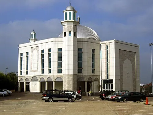 Baitul Futuh Mosque Attraction, Merton4.8 km NW
-
Nonsuch Palace Historic site, Epsom and Ewell District5.3 km W
-
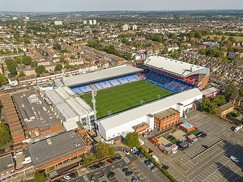 Selhurst Park Landmark, Croydon6.1 km NE
-
Croydon Transmitting Station Landmark, Croydon7 km NE
-
Nonsuch Park Natural site, Epsom and Ewell District5.6 km W
Sources & licences
Data last updated: · 2 independent sources