Clitheroe Castle
Located in Clitheroe, Ribble Valley District Coordinates: 53°52′14″ N 2°23′37″ W

- Local time
- UTC+00:00
- Europe/London · UTC+00:00
- Elevation
- 99 m
- above sea level
About Clitheroe Castle
Clitheroe Castle is a historic site. Location: Clitheroe, Ribble Valley District.
Clitheroe Castle is a ruined early medieval castle in Clitheroe in the Borough of Ribble Valley, Lancashire, England. It was the caput of the Honour of Clitheroe, a vast estate stretching along the western side of the Pennines. Its earliest history is debated but it is thought to be of Norman origin, probably built in the twelfth century. Property of the de Lacy family, the honour later merged with the earldom and then Duchy of Lancaster.
Read more on Wikipedia Text: Wikipedia contributors · CC BY-SA 4.0 · shortened
At a glance
- Built
- 12th century
- Heritage designation
- Grade I listed building, scheduled monument, Grade II listed park and garden
- Area
- 7.5 ha
Source: Wikidata
In comparison
- 24 sights and natural places within 10 km Clitheroe Castle Hill, The Alleys
Nearby attractions & nature
Everything nearby-
Clitheroe Castle Hill Mountain, Clitheroe0.1 km N
-
The Alleys Landmark, Clitheroe0.6 km N
-
Waddow Hill Mountain, Waddington1.4 km NW
-
The Ridge Mountain, Worston3.1 km NE
-
Worsaw Hill Mountain, Worston4 km NE
-
Sawley Abbey Historic site, Sawley5.9 km NE
-
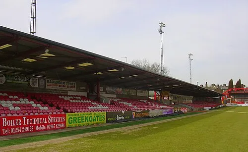 Crown Ground Landmark, Altham12 km S
-
River Hodder River, England4.4 km S
Nearest towns and villages
Sources & licences
Data last updated: · 2 independent sources