Ribble Valley District
Located in Lancashire, England Coordinates: 53°54′09″ N 2°24′58″ W
- Population
- 58,826
- 58.8K
- Elevation
- 164 m
- above sea level
- Local time
- UTC+00:00
- Europe/London · UTC+00:00
- Places inside
- 49
- listed under Ribble Valley District
About Ribble Valley District
Ribble Valley District is a municipality. Location: Lancashire, England. Population: 58,826. Elevation: 164 m.
In comparison
- No. 12 of 12 places in Lancashire by population
- Nearest larger town: Pendle District, 15 km E
- 31 sights and natural places within 10 km Waddow Hill, Waddington Fell
- Listed here: Village: 49
Climate of Ribble Valley District
Best months for sightseeing: June–August.
| Month | Jan | Feb | Mar | Apr | May | Jun | Jul | Aug | Sep | Oct | Nov | Dec |
|---|---|---|---|---|---|---|---|---|---|---|---|---|
| Average high (°C) | 6° | 6° | 8° | 11° | 15° | 17° | 19° | 19° | 16° | 12° | 9° | 7° |
| Average low (°C) | 1° | 1° | 2° | 3° | 6° | 9° | 11° | 11° | 9° | 6° | 3° | 2° |
| Precipitation (mm) | 138 | 86 | 111 | 77 | 73 | 87 | 91 | 112 | 120 | 142 | 148 | 147 |
Monthly averages for 1970–2000 at about 18 km resolution, adjusted for elevation. Highlighted months are mild and relatively dry. Source: WorldClim 2.1 (CC BY 4.0).
Airports nearest to Ribble Valley District
- Leeds Bradford Airport (LBA) Leeds, West Yorkshire 50 km
- Manchester Airport (MAN) Manchester, Greater Manchester 62 km
- Liverpool John Lennon Airport (LPL) Liverpool 69 km
Straight-line distance; airports with scheduled flights only. Source: OurAirports (public domain).
Places in Ribble Valley District
49 places-
Aighton, Bailey and Chaigley Village
-
Balderstone Village
-
Bashall Eaves Village
-
Billington and Langho Village
-
Bolton-by-Bowland Village
-
Bowland Forest High Village
-
Bowland Forest Low Village
-
Bowland-with-Leagram Village
-
Chatburn Village
-
Chipping Village
-
Clayton-le-Dale Village
-
Clitheroe Village
-
Dinckley Village
-
Downham Village
-
Dutton Village
-
Easington Village
-
Gisburn Village
-
Gisburn Forest Village
-
Great Mitton Village
-
Grindleton Village
-
Horton Village
-
Hothersall Village
-
Little Mitton Village
-
Longridge Village
-
Mearley Village
-
Mellor Village
-
Middop Village
-
Newsholme Village
-
Newton Village
-
Osbaldeston Village
-
Paythorne Village
-
Pendleton Village
-
Ramsgreave Village
-
Read Village
-
Ribchester Village
-
Rimington Village
-
Sabden Village
-
Salesbury Village
-
Sawley Village
-
Simonstone Village
-
Slaidburn Village
-
Thornley-with-Wheatley Village
-
Twiston Village
-
Waddington Village
-
West Bradford Village
-
Whalley Village
-
Wilpshire Village
-
Wiswell Village
-
Worston Village
Nearby attractions & nature
Everything nearby-
Tosside Beck River, England4.6 km E
-
Croasdale Brook River, England7.2 km N
-
Langden Brook River, England7.4 km NW
-
Pendle Hill Mountain, Barley-with-Wheatley Booth8.6 km SE
-
River Hodder River, England7.7 km S
-
River Loud River, England8 km W
-
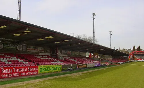 Crown Ground Landmark, Altham16 km S
-
 Turf Moor Landmark, Burnley District18 km SE
Other cities and towns in Lancashire
-
Pendle District Municipality, Lancashire15 km E
-
Hyndburn District Municipality, Lancashire16 km S
-
Clitheroe Town, Clitheroe4.1 km S
-
Burnley District Municipality, Lancashire19 km SE
-
Preston District Municipality, Lancashire21 km SW
-
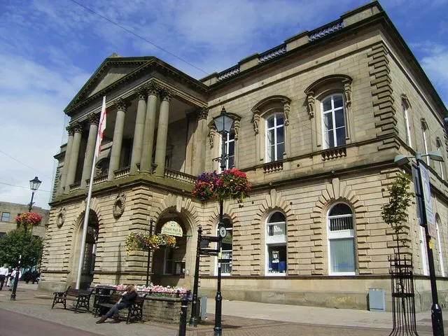 Accrington Town, Hyndburn District17 km S
Sources & licences
Data last updated: