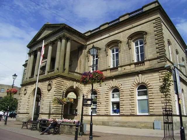
- Population
- 34,897
- 34.9K
- Elevation
- 148 m
- above sea level
- Local time
- UTC+00:00
- Europe/London · UTC+00:00
- Airports
- MAN Manchester Airport45 km
- LBA Leeds Bradford Airport48 km
About Accrington
Accrington is a town. Location: Hyndburn District, Lancashire. Population: 34,897. Elevation: 148 m.
Accrington is a town in the Hyndburn borough of Lancashire, England. It lies about 4 miles (6 km) east of Blackburn, 6 miles (10 km) west of Burnley, 13 miles (21 km) east of Preston, 20 miles (32 km) north of Manchester and is situated on the culverted River Hyndburn. Commonly abbreviated by locals to "Accy", the town has a population of 35,456 according to the 2011 census. Accrington is the largest settlement and the seat of the Hyndburn borough council.
Source: Wikipedia · CC BY-SA 4.0
Photos of Accrington
-

Ray Hutchings · CC BY-SA 4.0 -

Tim Green from Bradford · CC BY 2.0 -

Ray Hutchings · CC BY-SA 4.0 -

Rept0n1x · CC BY-SA 3.0 -

Tim Green from Bradford · CC BY 2.0


Travel notes for Accrington
From Wikivoyage
Accrington is a town in East Lancashire. The town's main visitor attraction is the Tiffany glass collection in its art gallery, and the stark natural beauty of the Pennine moors all around. It's also notorious for its football team Accrington Stanley, which until 2019 was unfairly regarded as a joke and byword for failure. But not any more.
The small towns of Baxenden, Oswaldtwistle (say ozzle-twizzle) and Clayton-le-Moors are nearby, and Blackburn is five miles west.
Understand+
Its name probably means "acorns" from the oak woods that once carpeted these valleys. It grew during the industrial revolution, when the streams racing down from the Pennines powered its textile mills
It had a population of 35,000 in 2011, with a total of 80,000 in the borough of Hyndburn area. Many of its residents are Bangladeshis who came to work the mills in the 1950s. The town also produced Accrington Brick or NORI ("Iron" backwards), an exceptionally hard and acid-resistant brick, valuable for lining furnaces, chimneys and the like. The brickworks closed in 2008, were re-opened to political fanfare in 2015, and quietly closed again in 2016. The northern suburb of Ewbank gave its name to the carpet-sweeper manufacturer.
Football team:
Lots of towns have had football (soccer) teams that collapsed. But this place is unique, at least in Britain, in the way the collapse of Accrington Stanley hung like a pall over the name of the town for decades, in spite of the team's resurgence. One reason is that they collapsed in the 1960s, in an era when that was difficult to accomplish. England's Football League was a closed shop. Promotion and relegation between fourth division and the minor leagues below was rare.
From 1960 Accrington Stanley were near bankrupt, and fell like a stone through the League placings. By March 1962 their debts were unsustainable, they couldn't afford to put on games, and they had to resign from the League during the 61/62 season. It was a traumatic disorderly exit, and all their results were expunged. In the following seasons they played in the Lancashire Combination Leagues, and then they dissolved in 1966.
Get in+
By air:
Manchester Airport is 27 miles (43 km) south, with excellent flight connections across the UK, Europe and beyond.
Leeds Bradford Airport is 30 miles (48 km) east of Accrington but has fewer flights and less onward transport.
By rail:
Accrington is on the East Lancashire Line. There is an hourly train (daily) from Preston via Blackburn to Accrington, continuing to Burnley, Halifax, Bradford, Leeds and York.
There's also an hourly train (daily) from Blackburn via Accrington to Manchester Victoria. (Change at Victoria for Manchester Piccadilly and Airport.) This train meanders on west via Salford and Wigan to Southport.
1 Accrington Railway Station is east side of town centre, with the main entrance on Eagle St next to Tesco.
By road:
The town is on the M65 motorway which traverses East Lancashire, and is just off the A56/M66 from Manchester.
By bus: Red Express X41 runs between Manchester, Prestwich and Accrington, taking 1 hr 50 min. It runs M-Sa every 30-40 min, on Sunday hourly.
There are two direct daytime National Express coaches and one overnight from London Victoria taking 7-8 hours (NX 540 & 422 to Accrington & Burnley). Megabus doesn't serve the town.
By bike: The town is on National Cycle Route 6 which runs from London to the Lake District.
The Leeds-Liverpool Canal runs by Accrington. It's navigable coast to coast, and its towpath is a good long-distance walking & cycling route.
Source: Wikivoyage · CC BY-SA 4.0 · abridged
Climate of Accrington
Best months for sightseeingBest months for sightseeing: June–August.
This month · November
A wet month
Day 9° · Night 3° · Rain 143 mm
- Hottest month
- July (day 19°)
- Coldest month
- January (night 1°)
- Wettest month
- November (143 mm)
- Driest month
- May (71 mm)
Bars: average monthly low and high temperature. Below: precipitation. Monthly averages for 1970–2000 at about 18 km resolution, adjusted for elevation. Highlighted months are mild and relatively dry. Source: WorldClim 2.1 (CC BY 4.0).
Show values as a table
| Month | Jan | Feb | Mar | Apr | May | Jun | Jul | Aug | Sep | Oct | Nov | Dec |
|---|---|---|---|---|---|---|---|---|---|---|---|---|
| Average high (°C) | 6° | 6° | 8° | 11° | 15° | 17° | 19° | 19° | 16° | 13° | 9° | 7° |
| Average low (°C) | 1° | 1° | 2° | 4° | 6° | 9° | 11° | 11° | 9° | 6° | 3° | 2° |
| Precipitation (mm) | 131 | 83 | 107 | 75 | 71 | 86 | 87 | 109 | 113 | 138 | 143 | 141 |
How to get to Accrington
The nearest airport is Manchester Airport (MAN), 45 km to the south as the crow flies. The nearest large city is Blackburn, 8 km to the west.
Airports
- Manchester Airport (MAN) Manchester, Greater Manchester 45 kmsouth
- Leeds Bradford Airport (LBA) Leeds, West Yorkshire 48 kmeast
- Liverpool John Lennon Airport (LPL) Liverpool 57 kmsouthwest
Nearby large cities
- Blackburn Population: 146.5K 8 kmwest
- Burnley Population: 149.4K 10 kmnortheast
- Bolton Population: 141.3K 20 kmsouth
- Preston Population: 313.3K 23 kmwest
- Oldham Population: 237.1K 29 kmsoutheast
Straight-line distances; road distances are longer. Airport data: OurAirports.
Day trips from Accrington
Within 100 km: 669 historic and cultural sites, 1,669 natural sites, 258 lakes, rivers and coasts.
0–25 km165 places
- The Island Island 15 kmSW
- Pickup Bank Reservoir Lake 7 kmSW
- Hollingworth Lake Lake 23 kmSE
- Anglezarke Reservoir Lake 17 kmSW
25–60 km689 places
- Great Britain Island 36 kmNE
- Formby Beach Beach 53 kmSW
- Ainsdale Beach Beach 49 kmW
- St Anne's Beach Beach 45 kmW
60–100 km1,742 places
- High Moor Mountain 72 kmNW
- Thurstaston Beach Beach 70 kmSW
- Roanhead Beach Beach 74 kmNW
- The Island Island 71 kmNE
Straight-line distances.
Nearby attractions & nature
Everything nearby-
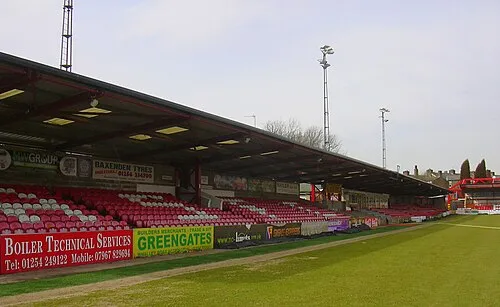 Crown Ground Landmark, Altham1.5 km NW
-
Whinney Hill Mountain, Altham1.8 km N
-
Great Hameldon Mountain, Hapton3 km E
-
Hapton Castle Historic site, Hapton3.7 km NE
-
Rushy Hill Mountain, Hyndburn District5.8 km SW
-
Hapton Tower Landmark, Hapton4.5 km E
-
Height House Hill Mountain, Hyndburn District6.6 km NW
-
Cribden Hill Mountain, Rossendale District5.8 km SE
Other cities and towns in Hyndburn District
-
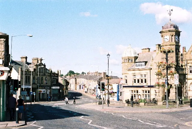 Great Harwood Town, Hyndburn District4.8 km NW
-
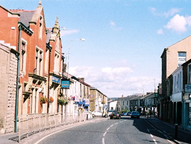 Rishton Town, Hyndburn District4 km NW
Sources & licences
Data last updated: · 2 independent sources