Preston District
Located in Lancashire, England Coordinates: 53°49′19″ N 2°42′34″ W
- Population
- 141,801
- 141.8K
- Elevation
- 44 m
- above sea level
- Local time
- UTC+00:00
- Europe/London · UTC+00:00
- Places inside
- 50
- listed under Preston District
About Preston District
Preston District is a municipality. Location: Lancashire, England. Population: 141,801. Elevation: 44 m.
In comparison
- No. 2 of 12 places in Lancashire by population
- Nearest larger town: Preston, 7 km S
- 42 sights and natural places within 10 km St Mary, Newhouse Roman Catholic Church, Broughton in Amounderness
- Listed here: Neighbourhood: 23, Attraction: 14, Village: 9, Landmark: 2
Places in Preston District
50 places-
Preston City313.3K
-
Red Scar Neighbourhood1.2K
-
Adelphi Neighbourhood
-
Ashton Bank Neighbourhood
-
Ashton-on-Ribble Neighbourhood
-
Avenham Neighbourhood
-
Barton Village
-
Broadgate Neighbourhood
-
Brookfield Neighbourhood
-
Broughton Village
-
Broughton in Amounderness Landmark
-
Cadley Neighbourhood
-
Deepdale Landmark
-
Deepdale Neighbourhood
-
Farringdon Park Neighbourhood
-
Fishwick Neighbourhood
-
Frenchwood Neighbourhood
-
Fulwood Village
-
Gallows Hill Neighbourhood
-
Goosnargh Village
-
Grange Neighbourhood
-
Grimsargh Village
-
Haighton Village
-
Holme Slack Neighbourhood
-
Ingol Neighbourhood
-
Larches Neighbourhood
-
Lea Village
-
Maudlands Neighbourhood
-
Nooklands Neighbourhood
-
Our Lady and St Edward Roman Catholic Church Attraction
-
Ribbleton Neighbourhood
-
Sacred Heart Roman Catholic Church Attraction
-
Sharoe Green Neighbourhood
-
Sherwood Neighbourhood
-
SS Peter and Paul Roman Catholic Church Attraction
-
St Anthony of Padua Roman Catholic Church Attraction
-
St Clare Roman Catholic Church Attraction
-
St Gregory the Great Roman Catholic Church Attraction
-
St Ignatius Roman Catholic Church Attraction
-
St Joseph Roman Catholic Church Attraction
-
St Maria Goretti Roman Catholic Church Attraction
-
St Walburge Roman Catholic Church Attraction
-
St Wilfrid Roman Catholic Church Attraction
-
Tanterton Neighbourhood
-
The Blessed Sacrament Roman Catholic Church Attraction
-
The Holy Family Roman Catholic Church Attraction
-
Tulketh Priory Historic site
-
Whittingham Village
-
Woodplumpton Village
Nearby attractions & nature
Everything nearby-
St Thomas, Apostle Roman Catholic Church Attraction, Claughton5.9 km N
-
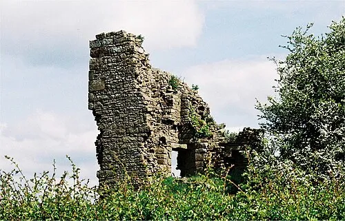 Greenhalgh Castle Historic site, Barnacre-with-Bonds9.3 km N
-
Our Lady and St Michael Roman Catholic Church Attraction, Longridge6.5 km E
-
Penwortham Castle Hill Historic site, Penwortham7.4 km S
-
Sullom Hill Mountain, Barnacre-with-Bonds8.1 km N
-
St Teresa Roman Catholic Church Attraction, Penwortham8 km S
-
Samlesbury Lower Hall Landmark, Samlesbury8 km SE
-
RNAS Inskip, Mast 4 Landmark, Inskip-with-Sowerby8 km W
Sources & licences
Data last updated: