Kenilworth Road
Located in Luton, England Coordinates: 51°53′03″ N 0°25′54″ W

- Local time
- UTC+00:00
- Europe/London · UTC+00:00
- Elevation
- 119 m
- above sea level
About Kenilworth Road
Kenilworth Road is a landmark. Location: Luton, England.
Kenilworth Road, also known as the Kenny, is a football stadium in the area of Bury Park, Luton, Bedfordshire, England. It has been the home ground of Luton Town Football Club since 1905. The stadium has also hosted women's and youth international matches, including the second leg of the 1984 European Competition for Women's Football final. The 12,000 all-seater stadium is situated in the district of Bury Park, one mile (1.6 km) west of the centre of Luton.
Read more on Wikipedia Text: Wikipedia contributors · CC BY-SA 4.0 · shortened
At a glance
- Built
- 1905
- Opened
- 1905
Source: Wikidata
In comparison
- 50 sights and natural places within 10 km Someries Castle, Lewsey Farm Mediumwave Transmitter
Airports nearest to Kenilworth Road
- London Luton Airport (LTN) Luton, Luton 4 km
- London Stansted Airport (STN) London, Essex 46 km
- London Heathrow Airport (LHR) London 46 km
Straight-line distance; airports with scheduled flights only. Source: OurAirports (public domain).
Nearby attractions & nature
Everything nearby-
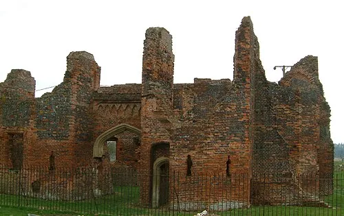 Someries Castle Historic site, Hyde4.2 km SE
-
Lewsey Farm Mediumwave Transmitter Landmark, Luton4.4 km NW
-
Sundon Church Attraction, Sundon6 km NW
-
Warden Hill Mountain, Streatley4.4 km N
-
St Margaret's church Attraction, Streatley6.9 km N
-
Blow's Down Mountain, Caddington4.6 km W
-
Galley Hill Mountain, Streatley4.7 km N
-
Ravensburgh Castle Historic site, Hexton8 km N
Nearest towns and villages
-
Luton City, Luton1.1 km SE
-
Stopsley Village, Luton3.3 km NE
-
Bury Park Neighbourhood, Luton0.3 km NE
-
Sundon Park Village, Luton4.6 km NW
Sources & licences
Data last updated: · 2 independent sources