- Elevation
- 535 m
- above sea level
- Local time
- UTC+00:00
- Europe/London · UTC+00:00
- Airports
- LBA Leeds Bradford Airport61 km
- MME Teesside International Airport67 km
About Blea Moor
Blea Moor is a mountain. Location: Ingleton, Craven District. Elevation: 535 m. The best months to visit are July. The nearest airport is Leeds Bradford Airport (61 km). Nearby sights include Wold Fell and Whernside.
Climate of Blea Moor
Best months for sightseeingBest months for sightseeing: July.
This month · November
A wet month
Day 6° · Night 1° · Rain 179 mm
- Hottest month
- July (day 17°)
- Coldest month
- January (night -2°)
- Wettest month
- November (179 mm)
- Driest month
- May (95 mm)
Bars: average monthly low and high temperature. Below: precipitation. Monthly averages for 1970–2000 at about 18 km resolution, adjusted for elevation. Highlighted months are mild and relatively dry. Source: WorldClim 2.1 (CC BY 4.0).
Show values as a table
| Month | Jan | Feb | Mar | Apr | May | Jun | Jul | Aug | Sep | Oct | Nov | Dec |
|---|---|---|---|---|---|---|---|---|---|---|---|---|
| Average high (°C) | 3° | 4° | 6° | 8° | 12° | 15° | 17° | 16° | 13° | 10° | 6° | 4° |
| Average low (°C) | -2° | -1° | 0° | 1° | 4° | 7° | 9° | 8° | 7° | 4° | 1° | -1° |
| Precipitation (mm) | 174 | 117 | 143 | 97 | 95 | 98 | 108 | 129 | 145 | 170 | 179 | 179 |
Other places to visit in this season: July
How to get to Blea Moor
The nearest airport is Leeds Bradford Airport (LBA), 61 km to the southeast as the crow flies. The nearest large city is Burnley, 49 km to the south.
Airports
- Leeds Bradford Airport (LBA) Leeds, West Yorkshire 61 kmsoutheast
- Teesside International Airport (MME) Darlington, Durham 67 kmnortheast
- Newcastle International Airport (NCL) Newcastle upon Tyne, Tyne and Wear 99 kmnortheast
Nearby large cities
- Burnley Population: 149.4K 49 kmsouth
- Blackburn Population: 146.5K 55 kmsouth
- Preston Population: 313.3K 58 kmsouthwest
- Bradford Population: 366.2K 63 kmsoutheast
- Blackpool Population: 145K 66 kmsouthwest
Straight-line distances; road distances are longer. Airport data: OurAirports.
Day trips from Blea Moor
Within 100 km: 881 historic and cultural sites, 1,820 natural sites, 301 lakes, rivers and coasts.
0–25 km212 places
- The Island Island 16 kmW
- Terrybank Tarn Lake 17 kmW
- Semer Water Lake 16 kmE
- Malham Tarn Lake 20 kmSE
25–60 km1,271 places
- Great Britain Island 35 kmSE
- High Moor Mountain 51 kmW
- Roanhead Beach Beach 60 kmW
- The Island Island 45 kmE
60–100 km1,519 places
- Formby Beach Beach 90 kmSW
- Ainsdale Beach Beach 84 kmSW
- St Anne's Beach Beach 71 kmSW
- St. Bees Beach Seafront Beach 86 kmW
Straight-line distances.
Nearest towns and villages
-
Newby Head Village, Ingleton2.5 km NE
-
Gearstones Village, Ingleton2.7 km SE
-
Ribblehead Village, Ingleton3.6 km S
-
Gauber Village, Ingleton3.9 km S
-
Stone House Village, Dent3.3 km N
-
Dent Village, Westmorland and Furness6 km NW
Nearby attractions & nature
Everything nearby-
Wold Fell Mountain, Dent2.9 km NE
-
Whernside Mountain, Dent3.7 km W
-
Redshaw Moss Mountain, Hawes4.5 km NE
-
Great Knoutberry Hill Mountain, Dent4.8 km N
-
Rise Hill Mountain, Dent6.6 km NW
-
High Pike Mountain, Dent5.6 km W
-
Park Fell Mountain, Ingleton5.7 km S
-
Ribblehead Viaduct Landmark, Ingleton3.3 km S
More nature in United Kingdom
-
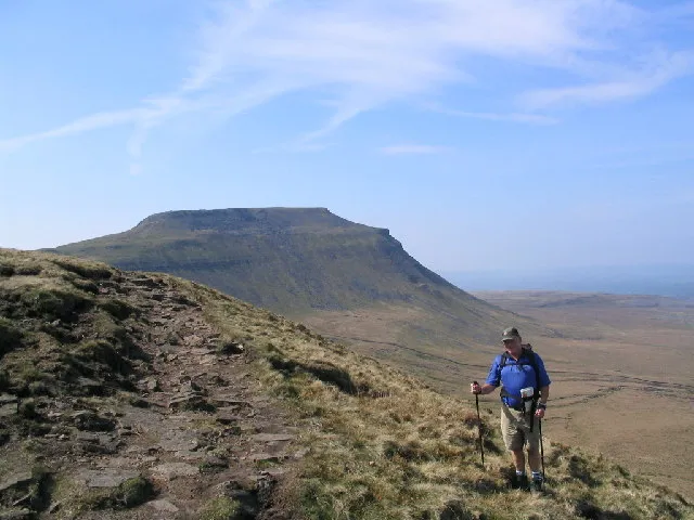 Ingleborough Mountain, Ingleton8.6 km S
-
Simon Fell Mountain, Ingleton7.6 km S
Sources & licences
Data last updated: · 2 independent sources