- Elevation
- 619 m
- above sea level
- Local time
- UTC+00:00
- Europe/London · UTC+00:00
- Airports
- NCL Newcastle International Airport56 km
- EDI Edinburgh Airport92 km
About Windy Gyle
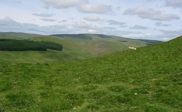
Windy Gyle is a mountain. Location: Alwinton, Northumberland. Elevation: 619 m.
Windy Gyle is a mountain in the Cheviot Hills range, on the border between England and Scotland. Like the other hills in the area, it is rounded and grass-covered. It is the highest summit on the border, although not the highest point as the border is higher where it runs along the western shoulder of The Cheviot, at a point called Cairn Hill West Top, or Hangingstone Hill.
Source: Wikipedia · CC BY-SA 4.0
At a glance
- Topographic prominence
- 113 m
Source: Wikidata
Photos of Windy Gyle
-

Dave Kelly · CC BY-SA 2.0 -

Dave Kelly · CC BY-SA 2.0 -

Bill Boaden · CC BY-SA 2.0 -

Bill Boaden · CC BY-SA 2.0 -

Iangpark · CC BY-SA 4.0


Climate of Windy Gyle
This month · November
A wet month
Day 5° · Night -1° · Rain 158 mm
- Hottest month
- July (day 16°)
- Coldest month
- January (night -3°)
- Wettest month
- January (171 mm)
- Driest month
- April (90 mm)
Bars: average monthly low and high temperature. Below: precipitation. Monthly averages for 1970–2000 at about 18 km resolution, adjusted for elevation. Highlighted months are mild and relatively dry. Source: WorldClim 2.1 (CC BY 4.0).
Show values as a table
| Month | Jan | Feb | Mar | Apr | May | Jun | Jul | Aug | Sep | Oct | Nov | Dec |
|---|---|---|---|---|---|---|---|---|---|---|---|---|
| Average high (°C) | 3° | 3° | 5° | 8° | 11° | 14° | 16° | 16° | 13° | 9° | 5° | 3° |
| Average low (°C) | -3° | -3° | -2° | -1° | 2° | 5° | 7° | 7° | 5° | 2° | -1° | -2° |
| Precipitation (mm) | 171 | 118 | 131 | 90 | 95 | 90 | 101 | 121 | 134 | 163 | 158 | 155 |
How to get to Windy Gyle
The nearest airport is Newcastle International Airport (NCL), 56 km to the southeast as the crow flies. The nearest large city is Newcastle upon Tyne, 64 km to the southeast.
Airports
- Newcastle International Airport (NCL) Newcastle upon Tyne, Tyne and Wear 56 kmsoutheast
- Edinburgh Airport (EDI) Ingliston, Edinburgh 92 kmnorthwest
- Teesside International Airport (MME) Darlington, Durham 115 kmsoutheast
Nearby large cities
- Newcastle upon Tyne Population: 300.1K 64 kmsoutheast
- Sunderland Population: 170.1K 80 kmsoutheast
- Edinburgh Population: 515K 84 kmnorthwest
- Middlesbrough Population: 142.7K 114 kmsoutheast
- Dundee Population: 148.2K 125 kmnorth
Straight-line distances; road distances are longer. Airport data: OurAirports.
Day trips from Windy Gyle
Within 100 km: 629 historic and cultural sites, 1,721 natural sites, 440 lakes, rivers and coasts.
0–25 km324 places
- Wooden Anna Island 22 kmNW
- Sharpitlaw Anna Island 23 kmNW
- Yetholm Loch Lake 14 kmN
- Hoselaw Loch Lake 18 kmN
25–60 km958 places
- Cocklawburn Beach Beach 38 kmNE
- Cheswick Sands Beach 37 kmNE
- Longhoughton Beach Beach 41 kmE
- South Wamses Island 44 kmNE
60–100 km1,508 places
- Burntisland Beach Beach 94 kmNW
- Cramond beach Beach 91 kmNW
- Portobello Beach Beach 80 kmNW
- Gullane Beach Beach 78 kmNW
Straight-line distances.
Nearest towns and villages
-
Cocklawfoot Village, The Scottish Borders2.2 km N
-
Sourhope Village, The Scottish Borders5.1 km N
-
Heigh Village, Alwinton6.8 km SE
-
 Hownam Village, The Scottish Borders8.7 km NW
-
Town Yetholm Village, The Scottish Borders13 km N
-
Howgate Village, The Scottish Borders9 km NW
Nearby attractions & nature
Everything nearby-
Windy Rig Mountain, The Scottish Borders1 km W
-
Ward Law Mountain, Alwinton1.8 km SE
-
Pudding Law Mountain, The Scottish Borders2.6 km NW
-
The Middle Mountain, Alwinton2.6 km SE
-
Mozie Law Mountain, The Scottish Borders2.7 km W
-
Mozie Law South Top Mountain, Alwinton2.7 km W
-
Swineside Law Mountain, Alwinton2.7 km SW
-
Shorthope Hill Mountain, Alwinton2.9 km S
Sources & licences
Data last updated: · 2 independent sources