- Elevation
- 328 m
- above sea level
- Local time
- UTC+00:00
- Europe/London · UTC+00:00
- Airports
- NCL Newcastle International Airport57 km
- EDI Edinburgh Airport91 km
About Cocklawfoot
Cocklawfoot is a village. Location: The Scottish Borders, Scotland. Elevation: 328 m. The best months to visit are June–August. The nearest airport is Newcastle International Airport (57 km). Nearby sights include Pudding Law and Windy Gyle.
Photos of Cocklawfoot
-
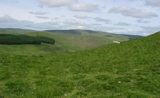
Windy Gyle Richard Webb · CC BY-SA 2.0

Climate of Cocklawfoot
Best months for sightseeingBest months for sightseeing: June–August.
This month · November
A wet month
Day 7° · Night 1° · Rain 158 mm
- Hottest month
- July (day 18°)
- Coldest month
- January (night -1°)
- Wettest month
- January (171 mm)
- Driest month
- April (90 mm)
Bars: average monthly low and high temperature. Below: precipitation. Monthly averages for 1970–2000 at about 18 km resolution, adjusted for elevation. Highlighted months are mild and relatively dry. Source: WorldClim 2.1 (CC BY 4.0).
Show values as a table
| Month | Jan | Feb | Mar | Apr | May | Jun | Jul | Aug | Sep | Oct | Nov | Dec |
|---|---|---|---|---|---|---|---|---|---|---|---|---|
| Average high (°C) | 5° | 5° | 7° | 10° | 13° | 16° | 18° | 17° | 14° | 11° | 7° | 5° |
| Average low (°C) | -1° | -1° | 0° | 1° | 4° | 7° | 9° | 9° | 7° | 4° | 1° | 0° |
| Precipitation (mm) | 171 | 118 | 131 | 90 | 95 | 90 | 101 | 121 | 134 | 163 | 158 | 155 |
How to get to Cocklawfoot
The nearest airport is Newcastle International Airport (NCL), 57 km to the southeast as the crow flies. The nearest large city is Newcastle upon Tyne, 66 km to the southeast.
Airports
- Newcastle International Airport (NCL) Newcastle upon Tyne, Tyne and Wear 57 kmsoutheast
- Edinburgh Airport (EDI) Ingliston, Edinburgh 91 kmnorthwest
- Teesside International Airport (MME) Darlington, Durham 117 kmsoutheast
Nearby large cities
- Newcastle upon Tyne Population: 300.1K 66 kmsoutheast
- Sunderland Population: 170.1K 81 kmsoutheast
- Edinburgh Population: 515K 82 kmnorthwest
- Middlesbrough Population: 142.7K 116 kmsoutheast
- Dundee Population: 148.2K 123 kmnorth
Straight-line distances; road distances are longer. Airport data: OurAirports.
Day trips from Cocklawfoot
Within 100 km: 623 historic and cultural sites, 1,699 natural sites, 441 lakes, rivers and coasts.
0–25 km324 places
- Wooden Anna Island 20 kmNW
- Sharpitlaw Anna Island 21 kmNW
- Mill Island Island 24 kmNW
- Yetholm Loch Lake 12 kmNW
25–60 km956 places
- Cocklawburn Beach Beach 36 kmNE
- Cheswick Sands Beach 35 kmNE
- Longhoughton Beach Beach 41 kmE
- South Wamses Island 44 kmNE
60–100 km1,483 places
- Burntisland Beach Beach 92 kmNW
- Cramond beach Beach 89 kmNW
- Portobello Beach Beach 79 kmNW
- Gullane Beach Beach 76 kmNW
Straight-line distances.
Nearby attractions & nature
Everything nearby-
Pudding Law Mountain, The Scottish Borders1.3 km W
-
Windy Gyle Mountain, Alwinton2.2 km S
-
Windy Rig Mountain, The Scottish Borders2.2 km S
-
Phillip Shank Mountain, The Scottish Borders3 km SW
-
Mozie Law Mountain, The Scottish Borders3.4 km SW
-
Fasset Hill Mountain, The Scottish Borders3.5 km N
Other cities and towns in The Scottish Borders
-
 Jedburgh Village, The Scottish Borders20 km W
-
 Coldstream Village, The Scottish Borders22 km N
-
Maxwellheugh Neighbourhood, The Scottish Borders20 km NW
-
Whitton Village, The Scottish Borders10 km W
-
Kirk Yetholm Village, The Scottish Borders11 km N
-
Morebattle Village, The Scottish Borders11 km NW
Sources & licences
Data last updated: