Ainsdale
Located in Sefton, England Coordinates: 53°36′11″ N 3°02′01″ W
- Population
- 12,723
- 12.7K
- Elevation
- 13 m
- above sea level
- Local time
- UTC+00:00
- Europe/London · UTC+00:00
About Ainsdale
Ainsdale is a village. Location: Sefton, England. Population: 12,723. Elevation: 13 m.
Ainsdale is a village in Southport, in the Sefton district, in Merseyside, England, situated three miles south of the centre of Southport. Originally in the historic county of Lancashire, at the 2001 Census it had a population of 12,723. By the time of the 2011 census, only figures for Ainsdale (ward) were available. It makes up the southern edge of the town, separated from neighbouring Formby by RAF Woodvale.
Read more on Wikipedia Text: Wikipedia contributors · CC BY-SA 4.0 · shortened
In comparison
- No. 3 of 4 places in Sefton by population
- Nearest larger town: Southport, 5 km N
- 18 sights and natural places within 10 km Ainsdale Beach, Haig Avenue
Nearby attractions & nature
Everything nearby-
Ainsdale Beach Beach, Sefton2.1 km W
-
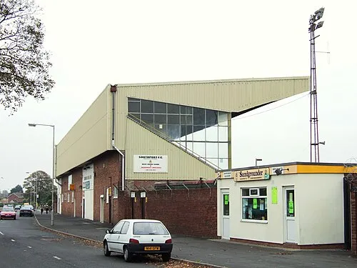 Haig Avenue Landmark, Sefton5.3 km NE
-
Princess Park Natural site, Sefton5.4 km N
-
Fine Jane Brook River, Sefton5.9 km NE
-
Kew Parkd Natural site, Sefton5.4 km NE
-
Formby Beach Beach, Formby5.9 km SW
Sources & licences
Data last updated: · 2 independent sources