Weybridge
Located in Elmbridge District, Surrey Coordinates: 51°22′18″ N 0°27′35″ W
- Population
- 19,463
- 19.5K
- Elevation
- 18 m
- above sea level
- Local time
- UTC+00:00
- Europe/London · UTC+00:00
About Weybridge
Weybridge is a town. Location: Elmbridge District, Surrey. Population: 19,463. Elevation: 18 m.
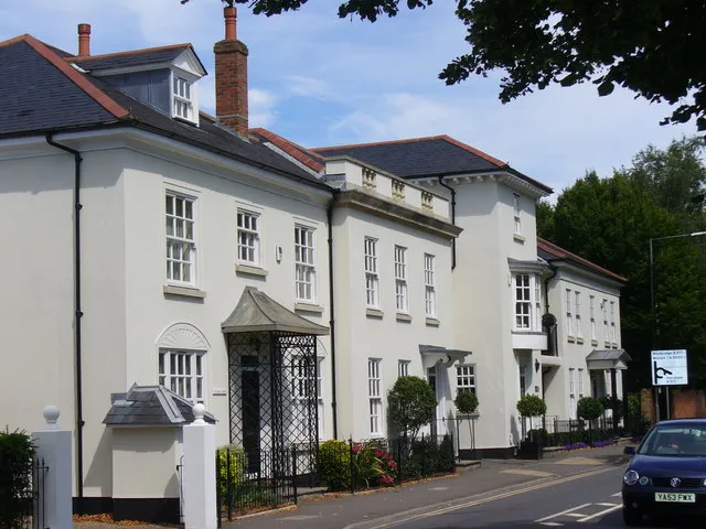
Weybridge () is a town in the Borough of Elmbridge in Surrey, England, around 17 mi (27 km) south-west of central London. The settlement is recorded as Waigebrugge and Weibrugge in the 7th century and the name derives from a crossing point of the River Wey, which flows into the River Thames to the north of the town centre. The earliest evidence of human activity is from the Bronze Age. During the Anglo-Saxon and medieval periods, Weybridge was held by Chertsey Abbey. In 2011 it had a population of 15,449.
Read more on Wikipedia Text: Wikipedia contributors · CC BY-SA 4.0 · shortened
At a glance
- Area
- 13.7 km²
Source: Wikidata
In comparison
- No. 3 of 13 places in Elmbridge District by population
- Nearest larger town: Walton on Thames, 4 km NE
- 62 sights and natural places within 10 km Bull Dog Island, Hamhaugh Island
Airports nearest to Weybridge
- London Heathrow Airport (LHR) London 11 km
- London Gatwick Airport (LGW) London 31 km
- London City Airport (LCY) London 39 km
Straight-line distance; airports with scheduled flights only. Source: OurAirports (public domain).
Nearby attractions & nature
Everything nearby-
Bull Dog Island Island, Elmbridge District0.5 km N
-
D'Oyly Carte Island Island, Elmbridge District1.3 km N
-
Hamhaugh Island Island, Spelthorne District1 km N
-
Lock Island Island, Spelthorne District1.1 km N
-
Pharaoh's Island Island, Spelthorne District1.2 km N
-
Woburn Park Natural site, Runnymede District1.5 km NW
-
Trinity Island Island, Runnymede District1.3 km SW
-
Desborough Island Island, Elmbridge District1.9 km NE
Other cities and towns in Elmbridge District
-
 Esher Town, Elmbridge District6.5 km E
-
East Molesey Town, Elmbridge District8.3 km E
-
Cobham Town, Elmbridge District5.7 km SE
-
Molesey Town, Elmbridge District6.4 km NE
-
Downside Town, Elmbridge District7.6 km SE
-
Thames Ditton Town, Elmbridge District8.6 km E
Sources & licences
Data last updated: · 2 independent sources