Cnoc an Locha
Located in Causeway Coast and Glens, Northern Ireland Coordinates: 54°51′09″ N 6°53′15″ W
- Elevation
- 407 m
- above sea level
- Local time
- UTC+00:00
- Europe/London · UTC+00:00
- Airports
- LDY City of Derry Airport27 km
- BFS Belfast International Airport48 km
About Cnoc an Locha
Cnoc an Locha is a mountain. Location: Causeway Coast and Glens, Northern Ireland. Elevation: 407 m. The nearest airport is City of Derry Airport (27 km). Nearby sights include Craigagh Hill and Mullaghmore.
Climate of Cnoc an Locha
This month · November
A wet month
Day 8° · Night 3° · Rain 163 mm
- Hottest month
- July (day 16°)
- Coldest month
- January (night 1°)
- Wettest month
- November (163 mm)
- Driest month
- May (86 mm)
Bars: average monthly low and high temperature. Below: precipitation. Monthly averages for 1970–2000 at about 18 km resolution, adjusted for elevation. Highlighted months are mild and relatively dry. Source: WorldClim 2.1 (CC BY 4.0).
Show values as a table
| Month | Jan | Feb | Mar | Apr | May | Jun | Jul | Aug | Sep | Oct | Nov | Dec |
|---|---|---|---|---|---|---|---|---|---|---|---|---|
| Average high (°C) | 5° | 5° | 7° | 9° | 12° | 14° | 16° | 16° | 14° | 11° | 8° | 6° |
| Average low (°C) | 1° | 1° | 1° | 2° | 5° | 7° | 10° | 9° | 8° | 5° | 3° | 1° |
| Precipitation (mm) | 157 | 120 | 127 | 93 | 86 | 92 | 98 | 121 | 133 | 158 | 163 | 162 |
How to get to Cnoc an Locha
The nearest airport is City of Derry Airport (LDY), 27 km to the northwest as the crow flies. For international flights: Belfast International Airport (BFS) (48 km). The nearest large city is Belfast, 68 km to the southeast.
Airports
- City of Derry Airport (LDY) Derry, Derry and Strabane 27 kmnorthwest
- Belfast International Airport (BFS) Belfast 48 kmsoutheast
- George Best Belfast City Airport (BHD) Belfast 70 kmeast
Nearby large cities
- Belfast Population: 348K 68 kmsoutheast
- Dublin Population: 1M 174 kmsouth
- Glasgow Population: 626.4K 201 kmnortheast
- Edinburgh Population: 515K 264 kmnortheast
- Limerick Population: 102.3K 269 kmsouthwest
Straight-line distances; road distances are longer. Airport data: OurAirports.
Day trips from Cnoc an Locha
Within 100 km: 98 historic and cultural sites, 785 natural sites, 746 lakes, rivers and coasts.
0–25 km70 places
- Lough Fea Lake 16 kmS
- White Mountain Mountain 3 kmE
- Sperrin Mountains Mountain 14 kmSW
- Slievemore Mountain 24 kmSW
25–60 km351 places
- Portstewart Beach Beach 37 kmN
- Benone Beach Beach 35 kmN
- Portstewart Strand Beach 36 kmN
- Lisfannon Beach Beach 47 kmNW
60–100 km1,208 places
- Island Roy Island 69 kmNW
- West Maiden Island 74 kmE
- Texa Island Island 97 kmNE
- Sheep Island Island 97 kmNE
Straight-line distances.
Nearest towns and villages
-
Dungiven Village, Causeway Coast and Glens9.2 km N
-
Moneyneany Village, Mid Ulster5.3 km SE
-
Carn Village, Causeway Coast and Glens6.3 km NE
-
Draperstown Village, Mid Ulster9.7 km SE
-
Ballydonegan Village, Causeway Coast and Glens8.4 km W
-
Feeny Village, Causeway Coast and Glens9 km NW
Nearby attractions & nature
Everything nearby-
Craigagh Hill Mountain, Mid Ulster2.3 km S
-
Mullaghmore Mountain, Causeway Coast and Glens2.4 km E
-
White Mountain Mountain, Mid Ulster2.8 km E
-
Mullach an Ionaidh Mountain, Causeway Coast and Glens3.9 km SW
-
Oughtmore Mountain, Mid Ulster3.9 km SW
-
Meenard Mountain Mountain, Derry City and Strabane4.9 km SW
-
Bohilbreaga Mountain, Mid Ulster4.5 km E
-
Cnoc an Chomraic Mountain, Causeway Coast and Glens5.1 km NE
More nature in United Kingdom
-
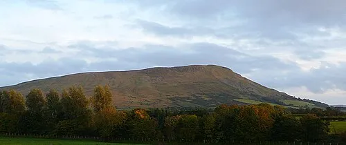 Benbradagh Mountain, Causeway Coast and Glens10 km N
-
Carn Hill Mountain, Causeway Coast and Glens7.5 km NE
-
Mullach Aise Mountain, Causeway Coast and Glens7.5 km W
-
Barnes Top Mountain, Causeway Coast and Glens7.8 km W
-
Boviel Top Mountain, Causeway Coast and Glens8.2 km N
-
Carntogher Mountain, Causeway Coast and Glens9.5 km NE
Sources & licences
Data last updated: