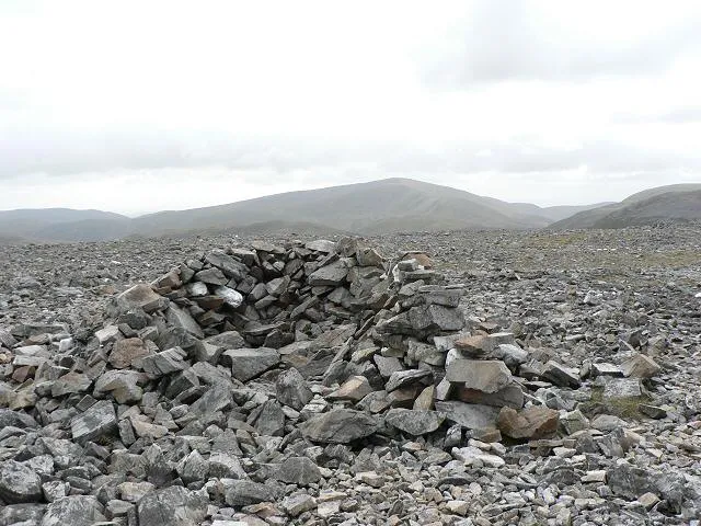
- Elevation
- 944 m
- above sea level
- Local time
- UTC+00:00
- Europe/London · UTC+00:00
- Airports
- DND Dundee Airport58 km
- INV Inverness Airport78 km
About An Socach
An Socach is a mountain. Location: Aberdeenshire, Scotland. Elevation: 944 m.
An Socach is a Scottish mountain situated some three miles (5 km) west of the A93 road from Perth to Braemar. It is located at grid ref. 080800 on Ordnance Survey sheet 43. The summit altitude is 944 m (3,097 ft). The name may derive from the Gaelic Soc, meaning the snout or beak, leading to the projecting place by analogy with the shape of a snout. Other sources state that it in fact means 'the sow'.
Source: Wikipedia · CC BY-SA 4.0
At a glance
- Topographic prominence
- 188 m
Source: Wikidata
Photos of An Socach
-

Bob Peace · CC BY-SA 2.0 -

Bob Peace · CC BY-SA 2.0 -

Trevor Littlewood · CC BY-SA 2.0 -

Trevor Littlewood · CC BY-SA 2.0 -

Russel Wills · CC BY-SA 2.0


Climate of An Socach
This month · November
A wet month
Day 3° · Night -3° · Rain 148 mm
- Hottest month
- July (day 14°)
- Coldest month
- February (night -5°)
- Wettest month
- January (184 mm)
- Driest month
- June (81 mm)
Bars: average monthly low and high temperature. Below: precipitation. Monthly averages for 1970–2000 at about 18 km resolution, adjusted for elevation. Highlighted months are mild and relatively dry. Source: WorldClim 2.1 (CC BY 4.0).
Show values as a table
| Month | Jan | Feb | Mar | Apr | May | Jun | Jul | Aug | Sep | Oct | Nov | Dec |
|---|---|---|---|---|---|---|---|---|---|---|---|---|
| Average high (°C) | 1° | 1° | 2° | 5° | 9° | 12° | 14° | 13° | 10° | 7° | 3° | 1° |
| Average low (°C) | -5° | -5° | -4° | -3° | 0° | 3° | 5° | 5° | 3° | 0° | -3° | -4° |
| Precipitation (mm) | 184 | 118 | 132 | 83 | 86 | 81 | 81 | 96 | 128 | 157 | 148 | 151 |
How to get to An Socach
The nearest airport is Dundee Airport (DND), 58 km to the southeast as the crow flies. For international flights: Aberdeen International Airport (ABZ) (87 km). The nearest large city is Dundee, 58 km to the southeast.
Airports
- Dundee Airport (DND) Dundee 58 kmsoutheast
- Inverness Airport (INV) Inverness, Highland 78 kmnorthwest
- Aberdeen International Airport (ABZ) Aberdeen 87 kmnortheast
Nearby large cities
- Dundee Population: 148.2K 58 kmsoutheast
- Aberdeen Population: 198.6K 90 kmeast
- Edinburgh Population: 515K 108 kmsouth
- Glasgow Population: 626.4K 124 kmsouth
- Newcastle upon Tyne Population: 300.1K 245 kmsoutheast
Straight-line distances; road distances are longer. Airport data: OurAirports.
Day trips from An Socach
Within 100 km: 116 historic and cultural sites, 3,572 natural sites, 673 lakes, rivers and coasts.
0–25 km479 places
- Loch Vrotachan Lake 5 kmE
- Loch Valigan Lake 15 kmSW
- Loch Tilt Lake 9 kmW
- Shechernich Loch Lake 15 kmSE
25–60 km1,497 places
- Moncreiffe Island Island 58 kmS
- Eilean an Righ Island 59 kmW
- Isle of Spar Island 46 kmSW
- Eilean nam Faoileag Island 59 kmSW
60–100 km2,385 places
- Balbithan Island Island 81 kmNE
- Findlays Seat Mountain 76 kmN
- Lossiemouth East Beach Beach 92 kmN
- Sunnyside Beach Beach 99 kmNE
Straight-line distances.
Nearest towns and villages
-
Inverey Village, Aberdeenshire7.2 km N
-
Newbigging Village, Aberdeenshire8.3 km NE
-
Corriemulzie Village, Aberdeenshire9.7 km N
-
Muir Village, Aberdeenshire9.8 km N
-
Spittal of Glenshee Village, Perth and Kinross11 km S
-
Braemar Village, Aberdeenshire14 km NE
Nearby attractions & nature
Everything nearby-
Carn Cruinn Mountain, Aberdeenshire1.6 km NE
-
Beinn Iutharn Bheag Mountain, Aberdeenshire1.7 km SW
-
An Socach East Top Mountain, Aberdeenshire2 km E
-
Carn a' Chlarsaich Mountain, Perth and Kinross2.4 km SW
-
An Socach North Top Mountain, Aberdeenshire2.9 km NE
-
Glas Tulaichean North Top Mountain, Perth and Kinross3.1 km SW
-
Creag Easgaidh Mountain, Perth and Kinross3.1 km S
-
Carn Creagach Mountain, Aberdeenshire3.2 km N
Sources & licences
Data last updated: · 2 independent sources