Colonsay
Located in Argyll and Bute, Scotland Coordinates: 56°04′00″ N 6°13′00″ W
- Elevation
- 82 m
- above sea level
- Local time
- UTC+00:00
- Europe/London · UTC+00:00
- Population
- 124
- 124
About Colonsay
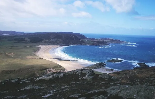
Colonsay is an island. Location: Argyll and Bute, Scotland. Population: 124.
Colonsay is an island in the Inner Hebrides of Scotland, located north of Islay and south of Mull. The ancestral home of Clan Macfie and the Colonsay branch of Clan MacNeil, it is in the council area of Argyll and Bute and has an area of 4,074 hectares (10,070 acres). Aligned on a south-west to north-east axis, it measures 8 miles (13 kilometres) in length and reaches 3 mi (5 km) at its widest point.
Read more on Wikipedia Text: Wikipedia contributors · CC BY-SA 4.0 · shortened
At a glance
- Length
- 16 km
- Area
- 40.7 km²
Source: Wikidata
In comparison
- 37 sights and natural places within 10 km Carn Airigh Shomhairle, Carn Mor
Nearest towns and villages
-
Isle of Colonsay Village, Argyll and Bute1.6 km N
-
Upper Kilchattan Village, Argyll and Bute<0.1 km N
-
Kilchattan Village, Argyll and Bute<0.1 km N
-
Lower Kilchattan Village, Argyll and Bute1.7 km NW
-
Scalasaig Village, Argyll and Bute1.8 km E
-
Balaruminmore Village, Argyll and Bute3.8 km S
Nearby attractions & nature
Everything nearby-
Carn Airigh Shomhairle Mountain, Argyll and Bute0.8 km S
-
Carn Mor Mountain, Argyll and Bute0.9 km NW
-
Loch Fada Lake, Argyll and Bute1 km E
-
Cnoc na Faire Mor Mountain, Argyll and Bute1.4 km E
-
Cnoc an t-Samhla Mountain, Argyll and Bute1.5 km SE
-
Beinn nan Gudairean Mountain, Argyll and Bute1.5 km NE
-
Beinn Arnicil Mountain, Argyll and Bute2 km S
-
Carn Spiris Mountain, Argyll and Bute2.2 km SW
Sources & licences
Data last updated: · 2 independent sources