- Elevation
- 416 m
- above sea level
- Local time
- UTC+00:00
- Europe/London · UTC+00:00
- Airports
- TRE Tiree Airport60 km
- ILY Islay Airport75 km
About Cruach Inagairt
Cruach Inagairt is a mountain. Location: Argyll and Bute, Scotland. Elevation: 416 m. The nearest airport is Tiree Airport (60 km). Nearby sights include Beinn Charsaig and Beinn na Croise.
Photos of Cruach Inagairt
-
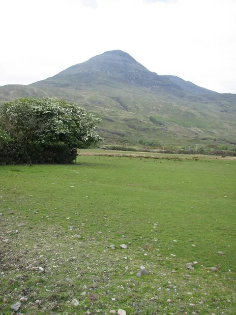
Ben Buie Mrs V Bryant · CC BY-SA 2.0

Climate of Cruach Inagairt
This month · November
A wet month
Day 7° · Night 4° · Rain 256 mm
- Hottest month
- July (day 15°)
- Coldest month
- February (night 1°)
- Wettest month
- January (277 mm)
- Driest month
- May (105 mm)
Bars: average monthly low and high temperature. Below: precipitation. Monthly averages for 1970–2000 at about 18 km resolution, adjusted for elevation. Highlighted months are mild and relatively dry. Source: WorldClim 2.1 (CC BY 4.0).
Show values as a table
| Month | Jan | Feb | Mar | Apr | May | Jun | Jul | Aug | Sep | Oct | Nov | Dec |
|---|---|---|---|---|---|---|---|---|---|---|---|---|
| Average high (°C) | 5° | 5° | 6° | 8° | 12° | 14° | 15° | 15° | 13° | 10° | 7° | 5° |
| Average low (°C) | 1° | 1° | 2° | 3° | 6° | 8° | 10° | 10° | 8° | 6° | 4° | 1° |
| Precipitation (mm) | 277 | 170 | 218 | 128 | 105 | 108 | 136 | 164 | 225 | 245 | 256 | 250 |
How to get to Cruach Inagairt
The nearest airport is Tiree Airport (TRE), 60 km to the west as the crow flies. The nearest large city is Glasgow, 117 km to the southeast.
Airports
- Tiree Airport (TRE) Balemartine, Argyll and Bute 60 kmwest
- Islay Airport (ILY) Isle of Islay, Argyll and Bute 75 kmsouth
- Campbeltown Airport (CAL) Campbeltown 102 kmsouth
Nearby large cities
- Glasgow Population: 626.4K 117 kmsoutheast
- Edinburgh Population: 515K 176 kmeast
- Dundee Population: 148.2K 184 kmeast
- Belfast Population: 348K 194 kmsouth
- Aberdeen Population: 198.6K 252 kmnortheast
Straight-line distances; road distances are longer. Airport data: OurAirports.
Day trips from Cruach Inagairt
Within 100 km: 51 historic and cultural sites, 2,918 natural sites, 1,223 lakes, rivers and coasts.
0–25 km310 places
- Scarba Island 22 kmSE
- Ulva Island 24 kmNW
- Torsa Island Island 22 kmSE
- Seil Island 19 kmE
25–60 km1,645 places
- Colonsay Island 35 kmSW
- Kiloran Beach Beach 30 kmSW
- Oronsay Island 36 kmN
- Oronsay Island 41 kmSW
60–100 km2,237 places
- Hebrides Island 88 kmNW
- Isle of Arran Island 93 kmSE
- Great Cumbrae Island Island 90 kmSE
- Eigg Island 64 kmN
Straight-line distances.
Nearest towns and villages
-
Carsaig Village, Argyll and Bute2.7 km SW
-
Lochbuie Village, Argyll and Bute4.9 km NE
-
Pennyghael Village, Argyll and Bute5.3 km NW
-
Pennycross Village, Argyll and Bute6.3 km NW
-
Killunaig Village, Argyll and Bute7.6 km W
-
Kilfinchen Village, Argyll and Bute9 km NW
Nearby attractions & nature
Everything nearby-
Beinn Charsaig Mountain, Argyll and Bute1.3 km SW
-
Beinn na Croise Mountain, Argyll and Bute2 km N
-
Beinn nan Gobhar Mountain, Argyll and Bute2.7 km NE
-
Beinn nam Feannag Mountain, Argyll and Bute3.2 km N
-
Cruach nan Con Mountain, Argyll and Bute3.8 km N
-
Ben Buie Mountain, Argyll and Bute5.7 km NE
-
Beinn Chreagach Mountain, Argyll and Bute4.5 km W
-
Loch Fuaran Lake, Argyll and Bute4.3 km NE
More nature in United Kingdom
-
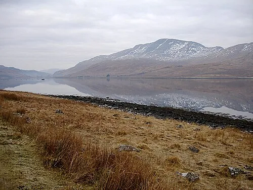 Creach Beinn Mountain, Argyll and Bute9.2 km NE
-
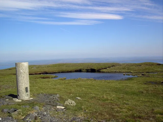 Druim Fada Mountain, Argyll and Bute8.5 km E
-
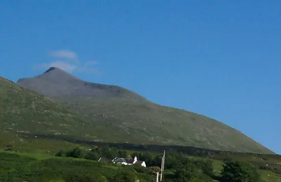 Ben More Mountain, Argyll and Bute11 km NW
-
Torr a' Ghoai Mountain, Argyll and Bute5.1 km N
-
Loch Buie Natural site, Argyll and Bute4.9 km E
-
Cnap nan Gobhar Mountain, Argyll and Bute6.1 km NE
Sources & licences
Data last updated: