Ben More
Located in Argyll and Bute, Scotland Coordinates: 56°25′28″ N 6°00′52″ W
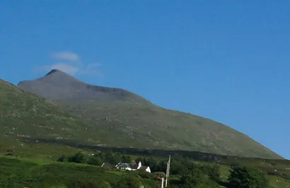
- Elevation
- 966 m
- above sea level
- Local time
- UTC+00:00
- Europe/London · UTC+00:00
About Ben More
Ben More is a mountain. Location: Argyll and Bute, Scotland. Elevation: 966 m.
Ben More (Scottish Gaelic: Beinn Mhòr, meaning "great mountain") is the highest mountain and only Munro (mountains in Scotland that reach an elevation of at least 3,000 feet or 914.4 metres) on the Isle of Mull, Scotland. It is also the highest peak in the Scottish isles – and the only Munro – apart from those on the Isle of Skye. The mountain is situated close to the centre of the island, above the shores of Loch na Keal.
Read more on Wikipedia Text: Wikipedia contributors · CC BY-SA 4.0 · shortened
At a glance
- Topographic prominence
- 966 m
Source: Wikidata
In comparison
- No. 388 of 18223 mountains in United Kingdom by elevation
- 52 sights and natural places within 10 km A' Chioch, Beinn Fhada
Nearest towns and villages
-
Knock Village, Argyll and Bute5.1 km N
-
Kilfinchen Village, Argyll and Bute5.6 km SW
-
Gruline Village, Argyll and Bute7.4 km N
-
Pennyghael Village, Argyll and Bute6.8 km S
-
Pennycross Village, Argyll and Bute7.1 km S
-
Argyll and Bute Village, Argyll and Bute7.3 km SW
Nearby attractions & nature
Everything nearby-
A' Chioch Mountain, Argyll and Bute1 km E
-
Beinn Fhada Mountain, Argyll and Bute2.4 km NE
-
Beinn Fhada NW Top Mountain, Argyll and Bute2.8 km N
-
An Cruachan Mountain, Argyll and Bute3.2 km NE
-
Torr na h-Uamha Mountain, Argyll and Bute3.3 km E
-
Beinn nan Gabhar Mountain, Argyll and Bute3.5 km NE
-
Coirc Bheinn Mountain, Argyll and Bute3.8 km W
-
Cruachan Dearg Mountain, Argyll and Bute4.3 km E
Sources & licences
Data last updated: · 2 independent sources