Cruachan an Draghair
Located in Argyll and Bute, Scotland Coordinates: 56°05′38″ N 4°54′17″ W
- Elevation
- 400 m
- above sea level
- Local time
- UTC+00:00
- Europe/London · UTC+00:00
- Airports
- GLA Glasgow Airport38 km
- PIK Glasgow Prestwick Airport69 km
About Cruachan an Draghair
Cruachan an Draghair is a mountain. Location: Argyll and Bute, Scotland. Elevation: 400 m. The nearest airport is Glasgow Airport (38 km). Nearby sights include Creachan Mor and Cruach Eighrach.
Photos of Cruachan an Draghair
-
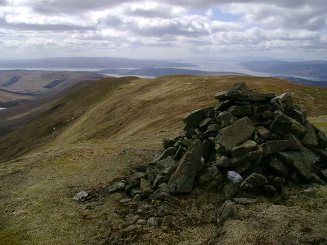
Beinn a' Mhanaich Mark Nightingale · CC BY-SA 2.0 -
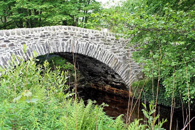
Glen Finart John McLeish · CC BY-SA 2.0


Climate of Cruachan an Draghair
This month · November
A wet month
Day 7° · Night 2° · Rain 203 mm
- Hottest month
- July (day 16°)
- Coldest month
- February (night 0°)
- Wettest month
- January (227 mm)
- Driest month
- May (97 mm)
Bars: average monthly low and high temperature. Below: precipitation. Monthly averages for 1970–2000 at about 18 km resolution, adjusted for elevation. Highlighted months are mild and relatively dry. Source: WorldClim 2.1 (CC BY 4.0).
Show values as a table
| Month | Jan | Feb | Mar | Apr | May | Jun | Jul | Aug | Sep | Oct | Nov | Dec |
|---|---|---|---|---|---|---|---|---|---|---|---|---|
| Average high (°C) | 5° | 5° | 6° | 9° | 12° | 14° | 16° | 15° | 13° | 10° | 7° | 5° |
| Average low (°C) | 0° | 0° | 1° | 2° | 5° | 7° | 9° | 9° | 8° | 5° | 2° | 1° |
| Precipitation (mm) | 227 | 145 | 168 | 102 | 97 | 97 | 112 | 134 | 182 | 204 | 203 | 210 |
How to get to Cruachan an Draghair
The nearest airport is Glasgow Airport (GLA), 38 km to the southeast as the crow flies. The nearest large city is Glasgow, 48 km to the southeast.
Airports
- Glasgow Airport (GLA) Glasgow 38 kmsoutheast
- Glasgow Prestwick Airport (PIK) Prestwick, South Ayrshire 69 kmsouth
- Campbeltown Airport (CAL) Campbeltown 88 kmsouthwest
Nearby large cities
- Glasgow Population: 626.4K 48 kmsoutheast
- Edinburgh Population: 515K 108 kmeast
- Dundee Population: 148.2K 127 kmeast
- Belfast Population: 348K 179 kmsouth
- Aberdeen Population: 198.6K 208 kmnortheast
Straight-line distances; road distances are longer. Airport data: OurAirports.
Day trips from Cruachan an Draghair
Within 100 km: 133 historic and cultural sites, 3,538 natural sites, 1,322 lakes, rivers and coasts.
0–25 km377 places
- Inchlonaig Island 18 kmE
- Inchcailloch Island 22 kmE
- Aber Isle Island 23 kmE
- Bucinch Island 19 kmE
25–60 km1,870 places
- Isle of Arran Island 59 kmS
- Great Cumbrae Island Island 36 kmS
- Hunterston Sands Beach 41 kmS
- Scarba Island 51 kmW
60–100 km2,746 places
- Colonsay Island 82 kmW
- Ayr Beach Beach 72 kmS
- Troon Beach Beach 63 kmS
- Kiloran Beach Beach 80 kmW
Straight-line distances.
Nearest towns and villages
-
Carrick Village, Argyll and Bute0.8 km NE
-
Garelochhead Village, Argyll and Bute4.9 km E
-
Portincaple Village, Argyll and Bute3.9 km E
-
Whistlefield Village, Argyll and Bute4.2 km E
-
Barnacabber Village, Argyll and Bute4.4 km S
-
Mambeg Village, Argyll and Bute5.2 km SE
Nearby attractions & nature
Everything nearby-
Creachan Mor Mountain, Argyll and Bute1.4 km SW
-
Cruach Eighrach Mountain, Argyll and Bute1.4 km SW
-
Glen Finart Natural site, Argyll and Bute3.5 km SW
-
Cruach a' Bhuic Mountain, Argyll and Bute2.5 km W
-
Clach Bheinn Mountain, Argyll and Bute3.1 km NE
-
Beinn Bhreac Mountain, Argyll and Bute3.4 km W
-
Larach Hill Mountain, Argyll and Bute3.7 km W
-
Cnoc na h-Airighe Mountain, Argyll and Bute3.9 km SE
More nature in United Kingdom
-
Beinn a' Mhanaich Mountain, Argyll and Bute7.7 km E
-
Tom Molach Mountain, Argyll and Bute4 km NE
-
Cnoc Madaidh Mountain, Argyll and Bute4.1 km W
-
Sgurr a' Choinnich Mountain, Argyll and Bute4.5 km NW
-
Cnoc na Tri Criche Mountain, Argyll and Bute4.7 km NW
-
Sligrachan Hill Mountain, Argyll and Bute4.9 km SW
Sources & licences
Data last updated: