- Elevation
- 15 m
- above sea level
- Local time
- UTC+00:00
- Europe/London · UTC+00:00
- Airports
- GLA Glasgow Airport38 km
- PIK Glasgow Prestwick Airport67 km
About Glen Finart
Glen Finart is a natural site. Location: Argyll and Bute, Scotland.
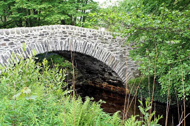
Glen Finart (Scottish Gaelic: Gleann Fhionnaird) is a glacially formed glen on the Cowal Peninsula, in Argyll and Bute, west of Scotland. The glen is within the Argyll Forest Park, which is itself within the Loch Lomond and The Trossachs National Park. Glen Finart runs northwest, from Finart Bay and Ardentinny on the west shore of Loch Long, following the Finart Burn.
Source: Wikipedia · CC BY-SA 4.0
Photos of Glen Finart
-

James T M Towill · CC BY-SA 2.0 -

James T M Towill · CC BY-SA 2.0 -

John Ferguson · CC BY-SA 2.0 -

John Ferguson · CC BY-SA 2.0


Climate of Glen Finart
Best months for sightseeingBest months for sightseeing: June–August.
This month · November
A wet month
Day 10° · Night 5° · Rain 203 mm
- Hottest month
- July (day 18°)
- Coldest month
- February (night 3°)
- Wettest month
- January (227 mm)
- Driest month
- May (97 mm)
Bars: average monthly low and high temperature. Below: precipitation. Monthly averages for 1970–2000 at about 18 km resolution, adjusted for elevation. Highlighted months are mild and relatively dry. Source: WorldClim 2.1 (CC BY 4.0).
Show values as a table
| Month | Jan | Feb | Mar | Apr | May | Jun | Jul | Aug | Sep | Oct | Nov | Dec |
|---|---|---|---|---|---|---|---|---|---|---|---|---|
| Average high (°C) | 8° | 8° | 9° | 11° | 15° | 17° | 18° | 18° | 16° | 13° | 10° | 8° |
| Average low (°C) | 3° | 3° | 4° | 5° | 7° | 10° | 12° | 12° | 10° | 8° | 5° | 3° |
| Precipitation (mm) | 227 | 145 | 168 | 102 | 97 | 97 | 112 | 134 | 182 | 204 | 203 | 210 |
How to get to Glen Finart
The nearest airport is Glasgow Airport (GLA), 38 km to the southeast as the crow flies. The nearest large city is Glasgow, 48 km to the southeast.
Airports
- Glasgow Airport (GLA) Glasgow 38 kmsoutheast
- Glasgow Prestwick Airport (PIK) Prestwick, South Ayrshire 67 kmsouth
- Campbeltown Airport (CAL) Campbeltown 85 kmsouthwest
Nearby large cities
- Glasgow Population: 626.4K 48 kmsoutheast
- Edinburgh Population: 515K 109 kmeast
- Dundee Population: 148.2K 129 kmeast
- Belfast Population: 348K 175 kmsouth
- Aberdeen Population: 198.6K 211 kmnortheast
Straight-line distances; road distances are longer. Airport data: OurAirports.
Day trips from Glen Finart
Within 100 km: 133 historic and cultural sites, 3,474 natural sites, 1,302 lakes, rivers and coasts.
0–25 km379 places
- Inchlonaig Island 20 kmE
- Inchcailloch Island 23 kmE
- Aber Isle Island 25 kmE
- Bucinch Island 21 kmE
25–60 km1,806 places
- Isle of Arran Island 56 kmS
- Great Cumbrae Island Island 33 kmS
- Hunterston Sands Beach 38 kmS
- Scarba Island 50 kmW
60–100 km2,724 places
- Colonsay Island 80 kmW
- Ayr Beach Beach 70 kmS
- Troon Beach Beach 61 kmS
- Kiloran Beach Beach 78 kmW
Straight-line distances.
Nearest towns and villages
-
Barnacabber Village, Argyll and Bute1.5 km SE
-
Ardentinny Village, Argyll and Bute2.6 km SE
-
Coirantee Village, Argyll and Bute3.1 km W
-
Garelochhead Village, Argyll and Bute6.7 km E
-
Carrick Village, Argyll and Bute4.3 km NE
-
Coulport Village, Argyll and Bute4.3 km SE
Nearby attractions & nature
Everything nearby-
Creachan Mor Mountain, Argyll and Bute2.1 km NE
-
Sligrachan Hill Mountain, Argyll and Bute2.3 km W
-
Cruach Eighrach Mountain, Argyll and Bute2.3 km N
-
Beinn Ruadh Mountain, Argyll and Bute2.4 km SW
-
Larach Hill Mountain, Argyll and Bute2.4 km NW
-
White Bay Natural site, Scotland2.3 km SE
-
Beinn Ruadh South Top Mountain, Argyll and Bute3.1 km SW
-
Finart Bay Natural site, Argyll and Bute2.8 km SE
Sources & licences
Data last updated: · 2 independent sources