Inner Hebrides
Local name: Na h-Eileanan a-staigh
Located in Argyll and Bute, Scotland Coordinates: 56°30′00″ N 6°00′00″ W
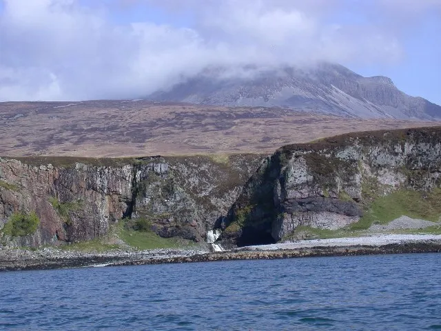
- Elevation
- 28 m
- above sea level
- Local time
- UTC+00:00
- Europe/London · UTC+00:00
About Inner Hebrides
Inner Hebrides is an island. Location: Argyll and Bute, Scotland.
The Inner Hebrides is an archipelago off the west coast of mainland Scotland, to the south east of the Outer Hebrides. Together these two island chains form the Hebrides, which experience a mild oceanic climate. The Inner Hebrides comprise 35 inhabited islands as well as 44 uninhabited islands with an area greater than 30 hectares (74 acres). Skye, Mull, and Islay are the three largest, and also have the highest populations. The main commercial activities are tourism, crofting, fishing and whisky distilling.
Read more on Wikipedia Text: Wikipedia contributors · CC BY-SA 4.0 · shortened
At a glance
- Area
- 4,158 km²
Source: Wikidata
In comparison
- 59 sights and natural places within 10 km River Bà, Kellan Wood
Nearest towns and villages
Nearby attractions & nature
Everything nearby-
River Bà River, Argyll and Bute<0.1 km N
-
Kellan Wood Natural site, Argyll and Bute1.2 km W
-
Creag Mhor Mountain, Argyll and Bute2.2 km N
-
Meall nan Gabhar Mountain, Argyll and Bute2.3 km NW
-
Meall Damh Ard Mountain, Argyll and Bute2.6 km W
-
Cruach Torr an Lochain Mountain, Argyll and Bute2.7 km E
-
Braigh a' Choire Mhoir Mountain, Argyll and Bute2.8 km NE
-
Beinn nan Carn Mountain, Argyll and Bute3.7 km W
Sources & licences
Data last updated: · 2 independent sources