Staffa
Located in Argyll and Bute, Scotland Coordinates: 56°26′11″ N 6°20′29″ W
- Elevation
- 24 m
- above sea level
- Local time
- UTC+00:00
- Europe/London · UTC+00:00
About Staffa
Staffa is an island. Location: Argyll and Bute, Scotland.
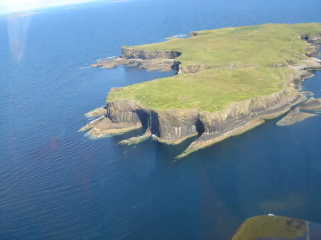
Staffa (Scottish Gaelic: Stafa, pronounced [ˈs̪t̪afa], from the Old Norse word for a stave or pillar) is an island of the Inner Hebrides in Argyll and Bute, Scotland. The Vikings gave it the name because its columnar basalt reminded them of their houses, which were constructed using vertical logs. Staffa lies about 10 kilometres (6 miles) west of the Isle of Mull. It is 33 hectares (82 acres) in area and the highest point is 42 metres (138 feet) above sea level.
Read more on Wikipedia Text: Wikipedia contributors · CC BY-SA 4.0 · shortened
At a glance
- Length
- 0.6 km
- Area
- 33 ha
Source: Wikidata
In comparison
- 40 sights and natural places within 10 km Meall nan Gamhna (Staffa), Mâisgeir
Nearest towns and villages
-
Gometra House Village, Argyll and Bute6 km NE
-
Gometra Village, Argyll and Bute6.2 km NE
-
Bearnus Village, Argyll and Bute9.1 km NE
-
Isle of Iona Village, Argyll and Bute13 km S
-
Fionnphort Village, Argyll and Bute13 km S
-
Dearg Phort Village, Argyll and Bute10 km S
Nearby attractions & nature
Everything nearby-
Meall nan Gamhna (Staffa) Island, Argyll and Bute0.5 km S
-
Mâisgeir Island, Argyll and Bute4.2 km NE
-
Little Colonsay Island, Argyll and Bute5.3 km E
-
Torr Mor Mountain, Argyll and Bute6.2 km NE
-
Cruachan (Lunga) Mountain, Argyll and Bute7.9 km NW
-
 Fladda Island, Argyll and Bute8.7 km N
-
Erisgeir Island, Argyll and Bute6.5 km SE
-
Sgeir Dhubh Island, Argyll and Bute6.7 km NE
Sources & licences
Data last updated: · 2 independent sources