Ben Cleuch
Local name: Beinn Cloiche
Located in Clackmannanshire, Scotland Coordinates: 56°11′08″ N 3°46′10″ W
- Elevation
- 721 m
- above sea level
- Local time
- UTC+00:00
- Europe/London · UTC+00:00
About Ben Cleuch
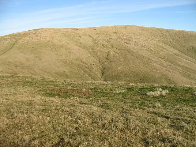
Ben Cleuch is a mountain. Location: Clackmannanshire, Scotland. Elevation: 721 m.
Ben Cleuch, from Scottish Gaelic: Beinn Cloiche, lit. 'stony prominent hill' (though likely influenced by the Scots word cleugh meaning "ravine", which some sources derive the name from) is a hill in the Ochil Hills range, part of the Central Lowlands of Scotland. It is the highest point in the range, Clackmannanshire and the Central Belt of Scotland; the summit is marked by a trig point within a stone windshelter and a viewpoint indicator.
Read more on Wikipedia Text: Wikipedia contributors · CC BY-SA 4.0 · shortened
In comparison
- No. 1886 of 18223 mountains in United Kingdom by elevation
- 52 sights and natural places within 10 km Ben Buck, Ben Ever
Nearest towns and villages
Nearby attractions & nature
Everything nearby-
Ben Buck Mountain, Clackmannanshire1 km NW
-
Ben Ever Mountain, Clackmannanshire1.1 km SW
-
Andrew Gannel Hill Mountain, Clackmannanshire1.6 km E
-
Craighorn Mountain, Clackmannanshire1.8 km W
-
Ben Buck NE Top Mountain, Clackmannanshire1.8 km N
-
The Nebit Mountain, Clackmannanshire2.5 km SW
-
Skythorn Hill Mountain, Perth and Kinross2.5 km E
-
Elistoun Hill Mountain, Clackmannanshire2.8 km SE
Sources & licences
Data last updated: · 2 independent sources