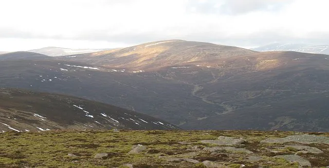
- Elevation
- 994 m
- above sea level
- Local time
- UTC+00:00
- Europe/London · UTC+00:00
- Airports
- INV Inverness Airport69 km
- DND Dundee Airport72 km
About Carn an Fhidhleir
Carn an Fhidhleir is a mountain. Location: Highland, Scotland. Elevation: 994 m.
Carn an Fhidhleir (994 m) is a mountain in the Grampian Mountains of Scotland. It lies on the border of Inverness-shire, Perthshire and Aberdeenshire, in one of the most remote areas of Scotland between the Cairngorms and the Mounth. A domed mountain, it lies at the heart of a vast roadless area. It is possible to reach the peak from Glen Tilt or via the Linn of Dee by mountain bike. It is the triple point between the catchment area of three rivers: the River Dee, the River Spey and the River Tay.
Source: Wikipedia · CC BY-SA 4.0
At a glance
- Topographic prominence
- 286 m
Source: Wikidata
Photos of Carn an Fhidhleir
-
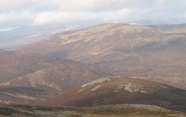
An Sgarsoch Richard Webb · CC BY-SA 2.0

Climate of Carn an Fhidhleir
This month · November
A wet month
Day 3° · Night -3° · Rain 167 mm
- Hottest month
- July (day 13°)
- Coldest month
- February (night -5°)
- Wettest month
- January (204 mm)
- Driest month
- June (88 mm)
Bars: average monthly low and high temperature. Below: precipitation. Monthly averages for 1970–2000 at about 18 km resolution, adjusted for elevation. Highlighted months are mild and relatively dry. Source: WorldClim 2.1 (CC BY 4.0).
Show values as a table
| Month | Jan | Feb | Mar | Apr | May | Jun | Jul | Aug | Sep | Oct | Nov | Dec |
|---|---|---|---|---|---|---|---|---|---|---|---|---|
| Average high (°C) | 0° | 0° | 2° | 5° | 9° | 12° | 13° | 13° | 10° | 6° | 3° | 1° |
| Average low (°C) | -5° | -5° | -4° | -3° | 0° | 3° | 5° | 5° | 3° | 0° | -3° | -4° |
| Precipitation (mm) | 204 | 132 | 149 | 90 | 93 | 88 | 90 | 105 | 141 | 172 | 167 | 170 |
How to get to Carn an Fhidhleir
The nearest airport is Inverness Airport (INV), 69 km to the north as the crow flies. For international flights: Aberdeen International Airport (ABZ) (102 km). The nearest large city is Dundee, 73 km to the southeast.
Airports
- Inverness Airport (INV) Inverness, Highland 69 kmnorth
- Dundee Airport (DND) Dundee 72 kmsoutheast
- Aberdeen International Airport (ABZ) Aberdeen 102 kmeast
Nearby large cities
- Dundee Population: 148.2K 73 kmsoutheast
- Aberdeen Population: 198.6K 106 kmeast
- Edinburgh Population: 515K 116 kmsouth
- Glasgow Population: 626.4K 123 kmsouth
- Newcastle upon Tyne Population: 300.1K 258 kmsoutheast
Straight-line distances; road distances are longer. Airport data: OurAirports.
Day trips from Carn an Fhidhleir
Within 100 km: 93 historic and cultural sites, 4,137 natural sites, 754 lakes, rivers and coasts.
0–25 km420 places
- Eilean na Cluanaich Island 23 kmNW
- Tom Dubh Island 22 kmN
- Eilean Dubh Island 23 kmN
- Ballochbuie Island Island 21 kmNW
25–60 km1,742 places
- Eilean nan Faoileag Island 58 kmNW
- Bàn Eilean Island 54 kmNW
- Eilean an Tuilaich Island 57 kmW
- Eilean an Righ Island 41 kmW
60–100 km2,822 places
- Balbithan Island Island 95 kmE
- Findlays Seat Mountain 79 kmNE
- Lossiemouth East Beach Beach 93 kmN
- Moy Island Island 82 kmNW
Straight-line distances.
Nearest towns and villages
-
Kingussie Village, Highland22 km NW
-
Achlean Village, Highland14 km NW
-
Newtonmore Village, Highland24 km NW
-
Gaick Lodge Village, Highland15 km W
-
 Insh Village, Highland20 km NW
-
Muir Village, Aberdeenshire17 km E
Nearby attractions & nature
Everything nearby-
Carn an Fhidhleir South Top Mountain, Aberdeenshire1.3 km SE
-
An Sgarsoch Mountain, Perth and Kinross2.9 km E
-
Sron Gharbh Mountain, Perth and Kinross2.2 km S
-
Leachdann Feith Seasgachain Mountain, Perth and Kinross2.9 km S
-
Scarsoch Bheag Mountain, Aberdeenshire3.1 km E
-
Meall Tionail na Beinne Brice Mountain, Perth and Kinross3.5 km SW
-
Tom Liath Mountain, Perth and Kinross3.6 km S
-
Leachdann Feith Seasgachain South Top Mountain, Perth and Kinross3.8 km SE
More nature in United Kingdom
-
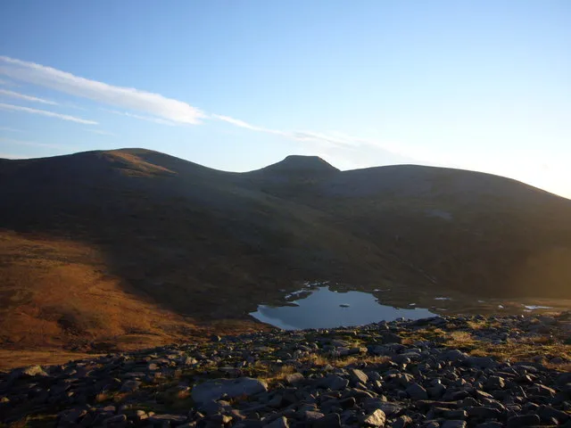 Monadh Mor Mountain, Highland11 km N
-
Glenfeshie Forest Natural site, Highland3.9 km NW
-
Sron na Ban-righ Mountain, Highland4.8 km NW
-
Carn an Fhidhleir Lorgaidh Mountain, Highland5.9 km NW
-
Glas-leathad Feshie Mountain, Highland6.1 km W
-
Leac an Taobhain Mountain, Highland7.3 km W
Sources & licences
Data last updated: · 2 independent sources