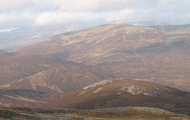
- Elevation
- 1,006 m
- above sea level
- Local time
- UTC+00:00
- Europe/London · UTC+00:00
- Airports
- DND Dundee Airport70 km
- INV Inverness Airport70 km
About An Sgarsoch
An Sgarsoch is a mountain. Location: Perth and Kinross, Scotland. Elevation: 1,006 m.
An Sgarsoch (1,006.5m) is a mountain in the Grampian Mountains of Scotland. It lies north of Blair Atholl in a very remote part of the Highlands, on the border of Aberdeenshire and Perthshire. Rounded and unspectacular, An Sgarsoch is noted mainly for its isolation, situated where it is between the Cairngorms and the Mounth, miles away from any villages or towns. The most common approach to the mountain is from the upper reaches of the River Dee.
Source: Wikipedia · CC BY-SA 4.0
At a glance
- Topographic prominence
- 319 m
Source: Wikidata
Photos of An Sgarsoch
-

Cary O'Donnell · CC BY-SA 2.0 -

David Brown · CC BY-SA 2.0 -

David Brown · CC BY-SA 2.0 -
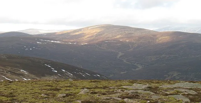
Carn an Fhidhleir Richard Webb · CC BY-SA 2.0


Climate of An Sgarsoch
This month · November
A wet month
Day 3° · Night -3° · Rain 167 mm
- Hottest month
- July (day 13°)
- Coldest month
- February (night -5°)
- Wettest month
- January (204 mm)
- Driest month
- June (88 mm)
Bars: average monthly low and high temperature. Below: precipitation. Monthly averages for 1970–2000 at about 18 km resolution, adjusted for elevation. Highlighted months are mild and relatively dry. Source: WorldClim 2.1 (CC BY 4.0).
Show values as a table
| Month | Jan | Feb | Mar | Apr | May | Jun | Jul | Aug | Sep | Oct | Nov | Dec |
|---|---|---|---|---|---|---|---|---|---|---|---|---|
| Average high (°C) | 0° | 0° | 2° | 5° | 9° | 11° | 13° | 13° | 10° | 6° | 3° | 1° |
| Average low (°C) | -5° | -5° | -4° | -3° | 0° | 3° | 5° | 5° | 3° | 0° | -3° | -4° |
| Precipitation (mm) | 204 | 132 | 149 | 90 | 93 | 88 | 90 | 105 | 141 | 172 | 167 | 170 |
How to get to An Sgarsoch
The nearest airport is Dundee Airport (DND), 70 km to the southeast as the crow flies. For international flights: Aberdeen International Airport (ABZ) (99 km). The nearest large city is Dundee, 70 km to the southeast.
Airports
- Dundee Airport (DND) Dundee 70 kmsoutheast
- Inverness Airport (INV) Inverness, Highland 70 kmnorth
- Aberdeen International Airport (ABZ) Aberdeen 99 kmeast
Nearby large cities
- Dundee Population: 148.2K 70 kmsoutheast
- Aberdeen Population: 198.6K 103 kmeast
- Edinburgh Population: 515K 114 kmsouth
- Glasgow Population: 626.4K 123 kmsouth
- Newcastle upon Tyne Population: 300.1K 256 kmsoutheast
Straight-line distances; road distances are longer. Airport data: OurAirports.
Day trips from An Sgarsoch
Within 100 km: 91 historic and cultural sites, 4,032 natural sites, 736 lakes, rivers and coasts.
0–25 km438 places
- Tom Dubh Island 24 kmNW
- Eilean Dubh Island 24 kmNW
- Ballochbuie Island Island 24 kmNW
- Loch Vrotachan Lake 20 kmE
25–60 km1,721 places
- Eilean nan Faoileag Island 60 kmNW
- Bàn Eilean Island 57 kmNW
- Eilean an Tuilaich Island 60 kmW
- Eilean an Righ Island 44 kmW
60–100 km2,700 places
- Balbithan Island Island 93 kmNE
- Findlays Seat Mountain 78 kmNE
- Lossiemouth East Beach Beach 92 kmN
- Moy Island Island 84 kmNW
Straight-line distances.
Nearest towns and villages
-
Muir Village, Aberdeenshire14 km NE
-
Kingussie Village, Highland25 km NW
-
 Bridge of Tilt Village, Perth and Kinross19 km S
-
Inverey Village, Aberdeenshire16 km E
-
 Blair Atholl Village, Perth and Kinross19 km S
-
Achlean Village, Highland16 km NW
Nearby attractions & nature
Everything nearby-
Druim Sgarsoch Mountain, Aberdeenshire1.2 km E
-
Scarsoch Bheag Mountain, Aberdeenshire1.6 km N
-
Carn an Fhidhleir Mountain, Highland2.9 km W
-
Carn Greannach Mountain, Perth and Kinross2.2 km SE
-
Carn an Fhidhleir South Top Mountain, Aberdeenshire2.4 km W
-
Leachdann Feith Seasgachain Mountain, Perth and Kinross2.9 km SW
-
An Sgarsoch Far East Top Mountain, Aberdeenshire3.2 km NE
-
Leachdann Feith Seasgachain South Top Mountain, Perth and Kinross3.2 km SW
More nature in United Kingdom
-
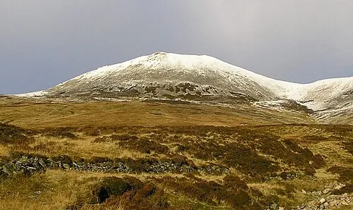 Carn a' Chlamain Mountain, Perth and Kinross8 km S
-
Braigh Coire Caochan nan Laogh Mountain, Perth and Kinross3.3 km SE
-
Sron Gharbh Mountain, Perth and Kinross4 km SW
-
Meall Dubh-chlais Mountain, Perth and Kinross4.3 km S
-
Tom Liath Mountain, Perth and Kinross5.1 km SW
-
Dun Mor Mountain, Perth and Kinross5.4 km SE
Sources & licences
Data last updated: · 2 independent sources