- Elevation
- 139 m
- above sea level
- Local time
- UTC+00:00
- Europe/London · UTC+00:00
- Airports
- SYY Stornoway Airport69 km
- INV Inverness Airport91 km
About Cnoc Rubha Sionascaig
Cnoc Rubha Sionascaig is a mountain. Location: Highland, Scotland. Elevation: 139 m. The nearest airport is Stornoway Airport (69 km). Nearby sights include Meall an Tota and Cnoc Fionn Loch.
Photos of Cnoc Rubha Sionascaig
-
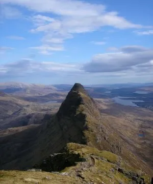
Suilven Original uploader was Grinner at en.wikipedia · CC BY-SA 3.0 -
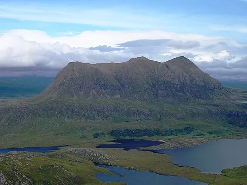
Cul Mor Foxie001 · Public domain -
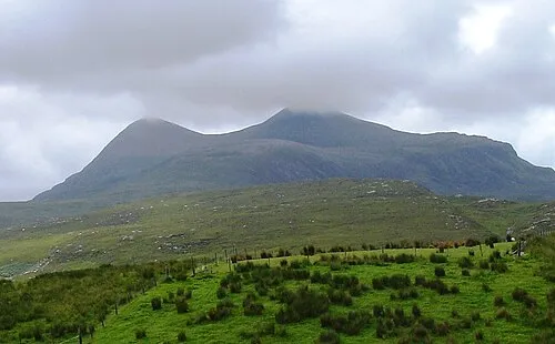
Cul Beag Foxie001 · Public domain -
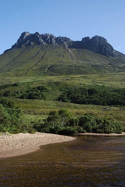
Stac Pollaidh Mehmet Karatay · CC BY-SA 3.0


Climate of Cnoc Rubha Sionascaig
This month · November
A wet month
Day 9° · Night 3° · Rain 213 mm
- Hottest month
- July (day 16°)
- Coldest month
- February (night 1°)
- Wettest month
- November (213 mm)
- Driest month
- May (83 mm)
Bars: average monthly low and high temperature. Below: precipitation. Monthly averages for 1970–2000 at about 18 km resolution, adjusted for elevation. Highlighted months are mild and relatively dry. Source: WorldClim 2.1 (CC BY 4.0).
Show values as a table
| Month | Jan | Feb | Mar | Apr | May | Jun | Jul | Aug | Sep | Oct | Nov | Dec |
|---|---|---|---|---|---|---|---|---|---|---|---|---|
| Average high (°C) | 6° | 6° | 8° | 10° | 13° | 15° | 16° | 16° | 14° | 12° | 9° | 6° |
| Average low (°C) | 1° | 1° | 2° | 4° | 5° | 8° | 10° | 10° | 8° | 6° | 3° | 1° |
| Precipitation (mm) | 193 | 134 | 162 | 96 | 83 | 98 | 109 | 126 | 177 | 199 | 213 | 196 |
How to get to Cnoc Rubha Sionascaig
The nearest airport is Stornoway Airport (SYY), 69 km to the west as the crow flies. The nearest large city is Aberdeen, 212 km to the southeast.
Airports
- Stornoway Airport (SYY) Stornoway, Western Isles 69 kmwest
- Inverness Airport (INV) Inverness, Highland 91 kmsoutheast
- Wick John O'Groats Airport (WIC) Wick 129 kmeast
Nearby large cities
- Aberdeen Population: 198.6K 212 kmsoutheast
- Dundee Population: 148.2K 224 kmsoutheast
- Glasgow Population: 626.4K 254 kmsouth
- Edinburgh Population: 515K 267 kmsoutheast
- Belfast Population: 348K 391 kmsouth
Straight-line distances; road distances are longer. Airport data: OurAirports.
Day trips from Cnoc Rubha Sionascaig
Within 100 km: 33 historic and cultural sites, 2,940 natural sites, 906 lakes, rivers and coasts.
0–25 km498 places
- Eilean a' Char Island 17 kmSW
- Eilean Dubh Island 25 kmN
- Tanera More Island 16 kmSW
- Summer Isles Island 18 kmSW
25–60 km1,249 places
- Whale Islet Island 39 kmN
- Eilean Sùbhainn Island 47 kmSW
- Eilean Ruairidh Mòr Island 48 kmSW
- Longa Island Island 55 kmSW
60–100 km2,132 places
- Isle of Harris Natural site 98 kmW
- Island of Raasay Island 95 kmSW
- Dalmore Beach Beach 96 kmW
- Dailbeag Beach Beach 95 kmW
Straight-line distances.
Nearest towns and villages
-
 Inverkirkaig Village, Highland6.4 km NW
-
Brackloch Village, Highland7.2 km N
-
Lochinver Village, Highland7.6 km NW
-
Baddidarroch Village, Highland8.5 km NW
-
Elphin Village, Highland9.7 km E
-
 Achmelvich Village, Highland11 km NW
Nearby attractions & nature
Everything nearby-
Meall an Tota Mountain, Highland1 km W
-
Cnoc Fionn Loch Mountain, Highland1.4 km N
-
Cnoc Loch a' Ghille Mountain, Highland1.4 km NW
-
Cnoc Breac Mountain, Highland1.5 km W
-
Sgeirean Dubha Island, Highland1.3 km S
-
Cnoc Lochan na Claise Mountain, Highland1.9 km SE
-
Creag na h-Iolaire Mountain, Highland1.9 km E
-
Eilean Mor Island, Highland1.6 km S
More nature in United Kingdom
-
Suilven Mountain, Highland4.1 km NE
-
Cnoc Kirkaig Mountain, Highland2 km N
-
Cnoc Mhairc Mountain, Highland2.1 km E
-
Cnoc Loch a' Chinn Ghairbh Mountain, Highland2.1 km S
-
Boat Bay Hill Mountain, Highland2.3 km W
-
Cnoc Loch Buine Moire Mountain, Highland2.5 km W
Sources & licences
Data last updated: