Suilven
Local name: Sùlabheinn
Located in Highland, Scotland Coordinates: 58°06′56″ N 5°08′12″ W
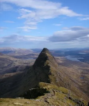
- Elevation
- 731 m
- above sea level
- Local time
- UTC+00:00
- Europe/London · UTC+00:00
About Suilven
Suilven is a mountain. Location: Highland, Scotland. Elevation: 731 m.
Suilven (Scottish Gaelic: Sùlabheinn) is a Graham mountain in Scotland. Lying in a remote area in the west of Sutherland, it rises from a wilderness landscape of moorland, bogs and lochans of the region known as Assynt. Suilven forms a steep-sided ridge some two kilometres (1+1⁄4 mi) in length. The highest point, Caisteal Liath ("Grey Castle" in Scottish Gaelic), lies at the northwest end of this ridge.
Read more on Wikipedia Text: Wikipedia contributors · CC BY-SA 4.0 · shortened
In comparison
- No. 1802 of 18223 mountains in United Kingdom by elevation
- 152 sights and natural places within 10 km Meall Meadhonach, Meall Beag
Nearest towns and villages
-
Brackloch Village, Highland6.1 km NW
-
Inverkirkaig Village, Highland7.6 km W
-
Lochinver Village, Highland7.1 km NW
-
Baddidarroch Village, Highland8.1 km NW
-
Elphin Village, Highland8.9 km SE
-
Loch Assynt Village, Highland9.1 km N
Nearby attractions & nature
Everything nearby-
Meall Meadhonach Mountain, Highland1.2 km SE
-
Meall Beag Mountain, Highland1.4 km SE
-
Meall nan Leapaichean Mountain, Highland1.5 km NW
-
Cnoc Gleannan a' Mhadaidh Mountain, Highland1.9 km S
-
Sithean a' Chleirich Mountain, Highland2.3 km NW
-
Cnoc Allt nan Damh Mountain, Highland2.6 km S
-
Cnoc an Alltain Duibh Mountain, Highland2.7 km NW
-
Cnoc Loch na Circe Mountain, Highland2.9 km NW
More nature in United Kingdom
-
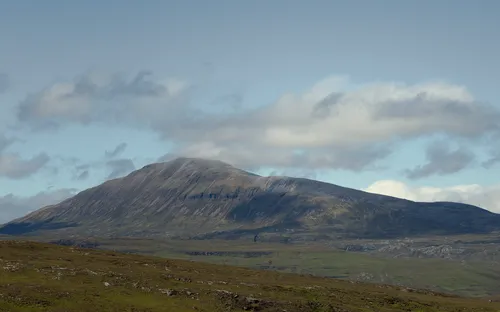 Canisp Mountain, Highland5 km E
-
Cnoc a' Choire Mhoir Mountain, Highland2.9 km W
-
Creag Liath Mountain, Highland3 km N
-
Creag na h-Iolaire Mountain, Highland3 km S
-
Cnoc Fionn Loch Mountain, Highland3 km SW
-
Cnoc Suileag Mountain, Highland3.1 km N
Sources & licences
Data last updated: · 2 independent sources