- Elevation
- 724 m
- above sea level
- Local time
- UTC+00:00
- Europe/London · UTC+00:00
- Airports
- SYY Stornoway Airport72 km
- INV Inverness Airport90 km
About Meall Meadhonach
Meall Meadhonach is a mountain. Location: Highland, Scotland. Elevation: 724 m. The nearest airport is Stornoway Airport (72 km). Nearby sights include Meall Beag and Suilven.
Photos of Meall Meadhonach
-
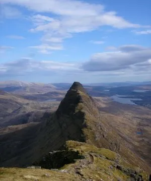
Suilven Original uploader was Grinner at en.wikipedia · CC BY-SA 3.0 -
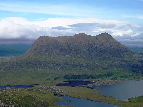
Cul Mor Foxie001 · Public domain -
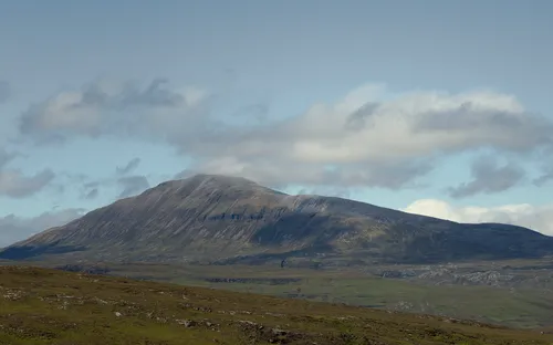
Canisp Paul Hermans · CC BY-SA 3.0


Climate of Meall Meadhonach
This month · November
A wet month
Day 5° · Night -1° · Rain 231 mm
- Hottest month
- July (day 13°)
- Coldest month
- December (night -3°)
- Wettest month
- November (231 mm)
- Driest month
- May (96 mm)
Bars: average monthly low and high temperature. Below: precipitation. Monthly averages for 1970–2000 at about 18 km resolution, adjusted for elevation. Highlighted months are mild and relatively dry. Source: WorldClim 2.1 (CC BY 4.0).
Show values as a table
| Month | Jan | Feb | Mar | Apr | May | Jun | Jul | Aug | Sep | Oct | Nov | Dec |
|---|---|---|---|---|---|---|---|---|---|---|---|---|
| Average high (°C) | 2° | 3° | 4° | 7° | 10° | 11° | 13° | 13° | 11° | 8° | 5° | 2° |
| Average low (°C) | -3° | -3° | -2° | -1° | 2° | 5° | 6° | 6° | 4° | 2° | -1° | -3° |
| Precipitation (mm) | 214 | 149 | 184 | 109 | 96 | 109 | 120 | 140 | 192 | 218 | 231 | 214 |
How to get to Meall Meadhonach
The nearest airport is Stornoway Airport (SYY), 72 km to the west as the crow flies. The nearest large city is Aberdeen, 210 km to the southeast.
Airports
- Stornoway Airport (SYY) Stornoway, Western Isles 72 kmwest
- Inverness Airport (INV) Inverness, Highland 90 kmsoutheast
- Wick John O'Groats Airport (WIC) Wick 125 kmeast
Nearby large cities
- Aberdeen Population: 198.6K 210 kmsoutheast
- Dundee Population: 148.2K 224 kmsoutheast
- Glasgow Population: 626.4K 256 kmsouth
- Edinburgh Population: 515K 267 kmsoutheast
- Belfast Population: 348K 394 kmsouth
Straight-line distances; road distances are longer. Airport data: OurAirports.
Day trips from Meall Meadhonach
Within 100 km: 33 historic and cultural sites, 2,817 natural sites, 856 lakes, rivers and coasts.
0–25 km533 places
- Eilean a' Char Island 22 kmSW
- Eilean Dubh Island 22 kmN
- Tanera More Island 21 kmSW
- Summer Isles Island 22 kmSW
25–60 km1,255 places
- Whale Islet Island 36 kmN
- Eilean Sùbhainn Island 51 kmSW
- Eilean Ruairidh Mòr Island 52 kmSW
- Priest Island Island 29 kmSW
60–100 km1,918 places
- Island of Raasay Island 99 kmSW
- Dalmore Beach Beach 99 kmW
- Dailbeag Beach Beach 98 kmW
- Scalpay Island 96 kmW
Straight-line distances.
Nearest towns and villages
-
Brackloch Village, Highland7.3 km NW
-
Elphin Village, Highland7.8 km SE
-
 Inverkirkaig Village, Highland8.8 km W
-
Lochinver Village, Highland8.4 km NW
-
Ledbeg Village, Highland8.5 km E
-
Stronchrubie Village, Highland8.5 km E
Nearby attractions & nature
Everything nearby-
Meall Beag Mountain, Highland0.2 km SE
-
Suilven Mountain, Highland1.2 km NW
-
Cnoc Gleannan a' Mhadaidh Mountain, Highland1.8 km SW
-
Cnoc Allt nan Damh Mountain, Highland2.2 km S
-
Canisp Mountain, Highland4 km E
-
Creag nam Fiadh Mountain, Highland2.5 km S
-
Meall nan Leapaichean Mountain, Highland2.6 km NW
-
Meall a' Mhuthaich Mountain, Highland2.8 km E
Sources & licences
Data last updated: