- Elevation
- 305 m
- above sea level
- Local time
- UTC+00:00
- Europe/London · UTC+00:00
- Airports
- TRE Tiree Airport63 km
- BRR Barra Airport106 km
About Creag a' Bharra
Creag a' Bharra is a mountain. Location: Highland, Scotland. Elevation: 305 m. The nearest airport is Tiree Airport (63 km). Nearby sights include Na Dunain and Loch Teacuis.
Photos of Creag a' Bharra
-
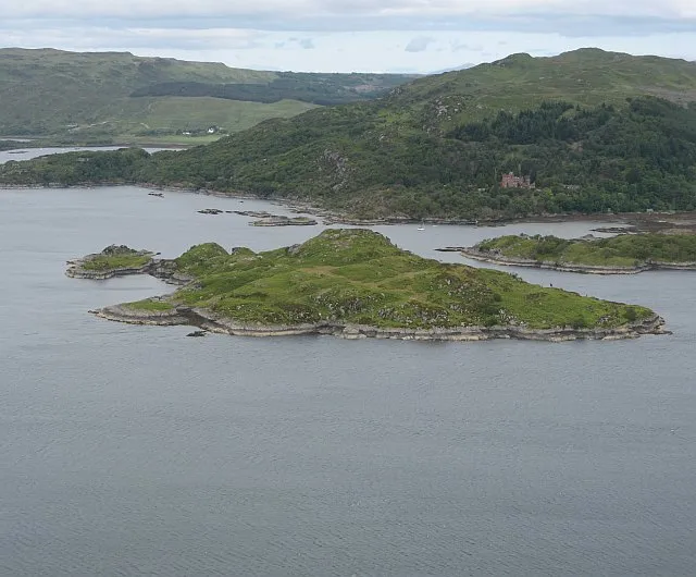
Risga Richard Webb · CC BY-SA 2.0 -
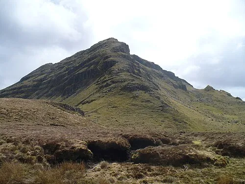
Beinn Iadain Clive Giddis · CC BY-SA 2.0 -
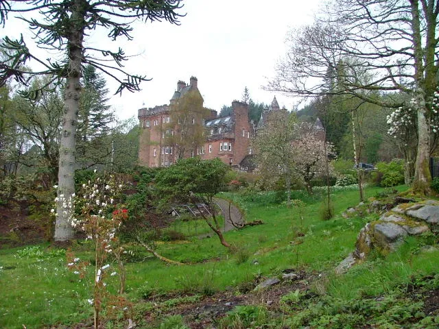
Glenborrodale Castle Dave Fergusson · CC BY-SA 2.0


Climate of Creag a' Bharra
This month · November
A wet month
Day 8° · Night 4° · Rain 255 mm
- Hottest month
- August (day 15°)
- Coldest month
- February (night 2°)
- Wettest month
- January (272 mm)
- Driest month
- May (101 mm)
Bars: average monthly low and high temperature. Below: precipitation. Monthly averages for 1970–2000 at about 18 km resolution, adjusted for elevation. Highlighted months are mild and relatively dry. Source: WorldClim 2.1 (CC BY 4.0).
Show values as a table
| Month | Jan | Feb | Mar | Apr | May | Jun | Jul | Aug | Sep | Oct | Nov | Dec |
|---|---|---|---|---|---|---|---|---|---|---|---|---|
| Average high (°C) | 5° | 6° | 7° | 9° | 12° | 14° | 15° | 15° | 13° | 10° | 8° | 5° |
| Average low (°C) | 2° | 2° | 3° | 4° | 7° | 9° | 11° | 11° | 9° | 7° | 4° | 2° |
| Precipitation (mm) | 272 | 165 | 209 | 121 | 101 | 105 | 132 | 160 | 223 | 241 | 255 | 249 |
How to get to Creag a' Bharra
The nearest airport is Tiree Airport (TRE), 63 km to the west as the crow flies. The nearest large city is Glasgow, 131 km to the southeast.
Airports
- Tiree Airport (TRE) Balemartine, Argyll and Bute 63 kmwest
- Barra Airport (BRR) Eoligarry 106 kmnorthwest
- Islay Airport (ILY) Isle of Islay, Argyll and Bute 108 kmsouth
Nearby large cities
- Glasgow Population: 626.4K 131 kmsoutheast
- Dundee Population: 148.2K 179 kmeast
- Edinburgh Population: 515K 182 kmsoutheast
- Belfast Population: 348K 226 kmsouth
- Aberdeen Population: 198.6K 237 kmeast
Straight-line distances; road distances are longer. Airport data: OurAirports.
Day trips from Creag a' Bharra
Within 100 km: 33 historic and cultural sites, 3,507 natural sites, 1,300 lakes, rivers and coasts.
0–25 km402 places
- Oronsay Island 5 kmNW
- Eilean Shona Island 18 kmN
- Isle of Mull Island 23 kmS
- Eorsa Island Island 22 kmSW
25–60 km1,666 places
- Eigg Island 36 kmNW
- Scarba Island 50 kmS
- Eriska Island 30 kmE
- Dùn Mòr Island 60 kmNW
60–100 km2,772 places
- Hebrides Island 69 kmNW
- Isle of Skye Island 79 kmN
- Island of Raasay Island 85 kmN
- Colonsay Island 66 kmS
Straight-line distances.
Nearest towns and villages
-
Barr Village, Highland1.2 km NW
-
Rahoy Village, Highland1.8 km NE
-
Kinlochteacuis Village, Highland2.4 km SE
-
Glencripesdale Village, Highland5.6 km NE
-
 Glenborrodale Village, Highland6.4 km N
-
Bonnavoulin Village, Highland6.7 km SW
Nearby attractions & nature
Everything nearby-
Na Dunain Mountain, Highland0.7 km SE
-
Loch Teacuis Natural site, Highland1.4 km NE
-
Eilean Chulaig Island, Scotland1.6 km N
-
Sithean na Raplaich Mountain, Highland3.3 km S
-
Monadh Rahuaidh Mountain, Highland3.1 km N
-
Tom nan Eildean Mountain, Highland3.1 km NW
-
Beinn Bhuidhe Mountain, Highland3.3 km SW
-
Eilean nan Gabhar Island, Highland2.9 km NW
More nature in United Kingdom
-
Beinn Iadain Mountain, Highland6.4 km E
-
Tom nan Eildean West Top Mountain, Highland3.8 km NW
-
Beinn Ghormaig Mountain, Highland3.9 km NE
-
Beinn Ithearlan Mountain, Highland4.3 km NE
-
Torr a' Choilich Mountain, Highland4.5 km NW
-
Ben Laga Mountain, Highland7.4 km N
Sources & licences
Data last updated: