- Local time
- UTC+00:00
- Europe/London · UTC+00:00
- Airports
- TRE Tiree Airport75 km
- BRR Barra Airport113 km
About Eilean a' Chuilinn
Eilean a' Chuilinn is an island. Location: Highland, Scotland. The nearest airport is Tiree Airport (75 km). Nearby sights include Garbh Eilean and Loch Sunart.
Photos of Eilean a' Chuilinn
-
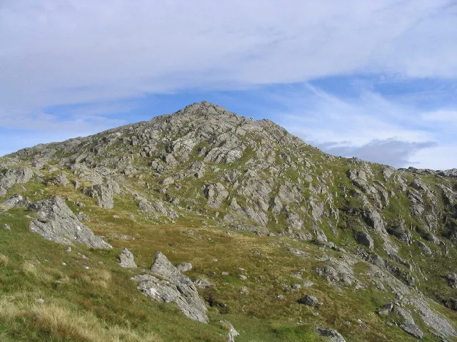
Beinn Resipol Andrew Dann · CC BY-SA 2.0 -
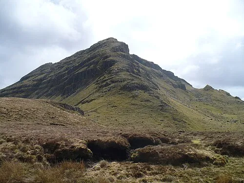
Beinn Iadain Clive Giddis · CC BY-SA 2.0


Climate of Eilean a' Chuilinn
This month · November
A wet month
Day 9° · Night 4° · Rain 257 mm
- Hottest month
- July (day 17°)
- Coldest month
- February (night 2°)
- Wettest month
- January (265 mm)
- Driest month
- May (99 mm)
Bars: average monthly low and high temperature. Below: precipitation. Monthly averages for 1970–2000 at about 18 km resolution, adjusted for elevation. Highlighted months are mild and relatively dry. Source: WorldClim 2.1 (CC BY 4.0).
Show values as a table
| Month | Jan | Feb | Mar | Apr | May | Jun | Jul | Aug | Sep | Oct | Nov | Dec |
|---|---|---|---|---|---|---|---|---|---|---|---|---|
| Average high (°C) | 6° | 6° | 8° | 10° | 13° | 15° | 17° | 17° | 15° | 11° | 9° | 6° |
| Average low (°C) | 2° | 2° | 3° | 4° | 7° | 9° | 11° | 11° | 9° | 7° | 4° | 2° |
| Precipitation (mm) | 265 | 164 | 208 | 118 | 99 | 106 | 129 | 154 | 220 | 240 | 257 | 252 |
How to get to Eilean a' Chuilinn
The nearest airport is Tiree Airport (TRE), 75 km to the west as the crow flies. The nearest large city is Glasgow, 128 km to the southeast.
Airports
- Tiree Airport (TRE) Balemartine, Argyll and Bute 75 kmwest
- Barra Airport (BRR) Eoligarry 113 kmwest
- Islay Airport (ILY) Isle of Islay, Argyll and Bute 118 kmsouth
Nearby large cities
- Glasgow Population: 626.4K 128 kmsoutheast
- Dundee Population: 148.2K 169 kmeast
- Edinburgh Population: 515K 175 kmsoutheast
- Aberdeen Population: 198.6K 225 kmeast
- Belfast Population: 348K 234 kmsouth
Straight-line distances; road distances are longer. Airport data: OurAirports.
Day trips from Eilean a' Chuilinn
Within 100 km: 33 historic and cultural sites, 3,925 natural sites, 1,320 lakes, rivers and coasts.
0–25 km481 places
- Oronsay Island 15 kmW
- Shuna Island Island 22 kmSE
- Eilean Shona Island 14 kmNW
- Samalaman Island Island 19 kmNW
25–60 km1,794 places
- Eigg Island 37 kmNW
- Scarba Island 57 kmS
- Eriska Island 25 kmSE
- Ulva Island 41 kmSW
60–100 km3,003 places
- Hebrides Island 75 kmNW
- Isle of Skye Island 75 kmNW
- Island of Raasay Island 80 kmN
- Colonsay Island 77 kmSW
Straight-line distances.
Nearest towns and villages


Nearby attractions & nature
Everything nearby-
Garbh Eilean Island, Highland0.4 km E
-
Loch Sunart Lake, Highland0.8 km S
-
Glas Eilean Island, Scotland2.6 km SE
-
Eilean Mòr Island, Highland2.6 km SE
-
Beinn Resipol Mountain, Highland4.4 km NE
-
Meall an Damhain Mountain, Highland3.1 km SW
-
Cnoc Lochan Dhonnachaidh Mountain, Highland3.4 km SW
-
Creag an Eighich Mountain, Highland3.4 km NE
More lakes, rivers and coasts in United Kingdom
-
Eilean Dhonnachaidh Island, Highland6 km N
-
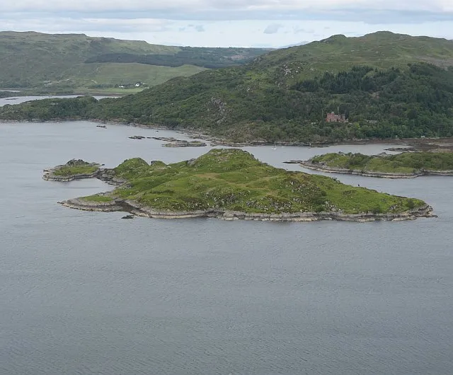 Risga Island, Highland13 km W
-
Eilean Dhònuill Island, Highland6 km N
-
Eilean Fhianain Island, Highland6.3 km N
-
Eilean nam Bàn Island, Highland7 km N
-
Eilean Camas Drollaman Island, Highland7.7 km N
Sources & licences
Data last updated: