Oldshoremore
Located in Highland, Scotland Coordinates: 58°28′43″ N 5°04′35″ W
- Elevation
- 46 m
- above sea level
- Local time
- UTC+00:00
- Europe/London · UTC+00:00
About Oldshoremore
Oldshoremore is a village. Location: Highland, Scotland. Elevation: 46 m.
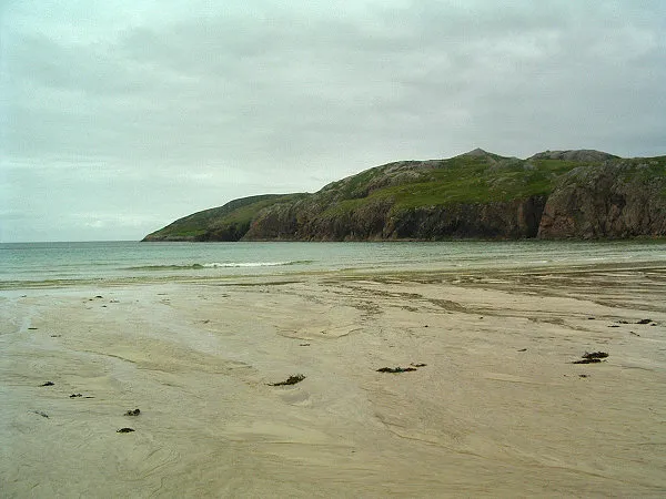
Oldshoremore is a scattered crofting hamlet in the Eddrachillis parish of Sutherland, Scotland. It incorporates around twenty houses, though several of these are holiday homes. Once owned by the Duke of Sutherland, Oldshoremore and the surrounding area are now part of the Sandwood Estate, a nature reserve owned by the John Muir Trust. Directly west lies Oldshoremore Bay, a sandy beach with a large headland at its northern end known as Eilean na h-Aiteig.
Read more on Wikipedia Text: Wikipedia contributors · CC BY-SA 4.0 · shortened
In comparison
- Nearest larger town: Durness, 22 km NE
- 99 sights and natural places within 10 km Eilear na Mola, Loch Aisir Mor
Climate of Oldshoremore
Best months for sightseeing: July.
| Month | Jan | Feb | Mar | Apr | May | Jun | Jul | Aug | Sep | Oct | Nov | Dec |
|---|---|---|---|---|---|---|---|---|---|---|---|---|
| Average high (°C) | 6° | 7° | 8° | 10° | 13° | 15° | 16° | 16° | 14° | 12° | 9° | 6° |
| Average low (°C) | 1° | 1° | 2° | 4° | 6° | 9° | 10° | 10° | 9° | 6° | 4° | 1° |
| Precipitation (mm) | 142 | 97 | 121 | 77 | 67 | 82 | 92 | 109 | 145 | 159 | 168 | 148 |
Monthly averages for 1970–2000 at about 18 km resolution, adjusted for elevation. Highlighted months are mild and relatively dry. Source: WorldClim 2.1 (CC BY 4.0).
Other places to visit in this season: July
Airports nearest to Oldshoremore
- Stornoway Airport (SYY) Stornoway, Western Isles 79 km
- Wick John O'Groats Airport (WIC) Wick 116 km
- Inverness Airport (INV) Inverness, Highland 121 km
Straight-line distance; airports with scheduled flights only. Source: OurAirports (public domain).
Nearby attractions & nature
Everything nearby-
Eilear na Mola Mountain, Highland0.5 km SE
-
Loch Aisir Mor Lake, Highland0.9 km NE
-
 Eilean an Ròin Mòr Island, Highland3.1 km W
-
Allt Druim na Gaoithe River, Highland1.4 km NW
-
Eilean na h-Aiteig Island, Highland1.5 km W
-
Eilean a' Chonnaidh Island, Highland1.7 km S
Sources & licences
Data last updated: · 2 independent sources