- Elevation
- 877 m
- above sea level
- Local time
- UTC+00:00
- Europe/London · UTC+00:00
- Airports
- TRE Tiree Airport81 km
- BRR Barra Airport109 km
About Rois-Bheinn West Top
Rois-Bheinn West Top is a mountain. Location: Highland, Scotland. Elevation: 877 m. The nearest airport is Tiree Airport (81 km). Nearby sights include Rois-bheinn and Sgurr a' Mheadhain.
Photos of Rois-Bheinn West Top
-
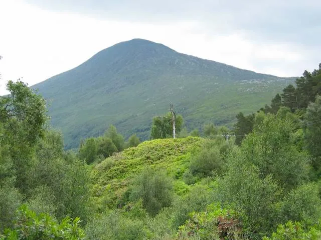
Rois-bheinn John Allan · CC BY-SA 2.0 -
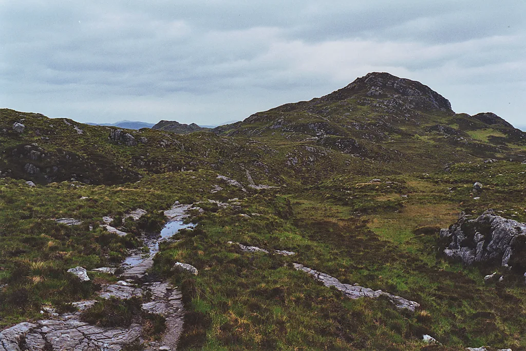
Ardnish Peninsula Nigel Brown · CC BY-SA 2.0


Climate of Rois-Bheinn West Top
This month · November
A wet month
Day 4° · Night -1° · Rain 264 mm
- Hottest month
- July (day 12°)
- Coldest month
- February (night -3°)
- Wettest month
- January (266 mm)
- Driest month
- May (99 mm)
Bars: average monthly low and high temperature. Below: precipitation. Monthly averages for 1970–2000 at about 18 km resolution, adjusted for elevation. Highlighted months are mild and relatively dry. Source: WorldClim 2.1 (CC BY 4.0).
Show values as a table
| Month | Jan | Feb | Mar | Apr | May | Jun | Jul | Aug | Sep | Oct | Nov | Dec |
|---|---|---|---|---|---|---|---|---|---|---|---|---|
| Average high (°C) | 2° | 2° | 3° | 6° | 9° | 11° | 12° | 12° | 10° | 7° | 4° | 2° |
| Average low (°C) | -3° | -3° | -2° | -1° | 2° | 4° | 6° | 6° | 4° | 2° | -1° | -2° |
| Precipitation (mm) | 266 | 167 | 209 | 116 | 99 | 110 | 129 | 152 | 225 | 247 | 264 | 259 |
How to get to Rois-Bheinn West Top
The nearest airport is Tiree Airport (TRE), 81 km to the southwest as the crow flies. The nearest large city is Glasgow, 140 km to the southeast.
Airports
- Tiree Airport (TRE) Balemartine, Argyll and Bute 81 kmsouthwest
- Barra Airport (BRR) Eoligarry 109 kmwest
- Benbecula Airport (BEB) Balivanich 124 kmnorthwest
Nearby large cities
- Glasgow Population: 626.4K 140 kmsoutheast
- Dundee Population: 148.2K 172 kmeast
- Edinburgh Population: 515K 183 kmsoutheast
- Aberdeen Population: 198.6K 221 kmeast
- Belfast Population: 348K 250 kmsouth
Straight-line distances; road distances are longer. Airport data: OurAirports.
Day trips from Rois-Bheinn West Top
Within 100 km: 31 historic and cultural sites, 4,043 natural sites, 1,289 lakes, rivers and coasts.
0–25 km509 places
- Oronsay Island 24 kmSW
- Eilean Shona Island 12 kmSW
- Samalaman Island Island 8 kmW
- Luinga Mhòr Island 16 kmNW
25–60 km1,762 places
- Eigg Island 30 kmW
- Scalpay Island 53 kmN
- Eriska Island 38 kmSE
- Dùn Mòr Island 53 kmNW
60–100 km3,092 places
- Hebrides Island 70 kmW
- Isle of Skye Island 62 kmNW
- Island of Raasay Island 65 kmN
- Colonsay Island 92 kmS
Straight-line distances.
Nearest towns and villages
-
 Roshven Village, Highland4.5 km W
-
Inverailort Village, Inverness-shire3.9 km N
-
 Lochailort Village, Inverness-shire4.9 km N
-
Peanmeanach Village, Highland5.7 km NW
-
Kinlochmoidart Village, Highland6.8 km SW
-
 Dalelia Village, Highland7.9 km S
Nearby attractions & nature
Everything nearby-
Rois-bheinn Mountain, Highland0.7 km E
-
Sgurr a' Mheadhain Mountain, Highland1.2 km S
-
An Stac Mountain, Highland2 km NE
-
Sgurr Dhomhuill Mor Mountain, Highland2.1 km S
-
Sgurr na Ba Glaise Mountain, Highland2.1 km E
-
Sgurr Dhomhuill Beag Mountain, Highland2.2 km S
-
Alisary Hill Mountain, Highland2.5 km N
-
Eilean Buidhe Island, Highland2.3 km NW
More nature in United Kingdom
-
Ardnish Peninsula Natural site, Highland4.2 km NW
-
Creag Coire na Cloiche Mountain, Highland2.7 km S
-
Seann Chruach Mountain, Highland2.9 km NE
-
An t-Slat-bheinn Mountain, Highland2.9 km E
-
Creag Coire na Cloiche South Top Mountain, Highland3.1 km S
-
Cruach an Aonaich Mountain, Highland3.4 km NW
Sources & licences
Data last updated: