- Elevation
- 494 m
- above sea level
- Local time
- UTC+00:00
- Europe/London · UTC+00:00
- Airports
- SYY Stornoway Airport83 km
- INV Inverness Airport91 km
About Stack of Glencoul
Stack of Glencoul is a mountain. Location: Highland, Scotland. Elevation: 494 m. The nearest airport is Stornoway Airport (83 km). Nearby sights include An Sniomh and Leitir Dhubh.
Photos of Stack of Glencoul
-
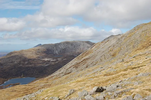
Beinn Uidhe Jim Barton · CC BY-SA 2.0 -
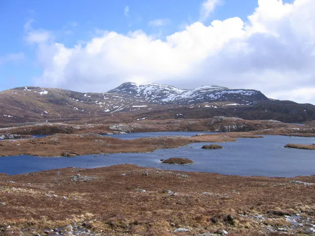
Beinn Leoid Andy Spenceley · CC BY-SA 2.0 -
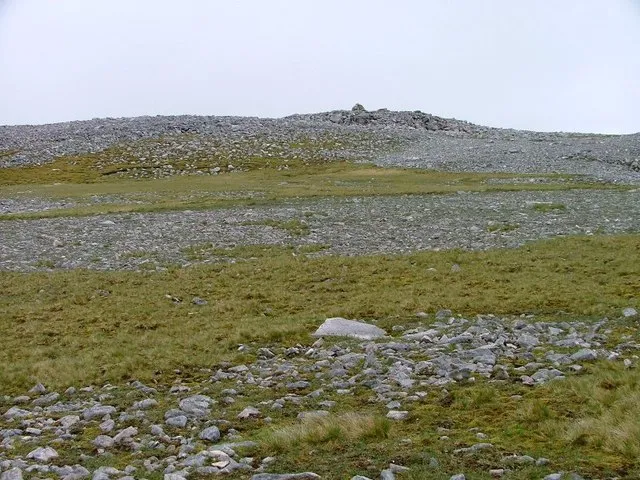
Glas Bheinn Mick Garratt · CC BY-SA 2.0


Climate of Stack of Glencoul
This month · November
A wet month
Day 6° · Night 1° · Rain 212 mm
- Hottest month
- July (day 14°)
- Coldest month
- December (night -2°)
- Wettest month
- November (212 mm)
- Driest month
- May (92 mm)
Bars: average monthly low and high temperature. Below: precipitation. Monthly averages for 1970–2000 at about 18 km resolution, adjusted for elevation. Highlighted months are mild and relatively dry. Source: WorldClim 2.1 (CC BY 4.0).
Show values as a table
| Month | Jan | Feb | Mar | Apr | May | Jun | Jul | Aug | Sep | Oct | Nov | Dec |
|---|---|---|---|---|---|---|---|---|---|---|---|---|
| Average high (°C) | 4° | 4° | 5° | 8° | 11° | 13° | 14° | 14° | 12° | 9° | 6° | 4° |
| Average low (°C) | -1° | -2° | -1° | 1° | 3° | 6° | 8° | 8° | 6° | 4° | 1° | -2° |
| Precipitation (mm) | 192 | 134 | 168 | 105 | 92 | 105 | 115 | 134 | 179 | 201 | 212 | 193 |
How to get to Stack of Glencoul
The nearest airport is Stornoway Airport (SYY), 83 km to the west as the crow flies. The nearest large city is Aberdeen, 206 km to the southeast.
Airports
- Stornoway Airport (SYY) Stornoway, Western Isles 83 kmwest
- Inverness Airport (INV) Inverness, Highland 91 kmsoutheast
- Wick John O'Groats Airport (WIC) Wick 110 kmeast
Nearby large cities
- Aberdeen Population: 198.6K 206 kmsoutheast
- Dundee Population: 148.2K 227 kmsoutheast
- Glasgow Population: 626.4K 264 kmsouth
- Edinburgh Population: 515K 272 kmsoutheast
Straight-line distances; road distances are longer. Airport data: OurAirports.
Day trips from Stack of Glencoul
Within 100 km: 33 historic and cultural sites, 2,368 natural sites, 698 lakes, rivers and coasts.
0–25 km602 places
- Eilean Dubh Island 18 kmNW
- Oldany Island Island 21 kmW
- Meall Mòr Island 19 kmNW
- Handa Island Island 25 kmNW
25–60 km1,103 places
- Eilean a' Char Island 38 kmSW
- Whale Islet Island 28 kmNW
- Tanera More Island 37 kmSW
- Summer Isles Island 39 kmSW
60–100 km1,394 places
- Clett Island 92 kmNE
- Tannaraidh Island 89 kmW
- Tabhaigh Mor Island 87 kmW
- Crois Eilean Island 90 kmW
Straight-line distances.
Nearest towns and villages
-
Unapool Village, Highland5.6 km NW
-
 Inchnadamph Village, Highland7.8 km SW
-
Kylesku Village, Highland7.9 km NW
-
Kinloch Village, Highland8.2 km NE
-
Corrykinloch Village, Highland8.3 km SE
-
Kylestrome Village, Highland9.4 km NW
Nearby attractions & nature
Everything nearby-
An Sniomh Mountain, Highland1.1 km N
-
Leitir Dhubh Mountain, Highland1.7 km W
-
Beinn Leoid Mountain, Highland3.1 km E
-
Cnoc an Fhuarain Bhain Mountain, Highland2 km SE
-
A' Chailleach Mountain, Highland2.1 km S
-
Creag Ghlas Mountain, Highland2.2 km NW
-
Loch Beag Natural site, Highland2.3 km W
-
Beinn Leoid West Top Mountain, Highland2.4 km E
More nature in United Kingdom
-
Glas Bheinn Mountain, Highland4.1 km SW
-
Beinn Uidhe Mountain, Highland3.6 km S
-
Torr na Coille Mountain, Highland2.6 km NW
-
Cnoc na Creige Mountain, Highland3 km W
-
Sail na Slataich Mountain, Highland3.1 km NE
-
Beinn Aird da Loch Mountain, Highland3.2 km N
Sources & licences
Data last updated: