Sutherlandshire
Located in Highland, Scotland Coordinates: 58°15′00″ N 4°30′00″ W
- Elevation
- 263 m
- above sea level
- Local time
- UTC+00:00
- Europe/London · UTC+00:00
- Places inside
- 1
- listed under Sutherlandshire
About Sutherlandshire
Sutherlandshire is a municipality. Location: Highland, Scotland. Elevation: 263 m.
In comparison
- Nearest larger town: Lairg, 26 km S
- 43 sights and natural places within 10 km Druim na Glas-choille, Meall an Fhuarain
Places in Sutherlandshire
1 place-
Keoldale Village
Nearby attractions & nature
Everything nearby-
Strath Vagastie Natural site, Highland2.7 km SE
-
Druim na Glas-choille Mountain, Highland2.4 km SE
-
Meall an Fhuarain Mountain, Highland2.4 km SW
-
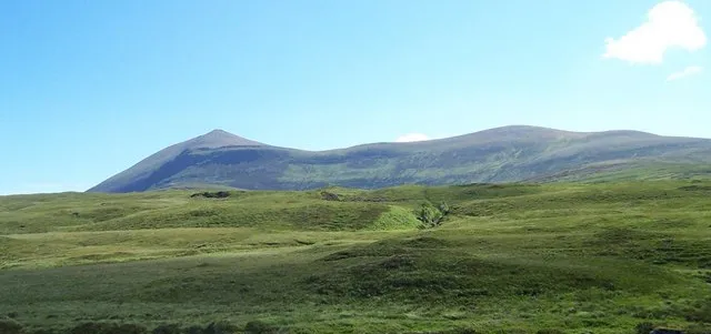 Ben Klibreck Mountain, Highland5.5 km E
-
Meall nan Uan Mountain, Highland3.7 km SE
-
The Crask Mountain, Highland5.6 km S
-
Cnoc Sgriodain Mountain, Highland5 km SE
-
A'Chaoirnichain Mountain, Highland5.6 km SE
Other cities and towns in Highland
Sources & licences
Data last updated: