Beinn Bharrain - Mullach Buidhe
Located in North Ayrshire, Scotland Coordinates: 55°37′59″ N 5°20′05″ W
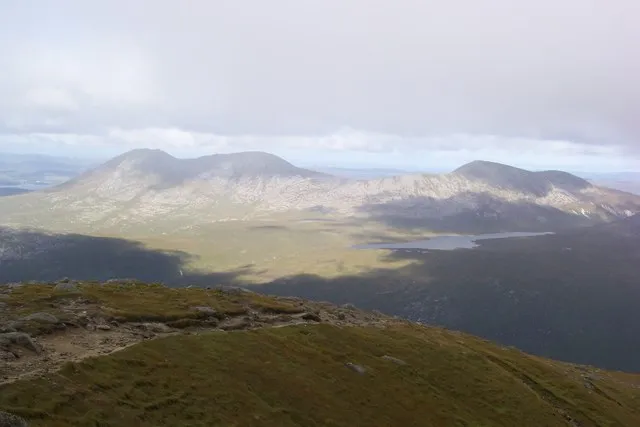
- Elevation
- 721 m
- above sea level
- Local time
- UTC+00:00
- Europe/London · UTC+00:00
- Airports
- CAL Campbeltown Airport31 km
- PIK Glasgow Prestwick Airport50 km
About Beinn Bharrain - Mullach Buidhe
Beinn Bharrain - Mullach Buidhe is a mountain. Location: North Ayrshire, Scotland. Elevation: 721 m.
Beinn Bharrain (721 m) is a mountain on the Isle of Arran, Scotland, located in the far northwest of the Island. Despite being less frequently visited than its eastern neighbours, it still provides fine views from the top. The entire hill is known as Beinn Bharrain, with 'Mullach Buidhe' the highest of its summits.
Source: Wikipedia · CC BY-SA 4.0
Climate of Beinn Bharrain - Mullach Buidhe
This month · November
A wet month
Day 6° · Night 1° · Rain 166 mm
- Hottest month
- July (day 14°)
- Coldest month
- February (night -1°)
- Wettest month
- January (180 mm)
- Driest month
- May (77 mm)
Bars: average monthly low and high temperature. Below: precipitation. Monthly averages for 1970–2000 at about 18 km resolution, adjusted for elevation. Highlighted months are mild and relatively dry. Source: WorldClim 2.1 (CC BY 4.0).
Show values as a table
| Month | Jan | Feb | Mar | Apr | May | Jun | Jul | Aug | Sep | Oct | Nov | Dec |
|---|---|---|---|---|---|---|---|---|---|---|---|---|
| Average high (°C) | 4° | 4° | 5° | 7° | 11° | 12° | 14° | 14° | 12° | 9° | 6° | 4° |
| Average low (°C) | -1° | -1° | 0° | 1° | 4° | 6° | 8° | 8° | 6° | 4° | 1° | 0° |
| Precipitation (mm) | 180 | 114 | 138 | 86 | 77 | 86 | 99 | 117 | 146 | 160 | 166 | 171 |
How to get to Beinn Bharrain - Mullach Buidhe
The nearest airport is Campbeltown Airport (CAL), 31 km to the southwest as the crow flies. For international flights: Glasgow Prestwick Airport (PIK) (50 km). The nearest large city is Glasgow, 72 km to the east.
Airports
- Campbeltown Airport (CAL) Campbeltown 31 kmsouthwest
- Glasgow Prestwick Airport (PIK) Prestwick, South Ayrshire 50 kmeast
- Islay Airport (ILY) Isle of Islay, Argyll and Bute 58 kmwest
Nearby large cities
- Glasgow Population: 626.4K 72 kmeast
- Belfast Population: 348K 121 kmsouth
- Edinburgh Population: 515K 139 kmeast
- Dundee Population: 148.2K 174 kmnortheast
- Newcastle upon Tyne Population: 300.1K 247 kmeast
Straight-line distances; road distances are longer. Airport data: OurAirports.
Day trips from Beinn Bharrain - Mullach Buidhe
Within 100 km: 109 historic and cultural sites, 2,377 natural sites, 1,064 lakes, rivers and coasts.
0–25 km208 places
- Isle of Arran Island 6 kmSE
- Inchmarnock Island 20 kmNE
- Holy Island Island 20 kmSE
- Eilean Aoidhe Island 25 kmN
25–60 km1,038 places
- Great Cumbrae Island Island 30 kmNE
- Ayr Beach Beach 48 kmSE
- Troon Beach Beach 44 kmE
- Hunterston Sands Beach 29 kmE
60–100 km2,304 places
- Colonsay Island 73 kmNW
- Kiloran Beach Beach 75 kmNW
- Scarba Island 66 kmN
- Oronsay Island 72 kmNW
Straight-line distances.
Nearest towns and villages
-
Pirnmill Village, North Ayrshire3.3 km W
-
Whitefarland Village, North Ayrshire4 km SW
-
Thundergay Village, North Ayrshire4.2 km NW
-
Imachar Village, North Ayrshire4.3 km SW
-
Isle of Arran Town, North Ayrshire9.6 km SE
-
Dougarie Village, North Ayrshire5.9 km S
Nearby attractions & nature
Everything nearby-
Casteal na h-Iolaire Mountain, North Ayrshire0.7 km SW
-
Meall Donn Mountain, North Ayrshire2.3 km N
-
Ceann Reamhar Mountain, North Ayrshire2.5 km SW
-
Beinn Tarsuinn SW Top Mountain, North Ayrshire2.7 km NE
-
Sail Chalmadale Mountain, North Ayrshire2.9 km SE
-
Loch Tanna Lake, Scotland2.2 km E
-
Meall Bhig Mountain, North Ayrshire3.6 km N
-
Meall nan Damh Mountain, North Ayrshire4.2 km N
Sources & licences
Data last updated: · 2 independent sources