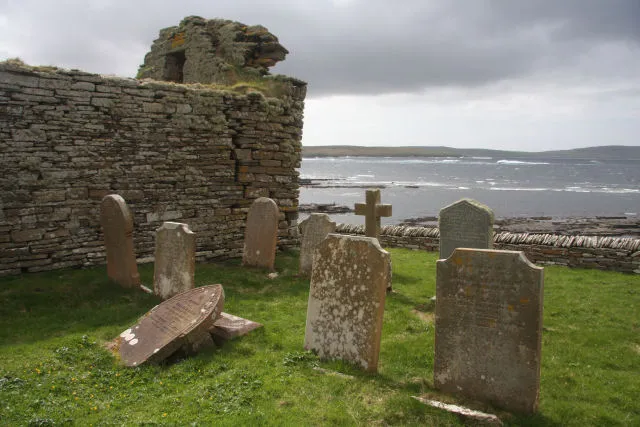
- Elevation
- 156 m
- above sea level
- Local time
- UTC+00:00
- Europe/London · UTC+00:00
- Population
- 216
- 216
- Airports
- EOI Eday Airport15 km
- KOI Kirkwall Airport24 km
About Rousay
Rousay is an island. Location: Orkney Islands, Scotland. Population: 216.
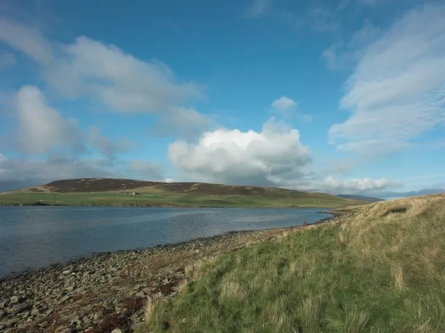
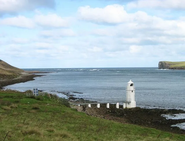
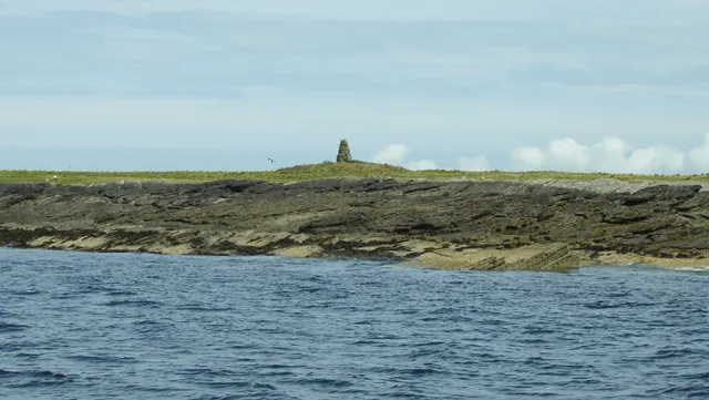
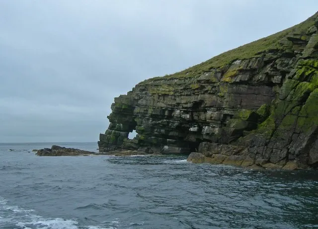
Rousay (, Scots: Rousee; Old Norse: Hrólfsey meaning Rolf's Island) is a small, hilly island about three kilometres (1+1⁄2 nautical miles) north of Mainland, the largest island in the Orkney Islands of Scotland. It has been nicknamed "Egypt of the north", due to its archaeological diversity and importance. Like its neighbours Egilsay and Wyre, it can be reached by ro-ro ferry MV Eynhallow from Tingwall.
Source: Wikipedia · CC BY-SA 4.0
At a glance
- Heritage designation
- Site of Special Scientific Interest
- Length
- 10 km
- Area
- 48.6 km²
Source: Wikidata
Photos of Rousay
-

United Kingdom Hydrographic Office · Public domain -

Gordon Hatton · CC BY-SA 2.0 -

Des Blenkinsopp · CC BY-SA 2.0 -

David Medcalf · CC BY-SA 2.0 -

David Medcalf · CC BY-SA 2.0


Travel notes for Rousay
From Wikivoyage
Rousay is one of the Orkney Islands, separated by a mile-wide strait from Orkney Mainland. Its name is Norse, Hrólfsey meaning Rolf's Island, and it's small and hilly, only 5 by 3 miles, with a population of 219 in 2011. Its terrain and land-use are in some ways more Hebridean than Orcadian, including a sad history of Clearances. The reason to visit is for its remarkable collection of prehistoric sites, and it's also a Site of Special Scientific Interest because of its geology, wildflowers and bird life.
You also come via Rousay to reach the islands of Wyre (population 5) and Egilsay (population 14) which are green, low-lying and look more typically Orcadian.
Get in+
1 Trumland Pier is the landing point for Orkney Ferries ro-ro from Tingwall on Mainland. This takes 30 min, with six M-Sa and four on Sunday; most sailings continue to Egilsay and Wyre (usually in that order) then back to Rousay before returning to Tingwall. Until April 2025, the return fare is adult £6.10, conc £4.60, child £3, car £19.40. Cars reverse onto the ferry, so you park in the marshalling area facing away from the slipway.
Bus 6 runs every couple of hours from Kirkwall via Finstown to meet the ferries at Tingwall, 20 min. In summer the first and last buses of the day continue round the Mainland coast to Birsay.
Source: Wikivoyage · CC BY-SA 4.0 · abridged
Climate of Rousay
This month · November
A wet month
Day 8° · Night 4° · Rain 138 mm
- Hottest month
- August (day 14°)
- Coldest month
- February (night 2°)
- Wettest month
- November (138 mm)
- Driest month
- May (53 mm)
Bars: average monthly low and high temperature. Below: precipitation. Monthly averages for 1970–2000 at about 18 km resolution, adjusted for elevation. Highlighted months are mild and relatively dry. Source: WorldClim 2.1 (CC BY 4.0).
Show values as a table
| Month | Jan | Feb | Mar | Apr | May | Jun | Jul | Aug | Sep | Oct | Nov | Dec |
|---|---|---|---|---|---|---|---|---|---|---|---|---|
| Average high (°C) | 6° | 6° | 6° | 8° | 10° | 12° | 14° | 14° | 13° | 11° | 8° | 7° |
| Average low (°C) | 2° | 2° | 2° | 3° | 5° | 7° | 9° | 9° | 8° | 6° | 4° | 3° |
| Precipitation (mm) | 119 | 92 | 105 | 68 | 53 | 56 | 63 | 77 | 109 | 127 | 138 | 127 |
How to get to Rousay
The nearest airport is Eday Airport (EOI), 15 km to the east as the crow flies. The nearest large city is Aberdeen, 232 km to the south.
Airports
- Eday Airport (EOI) Eday 15 kmeast
- Kirkwall Airport (KOI) Kirkwall, Orkney Islands 24 kmsouth
- Wick John O'Groats Airport (WIC) Wick 79 kmsouth
Nearby large cities
- Aberdeen Population: 198.6K 232 kmsouth
- Dundee Population: 148.2K 300 kmsouth
- Edinburgh Population: 515K 358 kmsouth
- Glasgow Population: 626.4K 375 kmsouth
Straight-line distances; road distances are longer. Airport data: OurAirports.
Day trips from Rousay
Within 100 km: 38 historic and cultural sites, 540 natural sites, 210 lakes, rivers and coasts.
0–25 km269 places
- Shapinsay Island 16 kmSE
- Eday Island 14 kmE
- Papa Westray Island Island 22 kmN
- Wyre Island 7 kmSE
25–60 km293 places
- Hoy Island 38 kmSW
- Flotta Island 37 kmS
- Auskerry Island 31 kmSE
- Hesta Head Natural site 43 kmS
60–100 km226 places
- Clett Island 67 kmSW
- Glass Islands Island 87 kmSW
- Garbh-eilean Island 85 kmSW
- Fair Isle Island 90 kmNE
Straight-line distances.
Nearest towns and villages
Nearby attractions & nature
Everything nearby-
Kierfea Hill Mountain, Orkney Islands1.4 km NE
-
Twelve Hours Tower Mountain, Orkney Islands2 km W
-
Saviskaill Bay Natural site, Orkney Islands2.1 km NE
-
The Burrian Island, Orkney Islands2.4 km NW
-
Ward Hill Mountain, Orkney Islands3.1 km SW
-
Erne Tower Mountain, Orkney Islands3.2 km N
-
Blotchnie Fiold Island, Orkney Islands2.8 km S
-
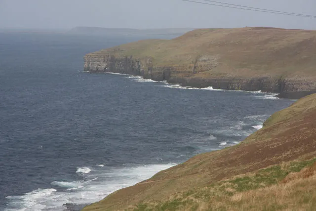 Faraclett Head Natural site, Orkney Islands4.2 km NE
More lakes, rivers and coasts in United Kingdom
Sources & licences
Data last updated: · 2 independent sources