- Elevation
- 810 m
- above sea level
- Local time
- UTC+00:00
- Europe/London · UTC+00:00
- Airports
- GLA Glasgow Airport55 km
- EDI Edinburgh Airport67 km
About Meall na Fearna
Meall na Fearna is a mountain. Location: Perth and Kinross, Scotland. Elevation: 810 m. The nearest airport is Glasgow Airport (55 km). Nearby sights include Stob Chalum Mhic Griogair and Ben Vorlich.
Photos of Meall na Fearna
-
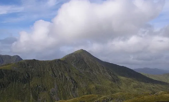
Ben Vorlich Grinner at English Wikipedia · CC BY-SA 3.0 -
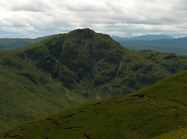
Beinn Each Andrew Smith · CC BY-SA 2.0 -
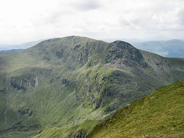
Stuc a' Chroin Rob Burke · CC BY-SA 2.0


Climate of Meall na Fearna
This month · November
A wet month
Day 4° · Night -1° · Rain 202 mm
- Hottest month
- July (day 13°)
- Coldest month
- February (night -4°)
- Wettest month
- January (241 mm)
- Driest month
- April (94 mm)
Bars: average monthly low and high temperature. Below: precipitation. Monthly averages for 1970–2000 at about 18 km resolution, adjusted for elevation. Highlighted months are mild and relatively dry. Source: WorldClim 2.1 (CC BY 4.0).
Show values as a table
| Month | Jan | Feb | Mar | Apr | May | Jun | Jul | Aug | Sep | Oct | Nov | Dec |
|---|---|---|---|---|---|---|---|---|---|---|---|---|
| Average high (°C) | 1° | 1° | 3° | 6° | 9° | 11° | 13° | 13° | 10° | 7° | 4° | 2° |
| Average low (°C) | -3° | -4° | -3° | -1° | 1° | 4° | 6° | 6° | 5° | 2° | -1° | -3° |
| Precipitation (mm) | 241 | 155 | 165 | 94 | 105 | 94 | 105 | 125 | 170 | 206 | 202 | 207 |
How to get to Meall na Fearna
The nearest airport is Glasgow Airport (GLA), 55 km to the south as the crow flies. The nearest large city is Glasgow, 53 km to the south.
Airports
- Glasgow Airport (GLA) Glasgow 55 kmsouth
- Edinburgh Airport (EDI) Ingliston, Edinburgh 67 kmsoutheast
- Dundee Airport (DND) Dundee 73 kmeast
Nearby large cities
- Glasgow Population: 626.4K 53 kmsouth
- Edinburgh Population: 515K 75 kmsoutheast
- Dundee Population: 148.2K 76 kmeast
- Aberdeen Population: 198.6K 156 kmnortheast
- Newcastle upon Tyne Population: 300.1K 222 kmsoutheast
Straight-line distances; road distances are longer. Airport data: OurAirports.
Day trips from Meall na Fearna
Within 100 km: 183 historic and cultural sites, 4,112 natural sites, 1,122 lakes, rivers and coasts.
0–25 km374 places
- Ellens Isle Island 20 kmSW
- Garbh Innis Island 19 kmSW
- An t-Eilean Island 7 kmNE
- Eilean nam Breaban Island 18 kmN
25–60 km1,497 places
- Mugdrum Island Island 58 kmE
- Inishail Island 56 kmW
- Inchlonaig Island 38 kmSW
- Inchcailloch Island 37 kmSW
60–100 km3,546 places
- Great Cumbrae Island Island 79 kmSW
- Troon Beach Beach 94 kmS
- Hunterston Sands Beach 82 kmSW
- Burntisland Beach Beach 67 kmSE
Straight-line distances.
Nearest towns and villages
-
Ardvorlich Village, Perth and Kinross3.5 km NW
-
 Callander Village, Stirling11 km S
-
Saint Fillans Village, Perth and Kinross6.3 km NE
-
Dalclathick Village, Perth and Kinross7.8 km E
-
Glen Beich Village, Stirling6.9 km NW
-
Comrie Village, Perth and Kinross13 km E
Nearby attractions & nature
Everything nearby-
Stob Chalum Mhic Griogair Mountain, Perth and Kinross1 km E
-
Ben Vorlich Mountain, Perth and Kinross2.2 km W
-
Beinn Domhnuill Mountain, Perth and Kinross1.3 km NW
-
Creagan an Lochain Mountain, Perth and Kinross2.1 km N
-
Stuc a' Chroin Mountain, Stirling3.6 km W
-
Stuc Gharbh Mountain, Perth and Kinross2.2 km SE
-
Black Craig Mountain, Perth and Kinross2.3 km N
-
Meall nan Saighdearan Mountain, Perth and Kinross3.3 km NE
Sources & licences
Data last updated: