- Elevation
- 347 m
- above sea level
- Local time
- UTC+00:00
- Europe/London · UTC+00:00
- Airports
- PIK Glasgow Prestwick Airport33 km
- CAL Campbeltown Airport70 km
About Knockeen
Knockeen is a mountain. Location: South Ayrshire, Scotland. Elevation: 347 m. The best months to visit are July. The nearest airport is Glasgow Prestwick Airport (33 km). Nearby sights include Larg Hill and Haggis Hill.
Climate of Knockeen
Best months for sightseeingBest months for sightseeing: July.
This month · November
A wet month
Day 7° · Night 2° · Rain 176 mm
- Hottest month
- July (day 16°)
- Coldest month
- February (night 0°)
- Wettest month
- October (177 mm)
- Driest month
- May (87 mm)
Bars: average monthly low and high temperature. Below: precipitation. Monthly averages for 1970–2000 at about 18 km resolution, adjusted for elevation. Highlighted months are mild and relatively dry. Source: WorldClim 2.1 (CC BY 4.0).
Show values as a table
| Month | Jan | Feb | Mar | Apr | May | Jun | Jul | Aug | Sep | Oct | Nov | Dec |
|---|---|---|---|---|---|---|---|---|---|---|---|---|
| Average high (°C) | 5° | 5° | 6° | 9° | 12° | 15° | 16° | 16° | 13° | 10° | 7° | 5° |
| Average low (°C) | 0° | 0° | 1° | 2° | 4° | 7° | 9° | 9° | 7° | 5° | 2° | 1° |
| Precipitation (mm) | 175 | 120 | 138 | 89 | 87 | 90 | 97 | 121 | 152 | 177 | 176 | 172 |
Other places to visit in this season: July
How to get to Knockeen
The nearest airport is Glasgow Prestwick Airport (PIK), 33 km to the north as the crow flies. The nearest large city is Glasgow, 77 km to the north.
Airports
- Glasgow Prestwick Airport (PIK) Prestwick, South Ayrshire 33 kmnorth
- Campbeltown Airport (CAL) Campbeltown 70 kmwest
- Glasgow Airport (GLA) Glasgow 75 kmnorth
Nearby large cities
- Glasgow Population: 626.4K 77 kmnorth
- Belfast Population: 348K 106 kmsouthwest
- Edinburgh Population: 515K 124 kmnortheast
- Dundee Population: 148.2K 175 kmnortheast
- Blackpool Population: 145K 187 kmsoutheast
Straight-line distances; road distances are longer. Airport data: OurAirports.
Day trips from Knockeen
Within 100 km: 151 historic and cultural sites, 2,156 natural sites, 635 lakes, rivers and coasts.
0–25 km275 places
- Isles of Trool Island 18 kmSE
- Kids Isle Island 23 kmE
- Maiden Isle Island 18 kmSE
- White Island Island 9 kmSE
25–60 km912 places
- Isle of Arran Island 57 kmNW
- Ayr Beach Beach 28 kmN
- Troon Beach Beach 37 kmN
- Hunterston Sands Beach 59 kmN
60–100 km1,755 places
- Great Cumbrae Island Island 64 kmN
- Powillimount Beach Beach 78 kmSE
- West Maiden Island 76 kmSW
- Rathlin Island Island 99 kmW
Straight-line distances.
Nearest towns and villages
Nearby attractions & nature
Everything nearby-
Larg Hill Mountain, South Ayrshire1.3 km SE
-
Haggis Hill Mountain, South Ayrshire2.4 km SE
-
Changue Mountain, South Ayrshire2.5 km SE
-
Daljedburgh Hill Mountain, South Ayrshire3.1 km N
-
Cairn Hill Mountain, South Ayrshire3.4 km S
-
Polmaddie Hill Mountain, South Ayrshire3.6 km SE
-
Mull of Miljoan Mountain, South Ayrshire3.9 km NW
-
Drumneillie Hill Mountain, South Ayrshire4 km SW
More nature in United Kingdom
-
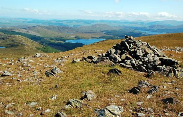 Shalloch on Minnoch Mountain, South Ayrshire9.6 km E
-
Craigenreoch Mountain, South Ayrshire4 km SE
-
Craig of Dalwine Mountain, South Ayrshire4.4 km NE
-
Craiginmoddie Mountain, South Ayrshire4.5 km N
-
Auchensoul Hill Mountain, South Ayrshire4.6 km W
-
Doughty Hill Mountain, South Ayrshire4.8 km N
Sources & licences
Data last updated: