Earl's Seat
Located in Stirling, Scotland Coordinates: 56°01′32″ N 4°17′47″ W
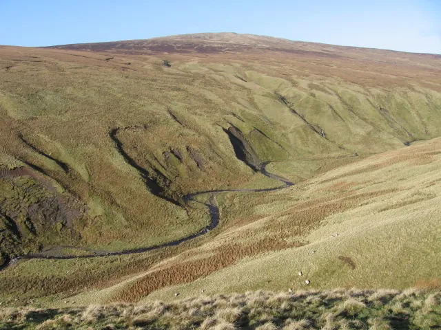
- Elevation
- 578 m
- above sea level
- Local time
- UTC+00:00
- Europe/London · UTC+00:00
About Earl's Seat
Earl's Seat is a mountain. Location: Stirling, Scotland. Elevation: 578 m.
Earl's Seat (578 m) is the highest hill of the Campsie Fells in Central Scotland. It lies on the border of Stirlingshire and East Dunbartonshire in central Scotland. Located on a plateau in the heart of the Campsies above the village of Strathblane, its summit is marked by a trig point.
Read more on Wikipedia Text: Wikipedia contributors · CC BY-SA 4.0 · shortened
At a glance
- Topographic prominence
- 511 m
Source: Wikidata
In comparison
- No. 3495 of 18223 mountains in United Kingdom by elevation
- 35 sights and natural places within 10 km Clachertyfarlie Knowes, Owsen Hill
Climate of Earl's Seat
| Month | Jan | Feb | Mar | Apr | May | Jun | Jul | Aug | Sep | Oct | Nov | Dec |
|---|---|---|---|---|---|---|---|---|---|---|---|---|
| Average high (°C) | 3° | 3° | 5° | 7° | 11° | 13° | 14° | 14° | 12° | 9° | 5° | 3° |
| Average low (°C) | -2° | -2° | -1° | 0° | 3° | 5° | 7° | 7° | 5° | 3° | 0° | -2° |
| Precipitation (mm) | 192 | 128 | 137 | 78 | 85 | 79 | 89 | 107 | 145 | 173 | 169 | 171 |
Monthly averages for 1970–2000 at about 18 km resolution, adjusted for elevation. Highlighted months are mild and relatively dry. Source: WorldClim 2.1 (CC BY 4.0).
Airports nearest to Earl's Seat
- Glasgow Airport (GLA) Glasgow 19 km
- Edinburgh Airport (EDI) Ingliston, Edinburgh 58 km
- Glasgow Prestwick Airport (PIK) Prestwick, South Ayrshire 61 km
Straight-line distance; airports with scheduled flights only. Source: OurAirports (public domain).
Nearest towns and villages
-
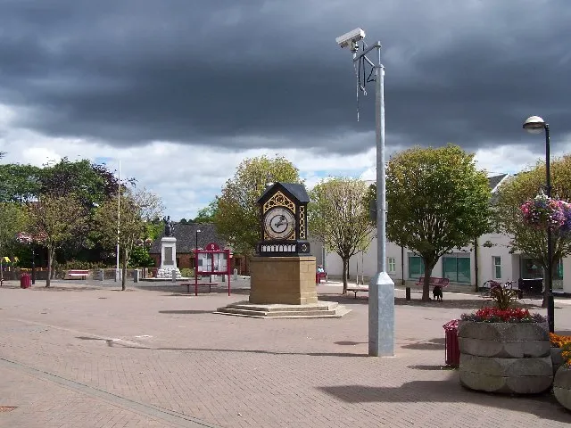 Milngavie Town, East Dunbartonshire9.6 km S
-
Strathblane Village, Stirling4.5 km S
-
Killearn Village, Stirling4.9 km NW
-
Balfron Village, Stirling5.3 km NW
-
Blanefield Village, Stirling4.4 km S
-
Branziert Neighbourhood, Stirling4.5 km W
Nearby attractions & nature
Everything nearby-
Clachertyfarlie Knowes Mountain, Stirling1.4 km W
-
Owsen Hill Mountain, East Dunbartonshire1.5 km S
-
Allanrowie Mountain, Stirling2 km NE
-
Dumbreck Mountain, East Dunbartonshire2.4 km S
-
Kailrine Hill Mountain, Stirling2.5 km E
-
Dumfoyn Mountain, Stirling2.6 km SW
-
Slackdhu Mountain, Stirling2.6 km SW
-
Dumgoyne Mountain, Stirling3 km W
Sources & licences
Data last updated: · 2 independent sources