- Elevation
- 153 m
- above sea level
- Airports
- GLA Glasgow Airport40 km
- EDI Edinburgh Airport72 km
About Garbh Innis
Garbh Innis is an island. Location: Stirling, Scotland. The best months to visit are July. The nearest airport is Glasgow Airport (40 km). Nearby sights include Dun Achray and Craig Leven.
Photos of Garbh Innis
-
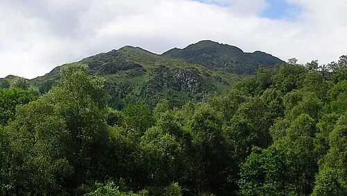
Ben Venue Grinner · CC BY-SA 3.0 -
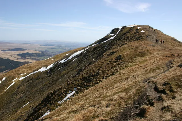
Ben Ledi Ian Cleland · CC BY-SA 2.0 -
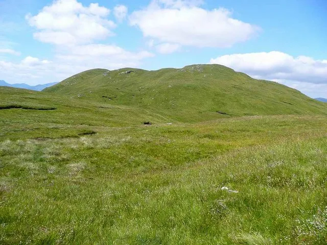
Benvane Gordon Brown · CC BY-SA 2.0


Climate of Garbh Innis
Best months for sightseeingBest months for sightseeing: July.
This month · November
A wet month
Day 8° · Night 3° · Rain 217 mm
- Hottest month
- July (day 17°)
- Coldest month
- January (night 1°)
- Wettest month
- January (254 mm)
- Driest month
- June (99 mm)
Bars: average monthly low and high temperature. Below: precipitation. Monthly averages for 1970–2000 at about 18 km resolution, adjusted for elevation. Highlighted months are mild and relatively dry. Source: WorldClim 2.1 (CC BY 4.0).
Show values as a table
| Month | Jan | Feb | Mar | Apr | May | Jun | Jul | Aug | Sep | Oct | Nov | Dec |
|---|---|---|---|---|---|---|---|---|---|---|---|---|
| Average high (°C) | 6° | 6° | 7° | 10° | 13° | 15° | 17° | 17° | 14° | 11° | 8° | 6° |
| Average low (°C) | 1° | 1° | 2° | 3° | 6° | 8° | 10° | 10° | 9° | 6° | 3° | 2° |
| Precipitation (mm) | 254 | 165 | 173 | 102 | 112 | 99 | 112 | 136 | 186 | 222 | 217 | 221 |
Other places to visit in this season: July
How to get to Garbh Innis
The nearest airport is Glasgow Airport (GLA), 40 km to the south as the crow flies. The nearest large city is Glasgow, 42 km to the south.
Airports
- Glasgow Airport (GLA) Glasgow 40 kmsouth
- Edinburgh Airport (EDI) Ingliston, Edinburgh 72 kmsoutheast
- Glasgow Prestwick Airport (PIK) Prestwick, South Ayrshire 81 kmsouth
Nearby large cities
- Glasgow Population: 626.4K 42 kmsouth
- Edinburgh Population: 515K 82 kmeast
- Dundee Population: 148.2K 93 kmeast
- Aberdeen Population: 198.6K 175 kmnortheast
- Belfast Population: 348K 205 kmsouthwest
Straight-line distances; road distances are longer. Airport data: OurAirports.
Day trips from Garbh Innis
Within 100 km: 174 historic and cultural sites, 3,992 natural sites, 1,137 lakes, rivers and coasts.
0–25 km401 places
- Inchlonaig Island 18 kmSW
- Inchcailloch Island 19 kmSW
- Ellens Isle Island 1 kmNW
- Aber Isle Island 19 kmSW
25–60 km1,504 places
- Great Cumbrae Island Island 60 kmSW
- Inishail Island 44 kmW
- Fraoch Eilean Island 43 kmNW
- Green Island Island 34 kmSW
60–100 km3,398 places
- Isle of Arran Island 87 kmSW
- Ayr Beach Beach 86 kmS
- Troon Beach Beach 78 kmS
- Hunterston Sands Beach 63 kmSW
Straight-line distances.
Nearest towns and villages
-
Aberfoyle Village, Stirling5.9 km S
-
Brig o' Turk Village, Stirling3.5 km E
-
Milton Neighbourhood, Stirling5.1 km S
-
 Kinlochard Village, Stirling6.2 km SW
-
Dail Malio Village, Stirling5.8 km SW
-
Kirkton Neighbourhood, Stirling6 km S
Nearby attractions & nature
Everything nearby-
Dun Achray Mountain, Stirling0.7 km N
-
Craig Leven Mountain, Stirling0.8 km NW
-
Sgiath nan Mucan Dubha Mountain, Stirling0.9 km N
-
Craig na Cailliche Mountain, Stirling1.1 km NW
-
Ellens Isle Island, Stirling1.1 km NW
-
Ben Venue Mountain, Stirling2.6 km W
-
Ben A'an Mountain, Stirling1.7 km N
-
Otter Island Island, Stirling1.5 km NW
Sources & licences
Data last updated: