Nether Oliver Dod
Located in The Scottish Borders, Scotland Coordinates: 55°31′14″ N 3°25′49″ W
- Elevation
- 511 m
- above sea level
- Local time
- UTC+00:00
- Europe/London · UTC+00:00
- Airports
- EDI Edinburgh Airport48 km
- PIK Glasgow Prestwick Airport72 km
About Nether Oliver Dod
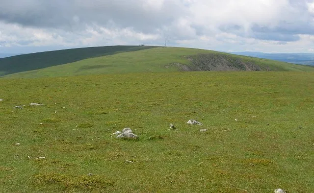
Nether Oliver Dod is a mountain. Location: The Scottish Borders, Scotland. Elevation: 511 m. The best months to visit are July. The nearest airport is Edinburgh Airport (48 km). Nearby sights include Upper Oliver Dod and Glengary Knowe.
Climate of Nether Oliver Dod
Best months for sightseeingBest months for sightseeing: July.
This month · November
A wet month
Day 6° · Night 0° · Rain 137 mm
- Hottest month
- July (day 16°)
- Coldest month
- January (night -2°)
- Wettest month
- January (144 mm)
- Driest month
- April (74 mm)
Bars: average monthly low and high temperature. Below: precipitation. Monthly averages for 1970–2000 at about 18 km resolution, adjusted for elevation. Highlighted months are mild and relatively dry. Source: WorldClim 2.1 (CC BY 4.0).
Show values as a table
| Month | Jan | Feb | Mar | Apr | May | Jun | Jul | Aug | Sep | Oct | Nov | Dec |
|---|---|---|---|---|---|---|---|---|---|---|---|---|
| Average high (°C) | 3° | 4° | 5° | 8° | 12° | 14° | 16° | 16° | 13° | 10° | 6° | 4° |
| Average low (°C) | -2° | -2° | -1° | 1° | 3° | 6° | 8° | 8° | 6° | 4° | 0° | -1° |
| Precipitation (mm) | 144 | 104 | 116 | 74 | 74 | 79 | 84 | 99 | 121 | 140 | 137 | 144 |
Other places to visit in this season: July
How to get to Nether Oliver Dod
The nearest airport is Edinburgh Airport (EDI), 48 km to the north as the crow flies. The nearest large city is Edinburgh, 50 km to the north.
Airports
- Edinburgh Airport (EDI) Ingliston, Edinburgh 48 kmnorth
- Glasgow Prestwick Airport (PIK) Prestwick, South Ayrshire 72 kmwest
- Glasgow Airport (GLA) Glasgow 74 kmnorthwest
Nearby large cities
- Edinburgh Population: 515K 50 kmnorth
- Glasgow Population: 626.4K 65 kmnorthwest
- Dundee Population: 148.2K 109 kmnorth
- Newcastle upon Tyne Population: 300.1K 131 kmsoutheast
- Sunderland Population: 170.1K 147 kmsoutheast
Straight-line distances; road distances are longer. Airport data: OurAirports.
Day trips from Nether Oliver Dod
Within 100 km: 505 historic and cultural sites, 2,808 natural sites, 791 lakes, rivers and coasts.
0–25 km494 places
- Talla Reservoir Lake 5 kmSE
- Loch Skeen Lake 12 kmSE
- Saint Marys Loch Lake 16 kmE
- Loch of the Lowes Lake 15 kmSE
25–60 km1,265 places
- Cramond beach Beach 52 kmN
- Portobello Beach Beach 52 kmN
- Inchkeith Island 60 kmN
- Inchcolm Island 57 kmN
60–100 km2,345 places
- Great Cumbrae Island Island 98 kmW
- Powillimount Beach Beach 71 kmS
- Ayr Beach Beach 77 kmW
- Troon Beach Beach 78 kmW
Straight-line distances.
Nearest towns and villages
-
Tweedsmuir Village, The Scottish Borders1.7 km S
-
Polmood Village, The Scottish Borders2.4 km NE
-
Stanhope Village, The Scottish Borders4.3 km NE
-
Glenbreck Village, The Scottish Borders6.9 km SW
-
Drumelzier Village, The Scottish Borders8.1 km NE
-
Biggar Village, South Lanarkshire13 km NW
Nearby attractions & nature
Everything nearby-
Upper Oliver Dod Mountain, The Scottish Borders1.1 km SW
-
Glengary Knowe Mountain, The Scottish Borders2.1 km W
-
Cockiland Hill Mountain, The Scottish Borders2.2 km SE
-
Hog Hill Mountain, The Scottish Borders2.4 km SE
-
Broomy Law Mountain, The Scottish Borders2.4 km NW
-
Glenlood Hill Mountain, The Scottish Borders2.7 km NW
-
Cocklie Rig Head Mountain, The Scottish Borders2.8 km N
-
Coomb Hill Mountain, The Scottish Borders2.9 km W
More nature in United Kingdom
-
 Broad Law Mountain, The Scottish Borders5.5 km SE
-
Benshaw Hill Mountain, The Scottish Borders3.4 km N
-
Birkside Law Mountain, The Scottish Borders3.9 km E
-
Middle Head Mountain, The Scottish Borders4 km N
-
Great Knock Mountain, The Scottish Borders4.1 km E
-
Whiteside Hill Mountain, The Scottish Borders4.4 km S
Sources & licences
Data last updated: