- Elevation
- 30 m
- above sea level
- Local time
- UTC+00:00
- Europe/London · UTC+00:00
- Airports
- SYY Stornoway Airport38 km
- BEB Benbecula Airport68 km
About Abhainn Mhor Reasovirt
Abhainn Mhor Reasovirt is a lake. Location: Western Isles, Scotland. Elevation: 30 m. The nearest airport is Stornoway Airport (38 km). Nearby sights include Amhuinn Mhòr Ceann Resort and Beinn a' Bhoth.
Climate of Abhainn Mhor Reasovirt
This month · November
A wet month
Day 9° · Night 4° · Rain 173 mm
- Hottest month
- July (day 16°)
- Coldest month
- February (night 2°)
- Wettest month
- October (173 mm)
- Driest month
- May (73 mm)
Bars: average monthly low and high temperature. Below: precipitation. Monthly averages for 1970–2000 at about 18 km resolution, adjusted for elevation. Highlighted months are mild and relatively dry. Source: WorldClim 2.1 (CC BY 4.0).
Show values as a table
| Month | Jan | Feb | Mar | Apr | May | Jun | Jul | Aug | Sep | Oct | Nov | Dec |
|---|---|---|---|---|---|---|---|---|---|---|---|---|
| Average high (°C) | 7° | 7° | 8° | 9° | 12° | 14° | 16° | 16° | 14° | 11° | 9° | 7° |
| Average low (°C) | 2° | 2° | 3° | 4° | 7° | 9° | 11° | 11° | 9° | 7° | 4° | 3° |
| Precipitation (mm) | 164 | 123 | 137 | 87 | 73 | 80 | 93 | 105 | 144 | 173 | 173 | 165 |
How to get to Abhainn Mhor Reasovirt
The nearest airport is Stornoway Airport (SYY), 38 km to the northeast as the crow flies. The nearest large city is Glasgow, 291 km to the southeast.
Airports
- Stornoway Airport (SYY) Stornoway, Western Isles 38 kmnortheast
- Benbecula Airport (BEB) Balivanich 68 kmsouthwest
- Barra Airport (BRR) Eoligarry 118 kmsouth
Nearby large cities
- Glasgow Population: 626.4K 291 kmsoutheast
- Dundee Population: 148.2K 294 kmsoutheast
- Aberdeen Population: 198.6K 304 kmeast
- Edinburgh Population: 515K 323 kmsoutheast
- Belfast Population: 348K 388 kmsouth
Straight-line distances; road distances are longer. Airport data: OurAirports.
Day trips from Abhainn Mhor Reasovirt
Within 100 km: 20 historic and cultural sites, 1,371 natural sites, 977 lakes, rivers and coasts.
0–25 km554 places
- Isle of Harris Natural site 17 kmS
- Scalpay Island 24 kmSE
- Rosaigh Island 23 kmSE
- Cèabhaigh Island 21 kmN
25–60 km563 places
- Dalmore Beach Beach 31 kmN
- Dailbeag Beach Beach 32 kmN
- Lingay Island 45 kmSW
- Clett Island 59 kmS
60–100 km1,251 places
- Isle of Skye Island 91 kmSE
- Island of Raasay Island 88 kmSE
- The Coral Beaches Beach 62 kmS
- Eilean a' Char Island 86 kmE
Straight-line distances.
Nearest towns and villages
-
Aird a Mhulaidh Village, Western Isles9.2 km SE
-
Ath Linne Village, Western Isles9.3 km SE
-
Amhuinnsuidhe Village, Western Isles9.3 km SW
-
Giosla Village, Western Isles9.7 km N
-
Cliasmol Village, Western Isles10 km S
-
Miavag Village, Western Isles11 km S
Nearby attractions & nature
Everything nearby-
Amhuinn Mhòr Ceann Resort River, Western Isles1 km SE
-
Beinn a' Bhoth Mountain, Western Isles1.9 km E
-
Beinisbhal Mountain, Western Isles2.9 km NW
-
Griosamul Mountain, Western Isles2.9 km E
-
Mullach na Reidheachd Mountain, Western Isles3 km SW
-
Loch Voshimid Lake, Western Isles2.8 km S
-
Rapaire Mountain, Western Isles3.4 km SE
-
Mullach an Roin Mountain, Western Isles3.5 km W
More lakes, rivers and coasts in United Kingdom
-
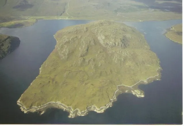 Seaforth Island Island, Western Isles11 km SE
-
Ulladale River River, Western Isles3 km SW
-
Loch Morsgail Lake, Western Isles5.4 km NE
-
Eilean na h-Iolaire Island, Western Isles6.1 km N
-
Sgeir Glas Bun Abhainn a' Lòin Island, Western Isles6.1 km N
-
Eilean an Tighe Island, Western Isles6.2 km N
Sources & licences
Data last updated: