- Elevation
- 119 m
- above sea level
- Local time
- UTC+00:00
- Europe/London · UTC+00:00
- Airports
- SYY Stornoway Airport29 km
- BEB Benbecula Airport74 km
About Cithis Bheag
Cithis Bheag is a mountain. Location: Western Isles, Scotland. Elevation: 119 m. The nearest airport is Stornoway Airport (29 km). Nearby sights include Sidhean an Airgid and Cithis Mhor.
Climate of Cithis Bheag
This month · November
A wet month
Day 8° · Night 4° · Rain 166 mm
- Hottest month
- July (day 15°)
- Coldest month
- February (night 2°)
- Wettest month
- November (166 mm)
- Driest month
- May (69 mm)
Bars: average monthly low and high temperature. Below: precipitation. Monthly averages for 1970–2000 at about 18 km resolution, adjusted for elevation. Highlighted months are mild and relatively dry. Source: WorldClim 2.1 (CC BY 4.0).
Show values as a table
| Month | Jan | Feb | Mar | Apr | May | Jun | Jul | Aug | Sep | Oct | Nov | Dec |
|---|---|---|---|---|---|---|---|---|---|---|---|---|
| Average high (°C) | 6° | 6° | 7° | 9° | 12° | 14° | 15° | 15° | 13° | 11° | 8° | 7° |
| Average low (°C) | 2° | 2° | 2° | 3° | 6° | 8° | 10° | 10° | 9° | 6° | 4° | 2° |
| Precipitation (mm) | 156 | 117 | 131 | 83 | 69 | 77 | 88 | 100 | 137 | 165 | 166 | 157 |
How to get to Cithis Bheag
The nearest airport is Stornoway Airport (SYY), 29 km to the northeast as the crow flies. The nearest large city is Glasgow, 283 km to the southeast.
Airports
- Stornoway Airport (SYY) Stornoway, Western Isles 29 kmnortheast
- Benbecula Airport (BEB) Balivanich 74 kmsouthwest
- Barra Airport (BRR) Eoligarry 121 kmsouth
Nearby large cities
- Glasgow Population: 626.4K 283 kmsoutheast
- Dundee Population: 148.2K 283 kmsoutheast
- Aberdeen Population: 198.6K 291 kmeast
- Edinburgh Population: 515K 314 kmsoutheast
- Belfast Population: 348K 385 kmsouth
Straight-line distances; road distances are longer. Airport data: OurAirports.
Day trips from Cithis Bheag
Within 100 km: 20 historic and cultural sites, 1,762 natural sites, 1,101 lakes, rivers and coasts.
0–25 km595 places
- Isle of Harris Natural site 16 kmSW
- Scalpay Island 19 kmS
- Tannaraidh Island 19 kmNE
- Tabhaigh Mor Island 20 kmNE
25–60 km510 places
- The Coral Beaches Beach 59 kmS
- Dalmore Beach Beach 31 kmN
- Dailbeag Beach Beach 32 kmN
- Lingay Island 52 kmSW
60–100 km1,778 places
- Isle of Skye Island 85 kmS
- Island of Raasay Island 81 kmSE
- Scalpay Island 93 kmSE
- Eilean a' Char Island 73 kmE
Straight-line distances.
Nearest towns and villages
-
Ath Linne Village, Western Isles4.9 km SW
-
Ceann Shìphoirt Village, Western Isles5.1 km NE
-
Aird a Mhulaidh Village, Western Isles6.5 km SW
-
Sildinis Village, Western Isles6.5 km NE
-
Balallan Village, Western Isles7.7 km NE
-
Eishken Village, Western Isles8.7 km E
Nearby attractions & nature
Everything nearby-
Sidhean an Airgid Mountain, Western Isles1.5 km E
-
Cithis Mhor Mountain, Western Isles1.9 km S
-
Cleit an Rathaid Mountain, Western Isles2.2 km NW
-
Guaineamol Mountain, Western Isles2.3 km E
-
Dun Chonaill Mountain, Western Isles2.7 km NE
-
Cadha Cleit Mountain, Western Isles2.7 km E
-
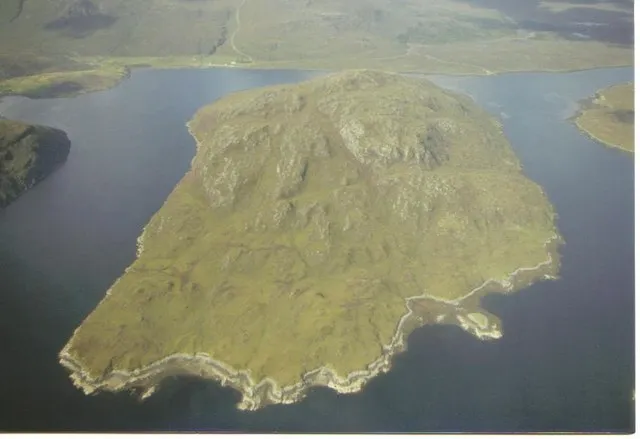 Seaforth Island Island, Western Isles4.6 km SW
-
Muaitheabhal Mountain, Western Isles3.4 km SE
Sources & licences
Data last updated: