- Elevation
- 37 m
- above sea level
- Local time
- UTC+00:00
- Europe/London · UTC+00:00
- Airports
- SYY Stornoway Airport30 km
- BEB Benbecula Airport130 km
About Skigersta
Skigersta is a village. Location: Western Isles, Scotland. Elevation: 37 m. The best months to visit are July. The nearest airport is Stornoway Airport (30 km). Nearby sights include An Campar Mor and An Cnoc Ard.
Climate of Skigersta
Best months for sightseeingBest months for sightseeing: July.
This month · November
A wet month
Day 9° · Night 4° · Rain 157 mm
- Hottest month
- July (day 16°)
- Coldest month
- February (night 2°)
- Wettest month
- November (157 mm)
- Driest month
- May (61 mm)
Bars: average monthly low and high temperature. Below: precipitation. Monthly averages for 1970–2000 at about 18 km resolution, adjusted for elevation. Highlighted months are mild and relatively dry. Source: WorldClim 2.1 (CC BY 4.0).
Show values as a table
| Month | Jan | Feb | Mar | Apr | May | Jun | Jul | Aug | Sep | Oct | Nov | Dec |
|---|---|---|---|---|---|---|---|---|---|---|---|---|
| Average high (°C) | 7° | 7° | 8° | 9° | 12° | 14° | 16° | 15° | 14° | 11° | 9° | 7° |
| Average low (°C) | 2° | 2° | 3° | 4° | 6° | 9° | 10° | 10° | 9° | 7° | 4° | 3° |
| Precipitation (mm) | 150 | 112 | 122 | 76 | 61 | 69 | 79 | 88 | 124 | 150 | 157 | 145 |
Other places to visit in this season: July
How to get to Skigersta
The nearest airport is Stornoway Airport (SYY), 30 km to the south as the crow flies. The nearest large city is Aberdeen, 286 km to the southeast.
Airports
- Stornoway Airport (SYY) Stornoway, Western Isles 30 kmsouth
- Benbecula Airport (BEB) Balivanich 130 kmsouthwest
- Inverness Airport (INV) Inverness, Highland 165 kmsoutheast
Nearby large cities
- Aberdeen Population: 198.6K 286 kmsoutheast
- Dundee Population: 148.2K 296 kmsoutheast
- Glasgow Population: 626.4K 314 kmsoutheast
- Edinburgh Population: 515K 335 kmsoutheast
Straight-line distances; road distances are longer. Airport data: OurAirports.
Nearby attractions & nature
Everything nearby-
An Campar Mor Mountain, Western Isles2.3 km S
-
An Cnoc Ard Mountain, Western Isles2.9 km NW
-
Stac a' Filiscleitir Mountain, Western Isles4.5 km SE
-
Butt of Lewis DGPS-Transmitter Landmark, Western Isles5.5 km NW
-
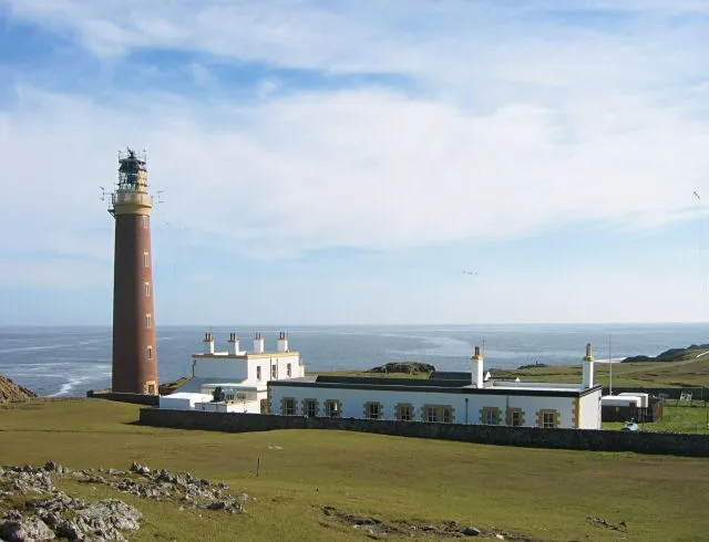 Butt of Lewis Lighthouse Landmark, Western Isles5.5 km NW
-
Cellar Head Natural site, Western Isles5.2 km SE
Sources & licences
Data last updated: