Llandyfriog
Located in Ceredigion, Wales Coordinates: 52°03′05″ N 4°24′32″ W
- Elevation
- 129 m
- above sea level
- Local time
- UTC+00:00
- Europe/London · UTC+00:00
- Places inside
- 14
- listed under Llandyfriog
About Llandyfriog
Llandyfriog is a municipality. Location: Ceredigion, Wales. Elevation: 129 m.
In comparison
- Nearest larger town: Llangeler, 4 km SE
- 39 sights and natural places within 10 km Felin Cwrrws, Castell Nant y Garan
- Listed here: Village: 8, Historic site: 5, Mountain: 1
Places in Llandyfriog
14 places-
Newcastle Emlyn Village1.9K
-
Aber-banc Village
-
Adpar Village
-
Adpar Motte Historic site
-
Allt yr Esgob Mountain
-
Bangor Teifi Village
-
Blaen-Cil-Llech Village
-
Castell Nant y Garan Historic site
-
Castell Pistog Historic site
-
Cwm-coy Village
-
Felin Cwrrws Historic site
-
Penrhiw-llan Village
-
Pont-Ceri Village
-
St Marys Old Church Motte Historic site
Nearby attractions & nature
Everything nearby-
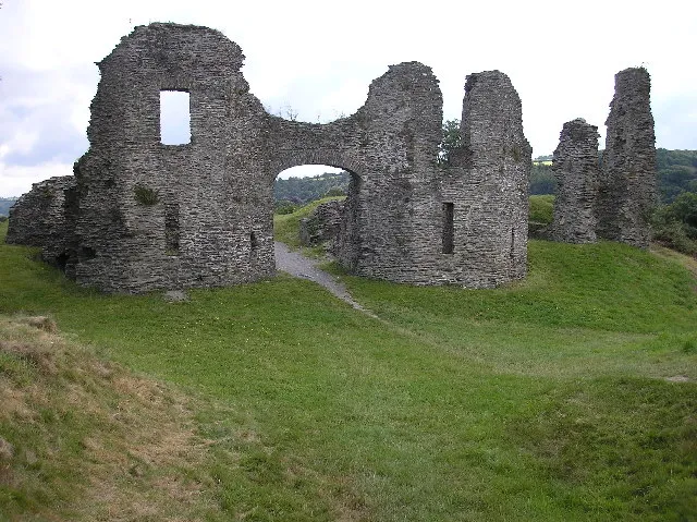 Newcastle Emlyn Castle Historic site, Newcastle Emlyn4 km W
-
Allt y Ddinas Mountain, Beulah3.4 km W
-
Gernos Mountain Mountain, Troedyraur4.1 km N
-
Tomenseba Historic site, Llangeler5.5 km SW
-
Castell Waun-Withan Historic site, Llangeler5.5 km SE
-
Pen y Garn Mountain, Cenarth5.9 km SW
-
Tomenlawddog Historic site, Llangeler5.8 km S
-
Moelfre Mountain, Llangeler6.3 km S
Sources & licences
Data last updated: