Trawsgoed
Located in Ceredigion, Wales Coordinates: 52°21′15″ N 3°56′21″ W
- Elevation
- 92 m
- above sea level
- Local time
- UTC+00:00
- Europe/London · UTC+00:00
- Places inside
- 11
- listed under Trawsgoed
About Trawsgoed
Trawsgoed is a municipality. Location: Ceredigion, Wales. Elevation: 92 m.
In comparison
- Nearest larger town: Capel Bangor, 6 km N
- 53 sights and natural places within 10 km Penpegws, Allt Goch
- Listed here: Village: 7, Mountain: 4
Airports nearest to Trawsgoed
- Cardiff International Airport (CWL) Cardiff 114 km
- Liverpool John Lennon Airport (LPL) Liverpool 132 km
- Bristol Airport (BRS) Bristol 137 km
Straight-line distance; airports with scheduled flights only. Source: OurAirports (public domain).
Places in Trawsgoed
11 places-
Abermagwr Village
-
Banc Lletysynod Mountain
-
Brynafan Village
-
Castell Grogwynion Mountain
-
Cnwch Coch Village
-
Llanafan Village
-
Llanfihangel-y-creuddyn Village
-
Penpegws Mountain
-
Pen y Bryn-mawr Mountain
-
Wenallt Village
-
Yspytty-Ystwyth Village
Nearby attractions & nature
Everything nearby-
Allt Goch Mountain, Melindwr2.9 km N
-
Pen Tynreithin Mountain, Llanilar3.4 km SW
-
Fron Ddu Mountain, Melindwr3.7 km NE
-
Ban Nant Gwyn Mountain, Pontarfynach3.8 km E
-
Gaer Fawr Mountain, Llanilar4.2 km SW
-
Pen Ty'n-llain Mountain, Lledrod4.5 km S
-
Cefn Blewog East Top Mountain, Ysbyty Ystwyth4.7 km E
-
Pen Felin-wynt Mountain, Pontarfynach4.7 km E
Other cities and towns in Ceredigion
-
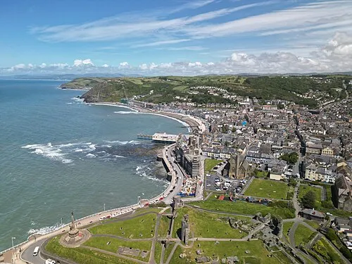 Aberystwyth Town, Aberystwyth12 km NW
-
Melindwr Municipality, Ceredigion6.1 km N
-
Ystrad Meurig Municipality, Ceredigion7.4 km S
-
Llanfarian Municipality, Ceredigion8.3 km W
-
Lledrod Municipality, Ceredigion8.5 km SW
-
Trefeurig Municipality, Ceredigion9.1 km N
Sources & licences
Data last updated: